7Weather- The sunshine returns tomorrow, and then showers move in Thursday night. The chance for snow is now mainly for northern New England with a northward track of the storm system.
WEDNESDAY:
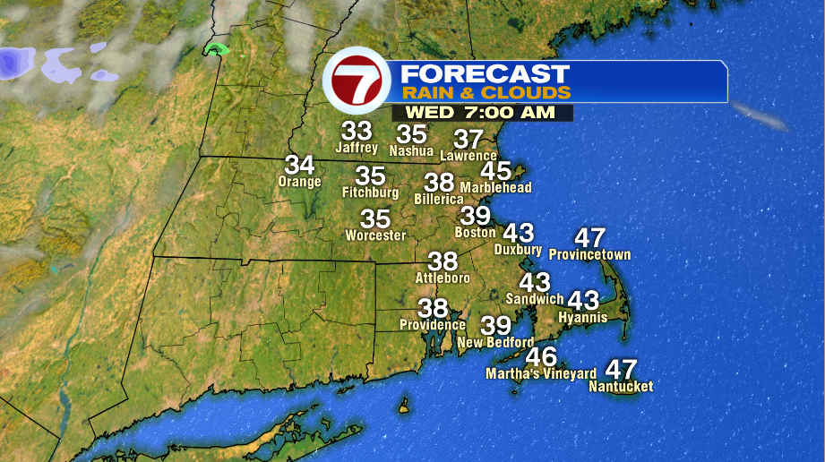
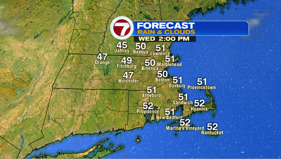
A high pressure system moves in tonight and clears us out for Wednesday. Temperatures are in the 30s in the morning, and there will be a cool breeze. The rest of the day has sunshine with highs in the upper 40s and low 50s.
COLD BLAST:
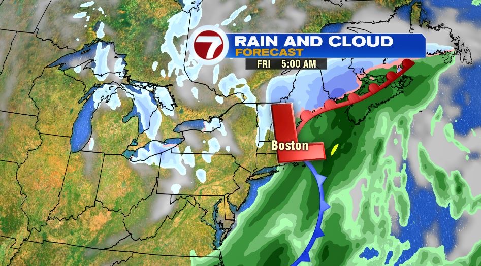
This system that could have brought us snow, is fast moving. The track of the low pressure system is right over us, and it moves into our area before the cold blast of air.
For these reasons, southern New England will get rain and not snow. If the low pressure was forecast to be further south Thursday night into Friday morning, then it would have caught some of the cold air and some areas could have seen snow.
For now, it becomes cloudy Thursday with a few showers around sunset. On and off rain is likely from 5 PM until midnight. From there it looks like it dries out and becomes windy and cold.

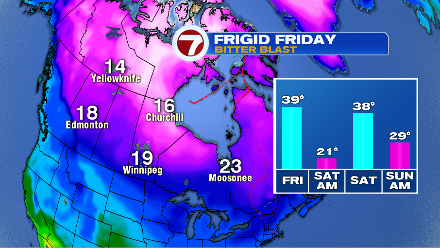
Temperatures start in the low to mid 40s around midnight on Friday, which will technically be our highs for the day.
We drop into be in the upper 30s in the afternoon, but it will feel a lot colder with a gusty northwest wind. Winds are between 15-25 mph, gusting to 40 mph.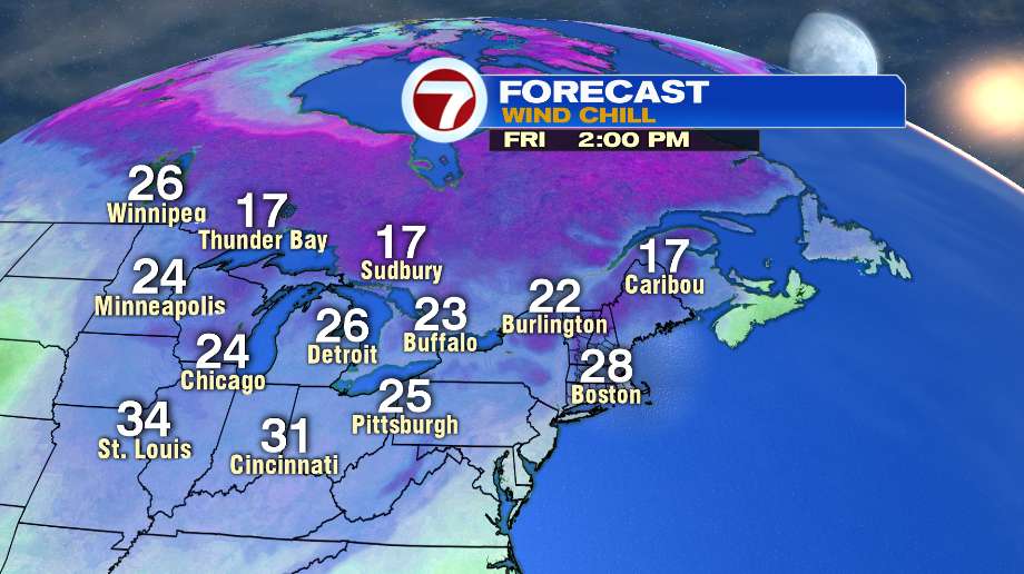
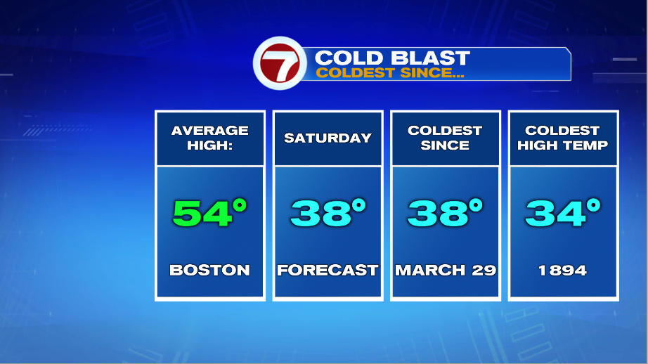
Saturday will be unseasonably cold. Our average highs for early November are in the mid 50s, but we only make it into the upper 30s. This is the coldest high temperature for Boston since late March.