A cold blast of air slides in overnight into Monday morning behind a cold front, coupled up with a northwest wind, wind chills likely be in the 20s for much of our Monday. Be sure to brace for that for your Monday morning commute.

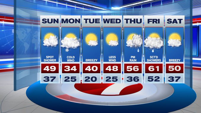
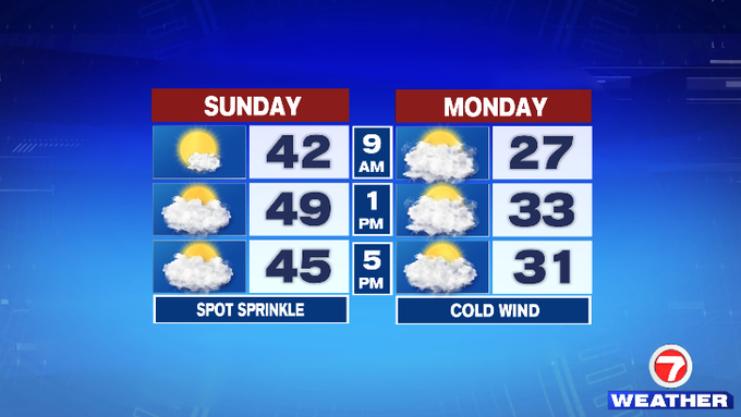
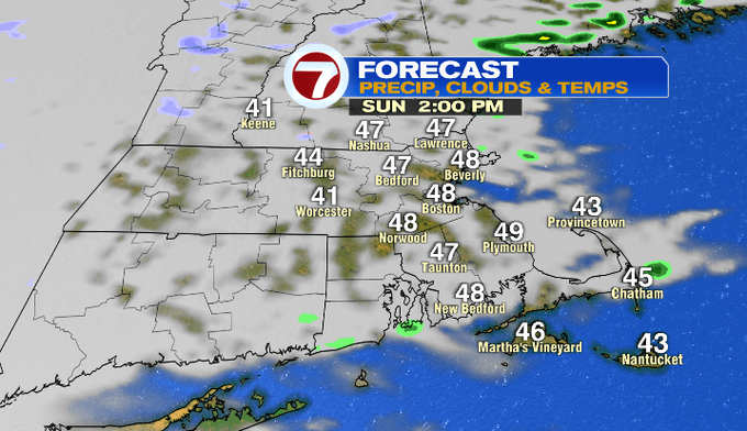
Before we rush the weekend away, today will be seasonable with highs approaching 50°, but it will be breezy, making it feel a touch cooler through the afternoon.
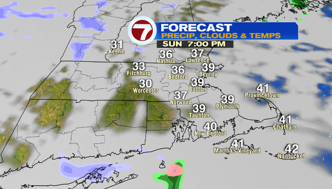
This evening, temperatures will fall back into the upper 30s to low 40s as early as 7pm (around sunset) and then we continue that colder trend overnight into Monday morning. Overnight lows will dip into the low to mid 20s.
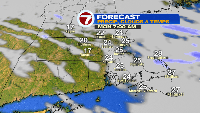
For your Monday morning commute, temperatures will be in the 20s, but wind chills will be in the teens at times, so dress the kids warmly for the bus stop.
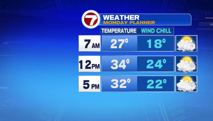
Monday’s highs will be in the low 30s with wind chills in the low to mid 20s for much of the afternoon under mostly cloudy skies. It will be quite blustery at times with winds out of the northwest at 10 to 20 mph. Don’t be surprised if you see a passing flurry.
Tuesday will still be breezy, but at least we have more sunshine. Highs will be around 40, but it will still feel cold. It’s not until Wednesday we start to feel more seasonable and with less wind.

We warm up for the latter half of the work week as 50s return Thursday and low 60s return Friday. However, with the warmer air, rain showers return too.