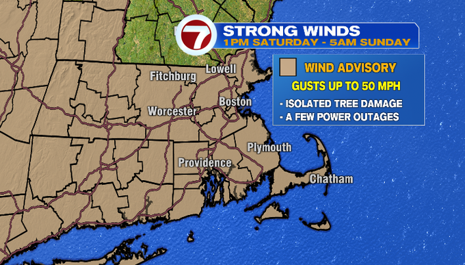
Showers bookend our day, wind picks up this afternoon and continues through this evening and we get a boost in the temperatures due to a warm front lifting north across southern New England. A Wind Advisory has been issued for the Bay State from 1pm today through 5am tomorrow for gusts up to 50 mph possible.
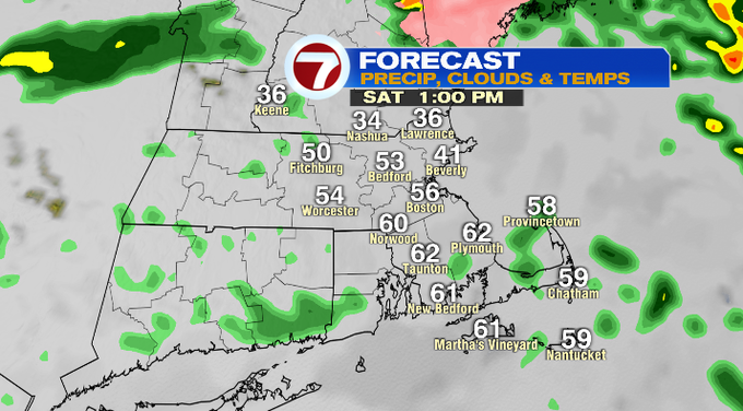
It’s a dynamic system traversing our area today. We saw a few locations with some freezing rain especially across the higher terrain in north central MA and southern NH.
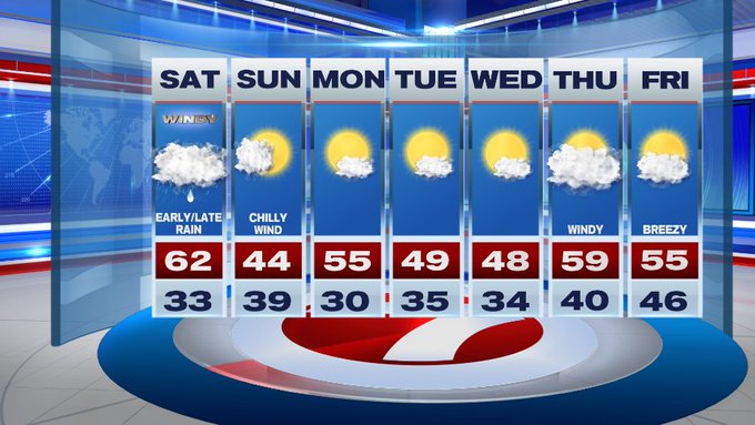
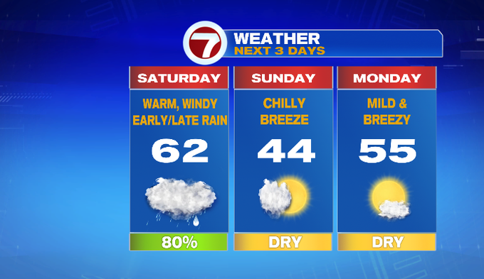
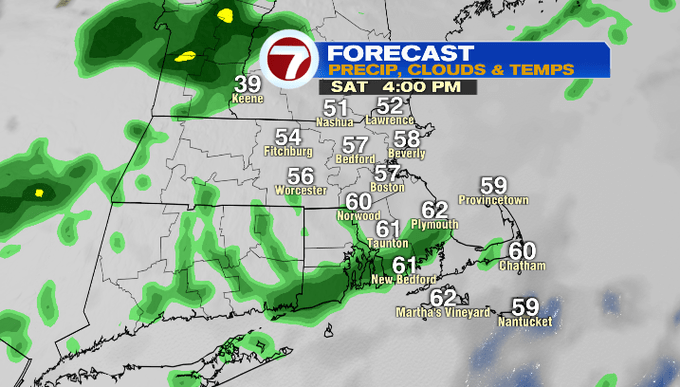
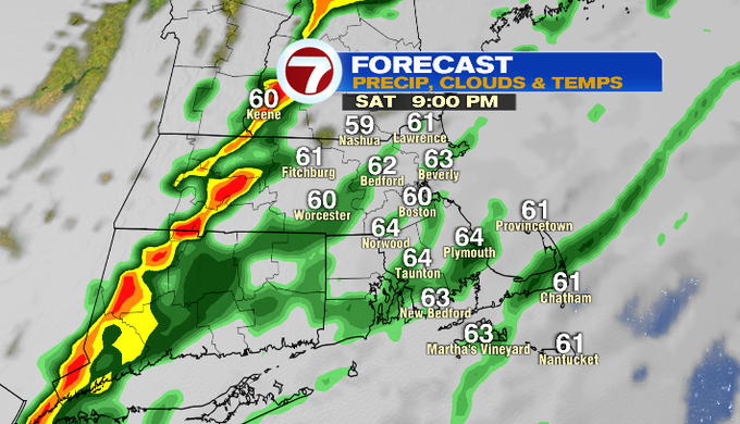
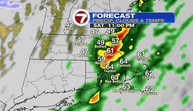
We see a lull in the rain showers in the early afternoon, followed by a line of showers that could contain embedded downpours and thunderstorms later tonight ahead of the cold front. The surge in the warmth with highs in the low 60s today will also bring the surge in wind gusts.
The rain clears off the coast just after midnight, and then we’ll see a gradual clearing of the skies and a dip in the temperatures.
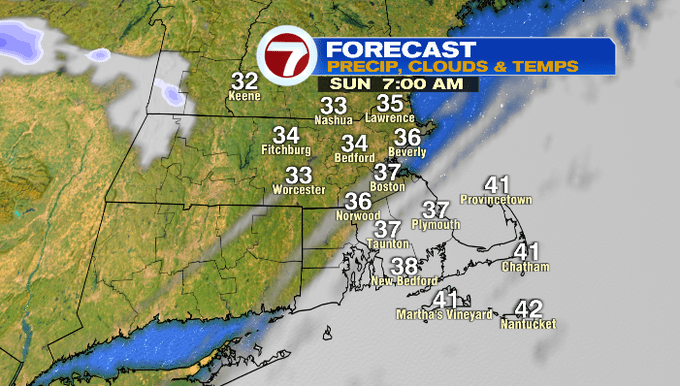
It’s a seasonable second half of the weekend with highs in the low 40s, but it will be coupled up with a chilly breeze under mostly sunny skies.
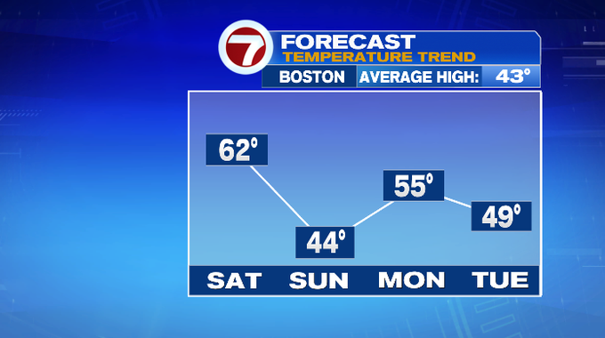
It’s back to mild air on Monday with highs in the mid 50s. A couple more 50s show up in that work week forecast.