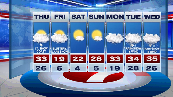
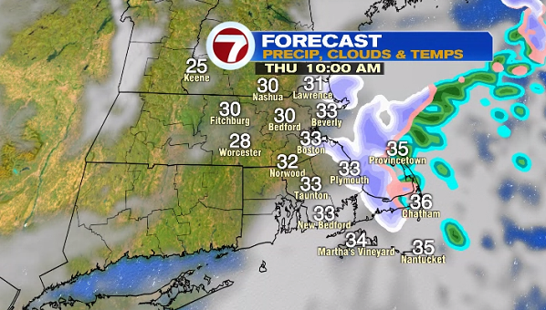
Most of the Bay State and southern NH woke up to several inches of snow on the ground this morning. That snow tapered to cloudy skies and seasonable high temperatures this afternoon.

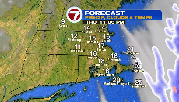
Tonight, isolated snow showers are possible, but not widespread or as heavy as last night. Overnight lows slip into the 20s.

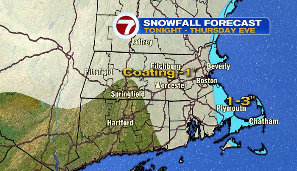
Those isolated snow showers linger into Thursday, especially along the immediate coastline where a couple inches of accumulation are possible, inland areas could see a coating.


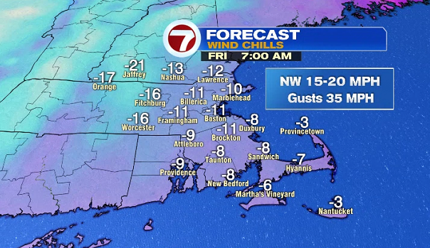
We see a clearing of the skies after sunset Thursday evening and that will be the leading edge of the cold blast that will settle in for Friday and Saturday.
Just how cold are we talking? Air temperatures that struggle to make it into the 20s Friday afternoon along with subzero wind chills (yes, even in the afternoon for quite a few locations).

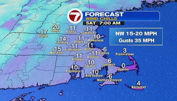
We start off the weekend with bitter cold wind chills and highs into the low to mid-20s. Sunday looks to be the pick of the weekend with slightly higher temperatures than Saturday, but still below freezing.

We’re keeping an eye on a system that could be impacting the region next Tuesday and Wednesday with rain, accumulating snow and wind, which we will have a better handle on timing and impacts as we get closer.