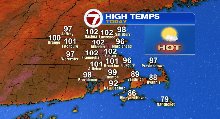
After a scorching start to this early July heat wave yesterday (highs in the 90s), we’re looking at the hottest temperatures of the week today and tomorrow.
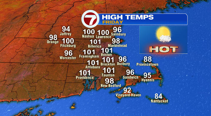
Today’s highs will be in the 90s AND triple digits, with the hottest temps largely along the 495 corridor, as well as for the city of Boston.
We could smash records today with the numbers being so high. Boston’s daily temperature record, for example, is 98 degrees (set back in 1963). Today’s high temperature forecast? 102. Yikes!
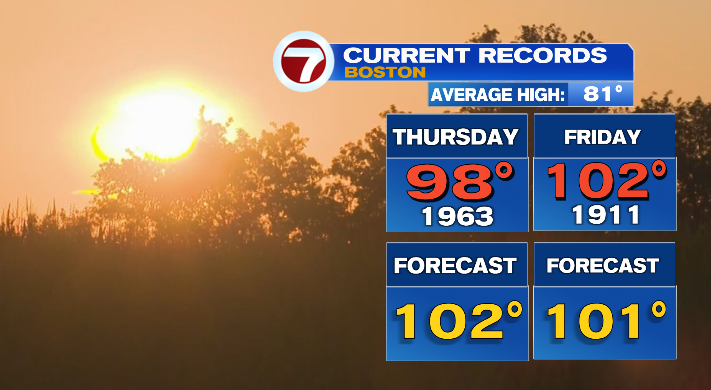
No relief tomorrow either– the numbers will remain in the 90s and triple digits for Southern New England, largely feeling like it’s between 100-110 degrees. While fewer records are in jeopardy, a few could still fall across the area.
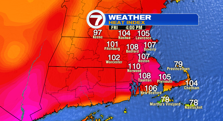
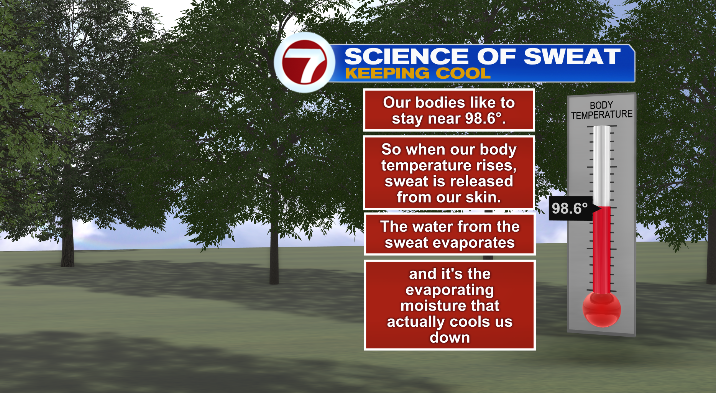
But here’s the thing: it’s not just the temps the next few days, it’s the dew point temps too. Dew point temperatures will be in the 60s and 70s, and humidity will feel high at times. This is really important to note for anyone who has to or is planning to spend time outdoors considering the humidity will make it harder for your body to cool down!
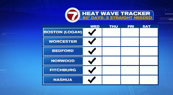
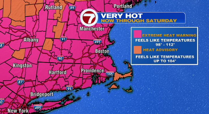
With all of this happening, it’s no surprise that the National Weather Service has put most of Massachusetts (and New England in general) in an Excessive Heat Warning.
When it comes to your health and safety the next few days, make sure you’re drinking plenty of water, wearing light/loose clothing outdoors, and taking breaks in the A/C when you can.
On another note, we have the potential to see a spotty storm or two tomorrow evening. While storms won’t be a widespread issue, any that we see could be a little punchy with gusty winds.
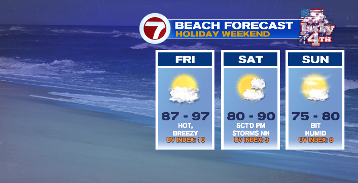
While temperatures may not be AS extreme, the heat wave does continue into the weekend. That means we’re awfully hot for the Fourth of July. We’ll start the holiday with morning temperatures in the 70s and 80s, with afternoon highs in the 90s for most of the area. The most relief will be found on the Cape and Islands, where temperatures will be in the 70s and 80s in the afternoon.
Be mindful if you’re spending the day inland, especially with prolonged periods of time outdoors!
We could also see a few punchy storms on the 4th as well, largely in the afternoon and early evening as a cold front moves through New England. Any storms will be isolated, but still worth keeping an eye on with a day full of outdoor fun!
In terms of the event of the night, the Boston Pops Fireworks Spectacular, timing is on our side! Storms should wrap up right around the time the event kicks off at 7 PM, and should be long gone by 9:15 when the fireworks begin.

Temperatures, while still warm, will be considerably cooler and more manageable than in the afternoon. We’ll be in the low to mid 80s when the event starts, and mid to upper 70s when it ends.
As for Sunday, we’ll still be above average, but waaay cooler than the days prior. We’ll wake up in the neighborhood of 70 degrees, while highs will be in the mid 80s in the afternoon.
We’ll continue the cool-down, with highs in the upper 70s at the start of the work week!