

Good morning! We had a gorgeous Saturday across Southern New England! While today and Monday are certainly a different story, the theme of the next 48 hours is that you can still enjoy the remainder of your three-day weekend… you just have to be a little more deliberate about planning!
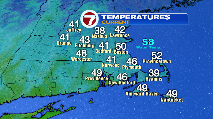
This morning, we’re waking up to a varied, but overall chilly start, even for this time of year with temperatures mainly in the upper 30s and low 40s. By this afternoon, we’re back in the neighborhood of average, with highs in the low 60s.
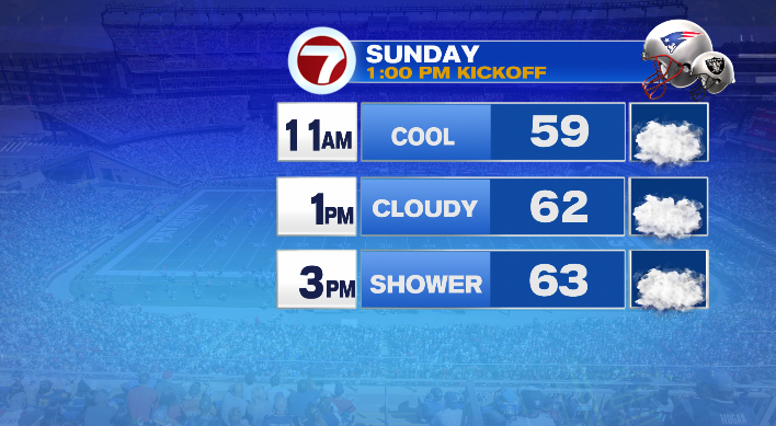
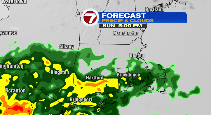
However, as temperatures increase, so does the cloud cover. Those clouds are out ahead of our next round of rain, which arrives late this afternoon.
That rain is courtesy of the remnants of Hurricane Isaias. While the storm brought deadly conditions to the Gulf Coast, and flooding and severe weather to the midsouth and southeast, for us, it’ll just bring some wet weather.
We may see a quick sprinkle early in the day today, but the rain really holds off until mid to late afternoon, generally speaking around 4PM or so.
However, as we go through the end of the afternoon and through the evening, rain becomes more widespread, and heavier as well.
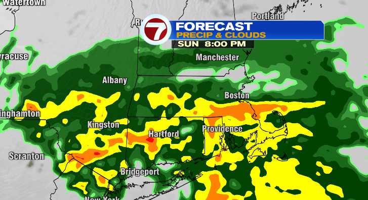
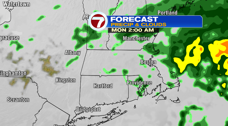
We’ll be in and out of light rain and downpours through Sunday night, with the rain tapering off slowly through the dark-and-early hours of Monday morning, mainly wrapping up before sunrise.
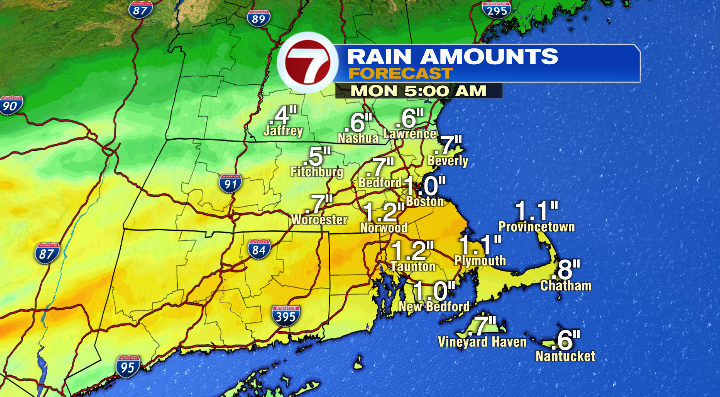
Between now and then, we’re generally looking at 0.5″ – 1.5″ of rain, with the highest numbers for areas south of the Pike.
With the rain timing out as it is, it might be bad news for anyone who wanted to be outdoors on Sunday night, but it’s great news if you have outdoor plans on Monday.
After the rain wraps early in the morning, the clouds will start to decrease throughout the day. By the afternoon, we’ll be partly to mostly sunny and mild, with highs in the upper 60s! If you didn’t get the chance to leaf peep, or enjoy fall festivities like the Topsfield Fair, you can certainly take Monday to do just that.

That said, we turn right back around to wetter weather on Tuesday.
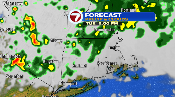
While Tuesday doesn’t look like a total wash either, we will see showers, and some downpours courtesy of an area of low pressure moving in from the west. Highs will be in the low to mid 60s.