Once the clouds cleared out after sunrise this morning, the bright beautiful blue skies are back however, we still have winds cranking out of the northwest (with a few gusts up to 30 mph), making it feel about 10 degrees colder than the actual air temperatures.
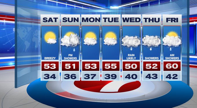
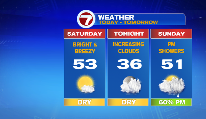
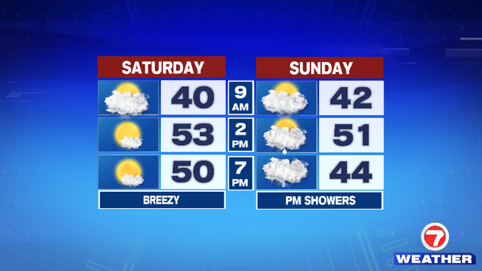
The winds will remain steady through much of the afternoon, but the gusts should will weaken. For your Saturday, expect seasonable highs in the low 50s and breezy as those sun-filled skies stick around.
Tonight, we’ll have increasing clouds late ahead of our next system. Overnight lows will be in the 30s.
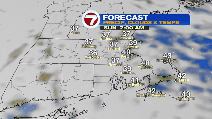
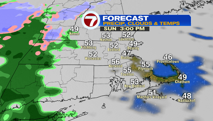
Sunday will be more cloudy than the day today and less breezy. Showers start to slide in by mid-late afternoon and will be with us through the evening hours.

A few rain drops could mix in with a few wet snowflakes for the higher elevations into north central MA, Berkshires and the Monadnock Region of southern NH tomorrow night.
It is a dry start to the week with highs in the low to mid 50s both Monday and Tuesday. We see a shift in the pattern Wednesday as rain returns along with an easterly wind that will make it colder at the coast with highs in the upper 40s to low 50s. Thursday will be similar to Wednesday before temperatures return to near 60 by Friday as showers move out after the morning hours.