
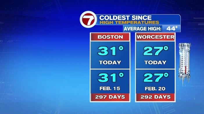
Between yesterday and today it felt like winter has set its its grips on New England. If you thought yesterday was cold, well today was colder! Highs across the area struggled to make it to freezing, and for those of us in Worcester county, we couldn’t even make it to 30!

In fact for both Boston and Worcester, today’s high was the coldest one of the season. For both cities you have to go back to last February to find a high temperature that was as cold as today was.
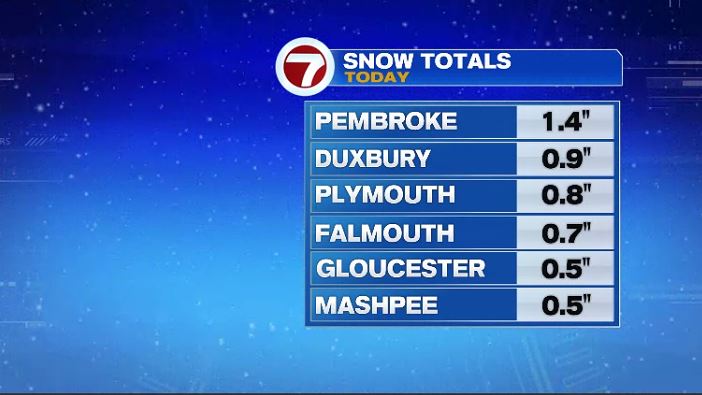
And while it felt like winter for everyone today, some of us woke up and it LOOKED like winter with some ocean effect snow flurries and snow showers in area. It wasn’t heavy snow, just about everyone who did see snow accumulate stayed below 1″.
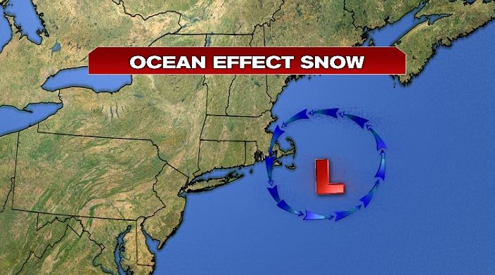
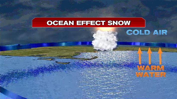
So what is ocean effect flurries? And how do they form? Well follow along to the graphics below. We had an area of low pressure move south of us which brought an on shore northeast wind. Now a lot of things need to come together for this to happen… not just any northeast wind will do. You need the wind over the water for a prolonged period of time and the temperature difference between the water and the air has to be significant. Generally the air has to be at least 13° colder than the water temperature.
Anyway, if we tilt the graphic you see above and we look “under” the storm you see the wind arrows flowing under the red banner. You have the cold air above and the relatively warm water temperatures below — the temperature doesn’t have to be swimming temperature to be warm, just warmer than the air.

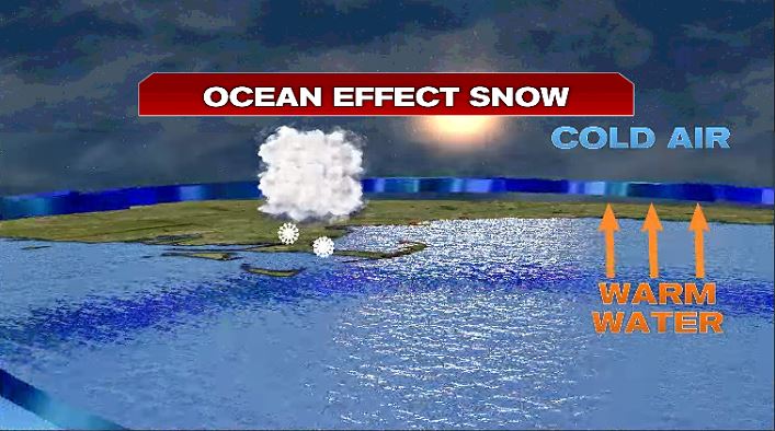
Warm air rises so the air near the water rises as it is less dense than cold air. As the warm air rises, it cools and condenses and forms a cloud.
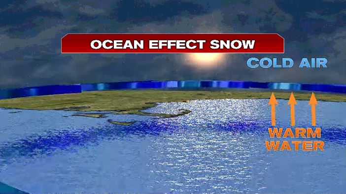

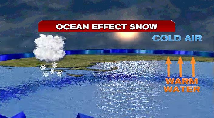
From there the cloud is carried downstream from the wind where it continues to build, grab more moisture and more rising air as it moves along this conveyor belt if you will. And eventually there is enough moisture added to the cloud where it starts to precipitate. And since air temperatures were below freezing all day and especially overnight — that precipitation falls as snow!
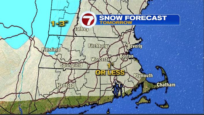
Tomorrow will once again bring snow showers to the area but it’s not ocean effect. It’s a little clipper system that races through here. It will bring us cloudy skies tomorrow and coating of snow possible. An inch or less across Massachusetts.
It will be cool again with another day in the 30s and cloudy skies.

But once we get through tomorrow it’s an uphill climb! Thursday and Friday temperatures will return to where they should be this year but a chilly breeze will make it feel like the 30s.
