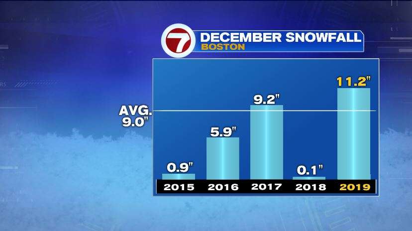
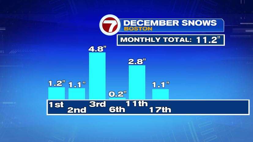
The only way to describe today was messy. Snow amounts under achieved a little bit but ice amounts over achieved to make up for it. So travel today was plenty rough today with plenty of spin outs, slide offs, and accidents. Boston’s official measurement was 1.1″ and 1.0″ in Worcester. That 1.1″ tally moves our monthly total to just over 11″… above the average and skyrocketing beyond last year’s 0.1″.
After this system moves out overnight the big weather story is the cold. It’s December. December is cold. But it will be the coldest air we’ve seen this season with air temperatures struggling to 20°. If you follow the path of the air mass that’s moving in, you will end up in the Arctic Circle.
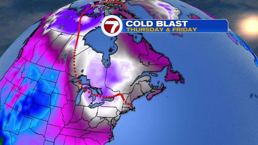
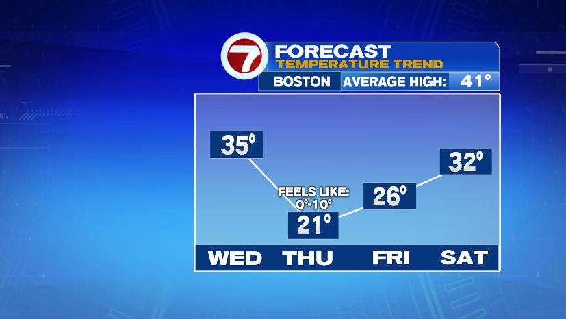
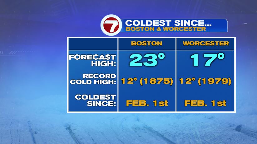
High temperatures Thursday will likely make it to the lower 20s in Boston and be stuck in the upper teens in Worcester. Is it record-setting cold? No. But it is the coldest air that we will see since last winter… February 1st to be exact.
Keep in mind, these will be actual air temperatures, not wind chills. And the wind chills will be much worse. You’ll wake up Thursday morning to subzero wind chills. And Thursday afternoon, the wind chill will likely not even make it to the double digits across the area! Brrrr.

Now it is cold, yes. But it’s not dangerous cold. There is no wind chill advisory in effect for the area. And you’ll see below it would have to be teens below zero before we start dealing with the real threat of frostbite. That said, when the kids are out waiting for the bus, make sure they’re bundled up because it will be bitter cold.

The cold will be here for a while with a slow climb through the weekend and eventually getting back to near average on Sunday with a forecast high of 41°