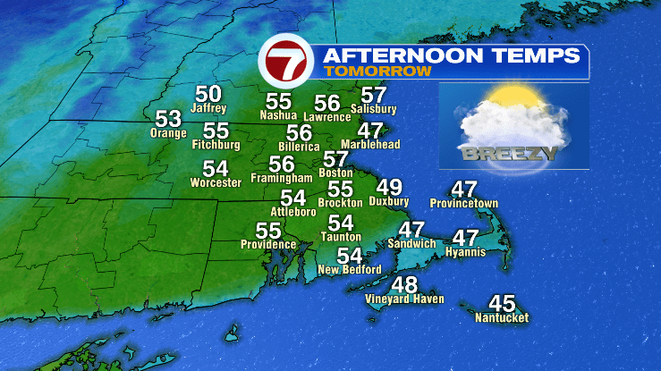
The holiday weekend will wrap up with well above average temperatures on Monday. Highs are expected to reach mid to upper 50s, all ahead of a cold front that looks to cool things down for the rest of the week.
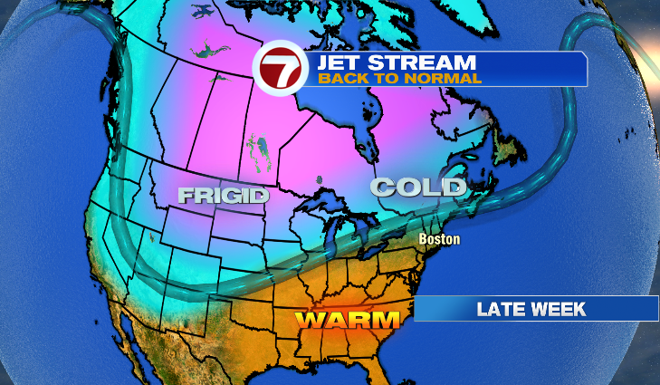
By Tuesday temperatures fall back into the 40s, with 30s returning for highs by Thursday. This is due to a dip in the jet stream that’s forecast to bring more seasonable weather to New England. The pattern will push storm systems into New England, as the jet stream parks itself over the area.

The combination of colder air and an active pattern will allow more opportunities for snow this week, we are watching 2 weather systems that have the potential to produce snow and will have updates throughout the week.