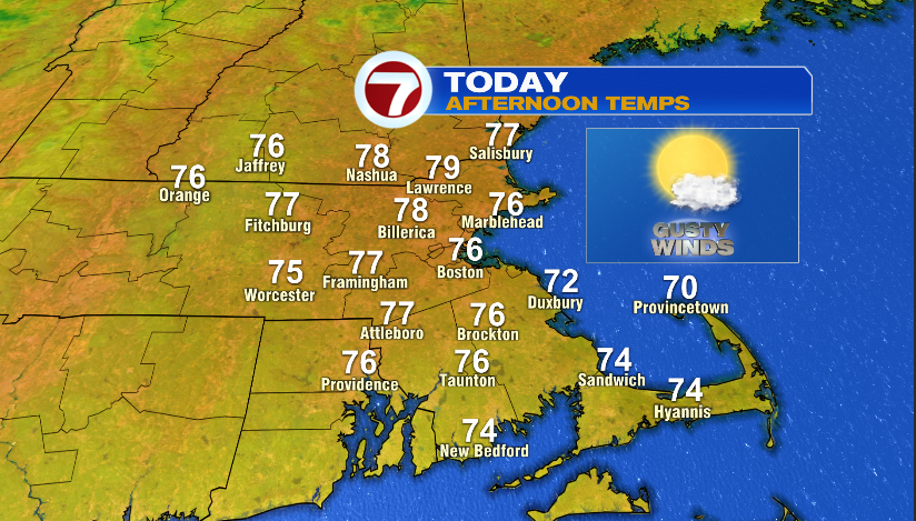
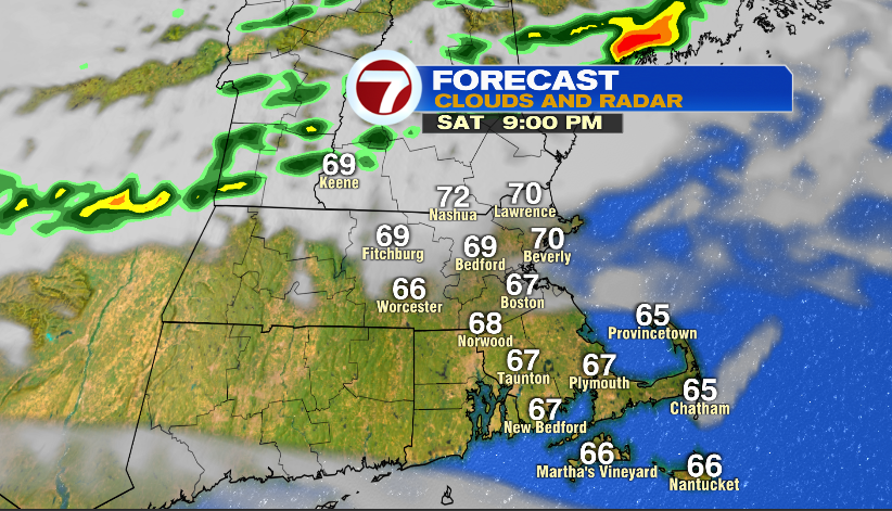
7Weather- If you like warmer weather, then you’ll like today! Temperatures will be 15-20 degrees warmer compared to yesterday with highs reaching into the mid and upper 70s.
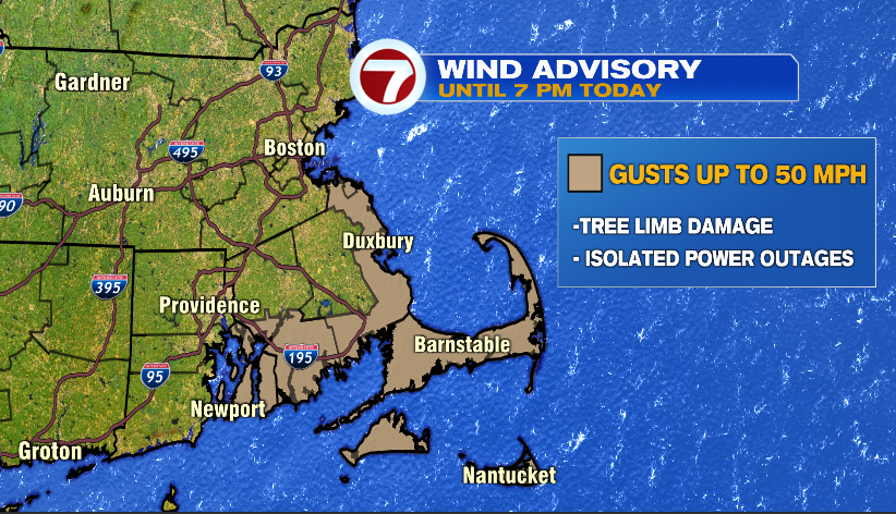
There will be a gusty breeze around today with gusts up to 35 mph for most of us. There are a few areas that could see higher wind gusts up to 50 mph. This includes the South Shore, along the coast of Plymouth County, the South Coast, and the Cape & the Islands. These areas are under a Wind Advisory until 7 PM today. There could be a few broken tree branches that could lead to isolated power outages.
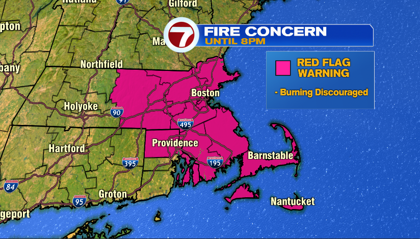
With low relative humidity, gusty winds and dry conditions a Red Flag Warning in effect for today. Burning of any kind is discouraged.
Clouds move in later this evening as a cold front moves in. A line of downpours will form along the front, but it falls apart as it gets closer to our area. One or two of these storms could spill into Southern New Hampshire and northern Worcester County between 8-11 PM.
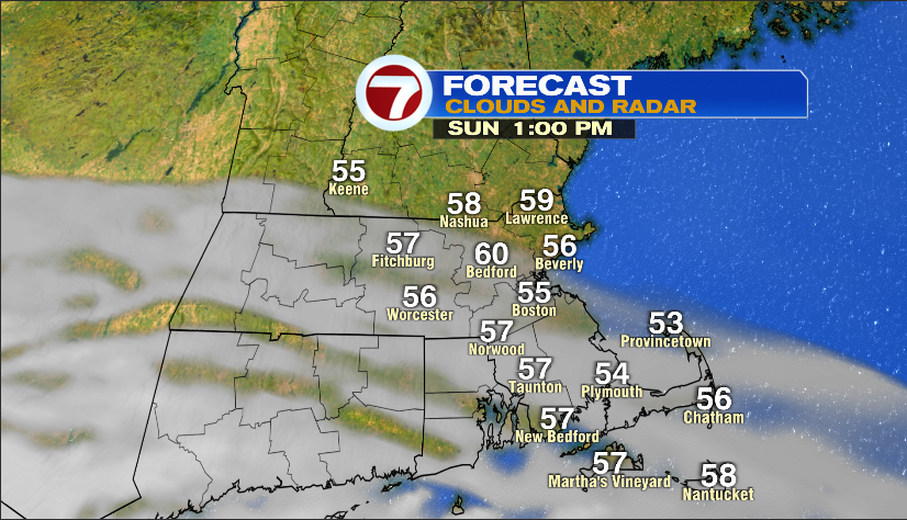
Sunday starts with sunshine and temperatures in the upper 40s to low 50s. Clouds gradually move in, and highs are cooler near 60º.
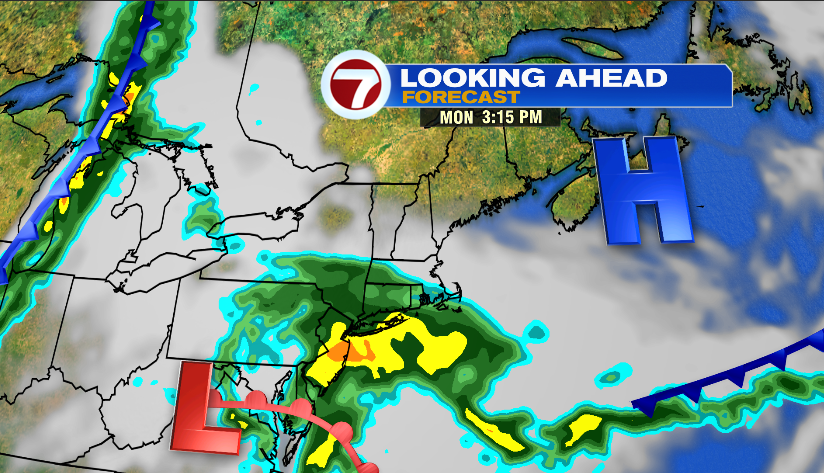
The remnants of Delta move into southern New England, and will be around until mid-day Tuesday. Light showers move in mid-day Monday, with the steadier rain starting in the evening. There will be on and off showers Monday overnight through mid-day Tuesday. Most areas receive about 1.0″ of rain.