Today was the tale of two forecasts — all thanks to the clouds and onshore wind. Just look at the high temperature map from today. For some, it was a cool, gloomy March day. For others it was bright blue skies and felt more like early June.

This is the satellite snapshot from 3:30 this afternoon, but that cloud line was pretty consistent all day long. Sunshine north of Boston. A mix of clouds and sun from Boston through Bristol County. And if you were on the Cape or in Plymouth County, especially along and east of Route 3 it was cloudy day with on and off drizzle.
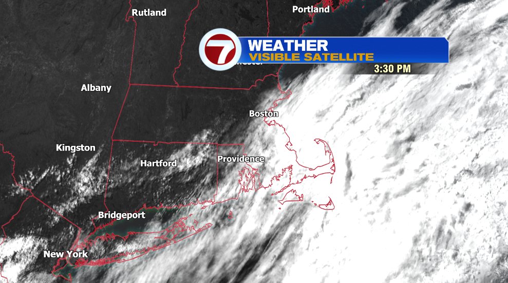
This is all thanks to the same area of low pressure that has been impacting our weather since Saturday! That low is slowly drifting south and you can see the onshore wind that is also moving south with cooler temperatures on the Atlantic coastline.
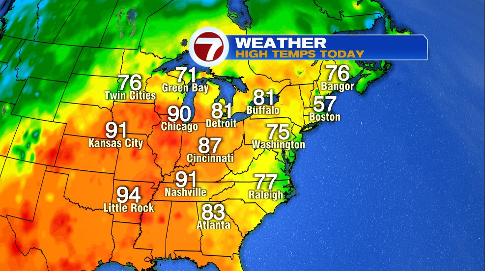
But also look at the 90s in the Midwest! Once the low gets far enough south, and far enough away from us, that warm air will leap into New England — mainly for the weekend. We won’t see 90s here, but still it’ll be a taste of summer with 80s and a bit of humidity as well.

The warmth is not here yet tomorrow. Temperatures will return to the low 70s inland with temps on the coastline near 60° tomorrow afternoon. We’ll start off with clouds and even some fog in the morning and developing sunshine through the day.

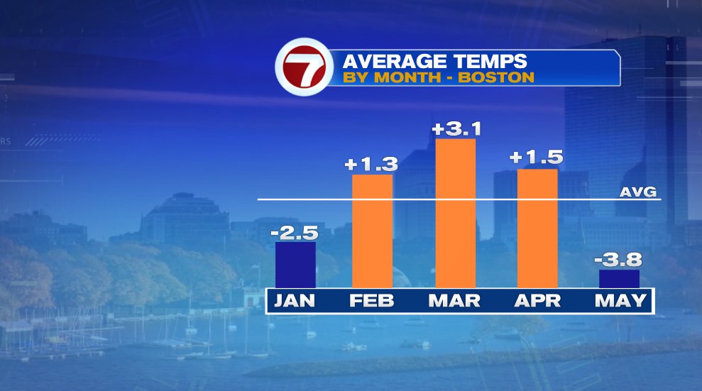
The month of May has been incredibly chilly in Boston so this pattern change is welcome! It’ll take some work to pull our monthly temperature back to where we should be, but the mild pattern ahead will help us make some headway!