Today is the pick of the weekend with sunshine and warmer temperatures. Highs today stretch into the low to mid 70s for interior MA and southern NH, Boston could reach 70° as along as the afternoon seabreeze stays out to sea, 50s for the Cape/Islands and the South Coast due to the southwesterly wind direction off the cooler ocean waters.

Tonight, clouds increase in coverage across the region with temperatures only dipping into the upper 40s to low 50s.
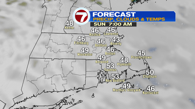
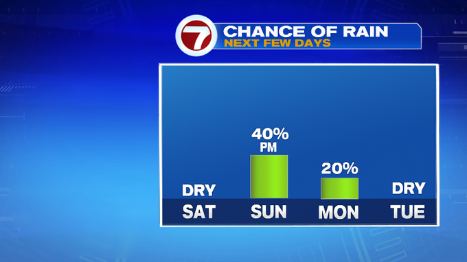
Tomorrow, cloudy and cooler with highs into the low 50s (which is nearly seasonable for this time of year) and we’ll see a few late day showers (closer to dinner time) as a system over the Great Lakes region propels a line of showers into southern New England.


These showers break apart as they move from southwest to northeast, with NE MA and southern NH seeing the showers closer to 8PM -10PM, which means the bulk of the day should be dry for many north of the Pike.


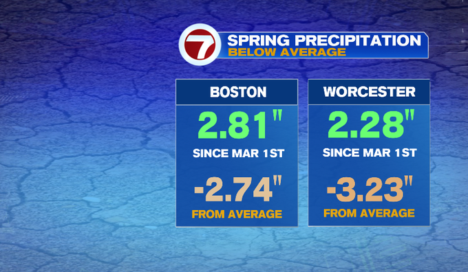
These showers won’t make a dent in our abnormally dry spring, but at least it’s some water for those yards and spring flowers.
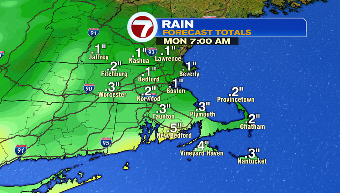
A few showers linger into Monday, but like Sunday, not a washout. The cloud cover lingers along with an onshore breeze which will keep high temperatures in the upper 40s.
Tuesday brings highs into the 50s under mostly cloudy skies. Another chance for showers Wednesday morning with a partial clearing of the skies by the afternoon with highs into the low 50s. Thursday looks to be the nicest out of the work week with partly cloudy skies and highs into the mid 50s (a touch cooler at the coast though).
Friday brings back mostly cloudy skies with highs in the low 50s, cooler coast.