

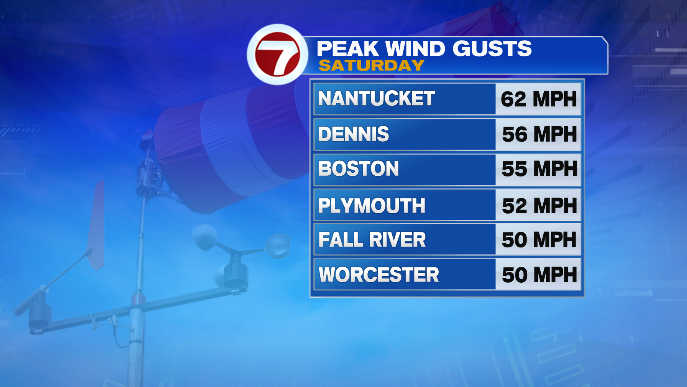
Good morning! Hope everyone is faring okay after yesterday’s storm! We saw plenty of places with wind gusts in the 50s and even a few in the 60s on top of the rain and the early-spring chill.
But, today is a different day with a very different forecast! Now, don’t get me wrong, we are starting out chilly. In fact, some spots around Massachusetts woke up in the 30s this morning! Now, we’re making our way through the 40s, and highs later on today will largely be in the 60s, with the warmest spots right around 70.
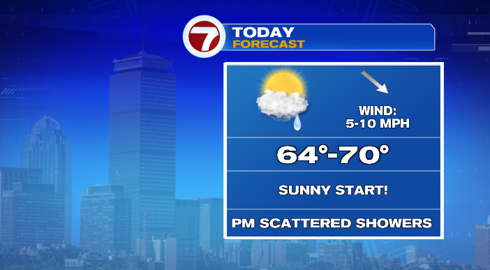
We’ll start the day with tons of sun! That said, later in the afternoon as a disturbance drops into New England from the north, we’ll see more clouds and a few showers as well (a rumble of thunder, particularly to the north, is possible too).
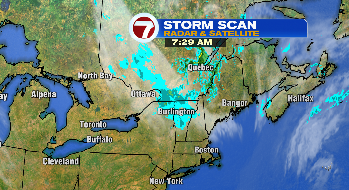
This system has a lot less “oomph” behind it than our storm yesterday– certainly a much calmer afternoon overall! Just have the umbrella on hand around/after 2 PM if you really hate the rain.
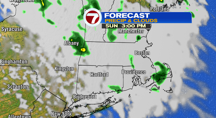
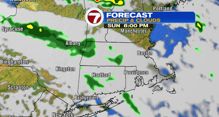
Monday morning starts with lingering showers, but conditions become brighter later in the day, as showers dissipate and clouds start to decrease!
It’s worth noting that tomorrow is June 1… the start of meteorological SUMMER! If you’re looking to switch things up and get into the new season a little early (astronomical summer starts on June 21 with the summer solstice), there ya go!
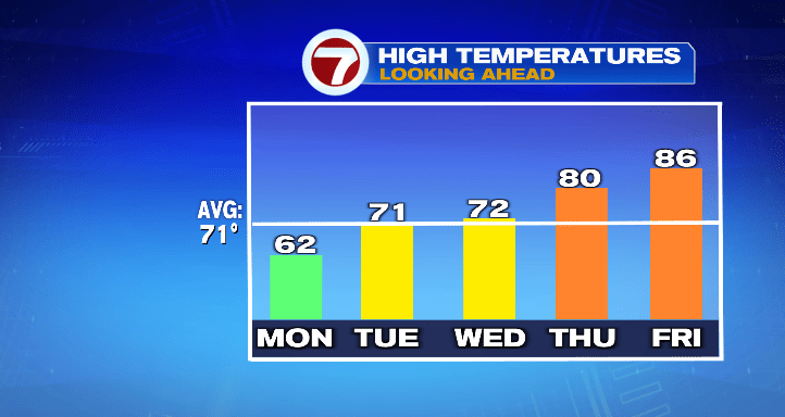
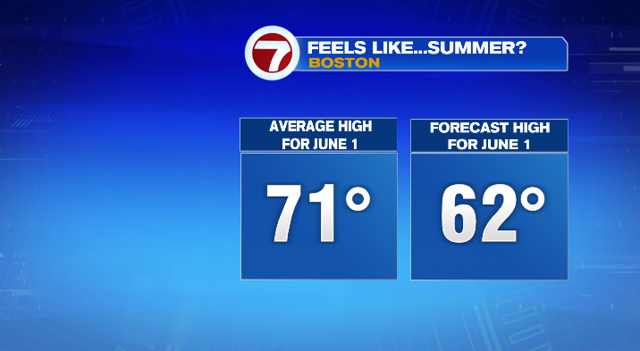
Unfortunately, our highs will be far from summerlike. Our average June 1 high is 71 degrees in Boston. Our expected highs? Low 60s.
However, the chill doesn’t last long! As our stormy, cool pattern in the upper atmosphere finally falls apart, warmer, drier weather enters the chat. We’ll still keep an isolated shower around Tuesday, but most of the day will stay dry. Temperatures will be in the upper 60s and low 70s.
Wednesday will be mostly to partly sunny and in the low 70s as well. Thursday and Friday, however? Temperatures get an extra boost! We’ll be in the neighborhood of 80 on Thursday, and in the mid 80s on Friday!