It was a chilly and wet end to the week with highs today only in the 40s for most locations. We did add more beneficial rain today, making a dent in the drought monitor, which has seen great improvement over the last month.
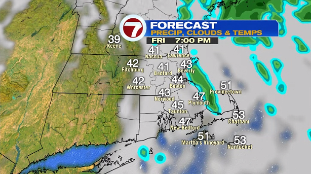
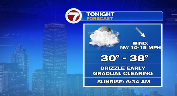
Tonight, the scattered showers should taper by 7PM and we’ll see a gradual clearing of the skies overnight with lows in the 30s.
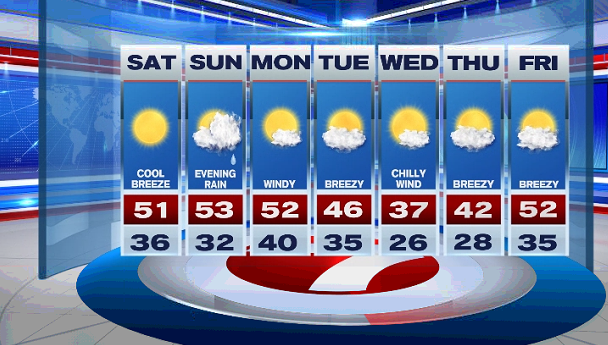
Saturday is sun-filled with a cool breeze out of the northwest and high temperatures into the upper 40s to mid 50s.
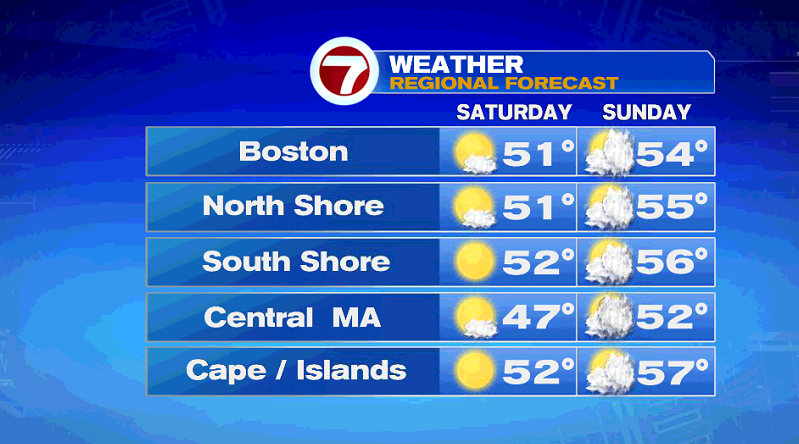
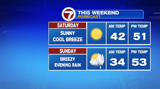
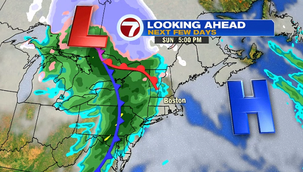
Sunday is breezy with increasing cloud cover ahead of cold front that will bring in rain by the evening and continuing Sunday night. Highs on Sunday will be in the low to mid 50s.
For the next work week, Monday and Friday are the warmest with highs in the 50s with a cool down through the middle of the week, bottoming out in the upper 30s for highs on Wednesday. Then, temperatures moderate back to normal highs by the end of the week.