

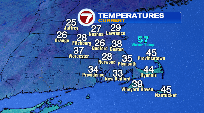
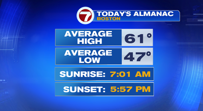
A wicked chilly, if not downright cold start to the morning! We’re waking up in the 20s and 30s, when the average low for this time of year is in the 40s.
Bundle up if you’re heading out bright and early!
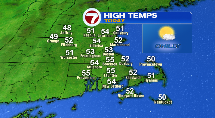
The good news is, aside from layers, you’ll also want the sunglasses. We’ll stay mostly sunny all Sunday long. In the afternoon, it’ll be cool but calm, with highs in the low to mid 50s.
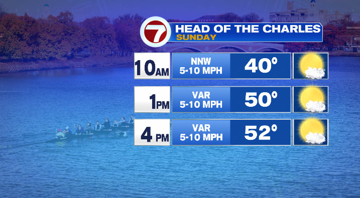
The good news for anyone wanting to spend time outdoors, but perhaps for the rowers taking on the Head of the Charles in particular, is that today won’t be nearly as windy as yesterday was!
Also good news if you’re headed out to watch the Pats take on the Jets at Gillette!
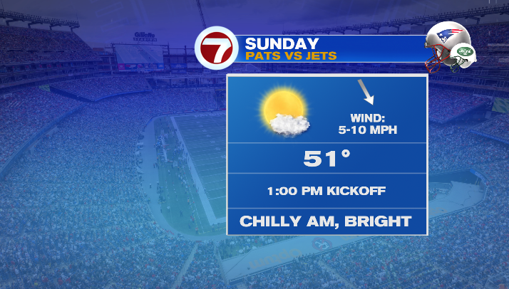
It’ll be chilly, particularly if you’re going early to tailgate. But by our 1:00PM kickoff, we’ll be around 50 degrees or so, and warm up a few degrees more by halftime. It’ll reeeally feel like a fall day for football in Southern New England!
Overnight tonight, temps plummet again– not as much so as they did Saturday night, but we’ll still be 5-10 degrees below average, with most of us in the low to mid 30s as we wake up Monday morning. Keep that in mind as you head out for your morning commute! The heavy jacket isn’t a bad idea when you’re hopping in a cold car!
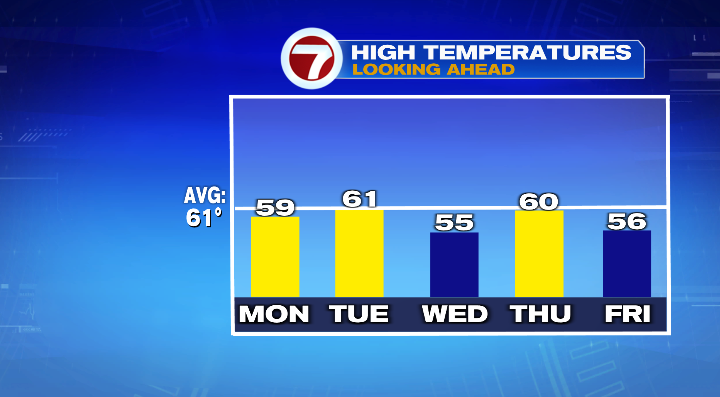
Temperatures continue to get a little boost by Monday afternoon, and we’ll largely be in the upper 50s. Not too bad for this time of year. Temperatures stay relatively consistent through the rest of the week, only fluctuating by a few degrees here and there.
The big focus this coming week will be an area of low pressure that’s currently trying to form off the Carolina coastline.
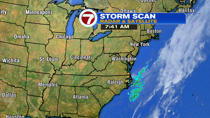
While the energy for this storm is hundreds of miles away, it could try to make a push toward New England this coming week… but with high pressure trying to dig its claws into the northeast, that impending storm can only move so far in our direction with high pressure blocking the way.
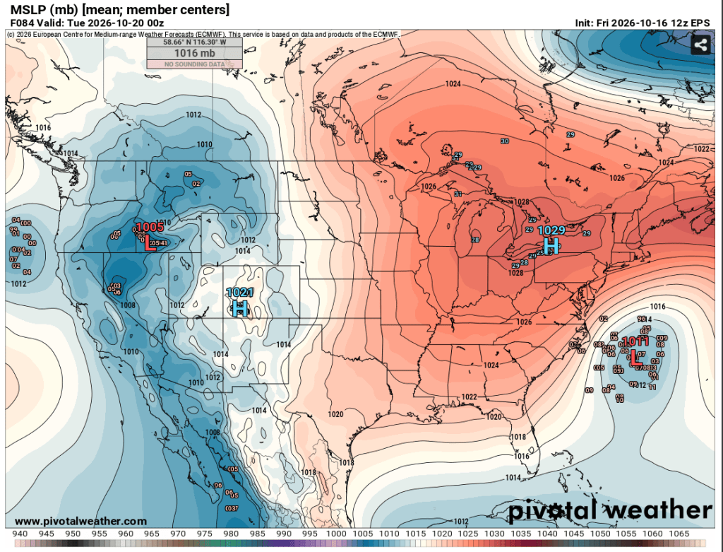
The result in all of this is more cloud cover than we would have otherwise (leaving us partly cloudy Monday-Wednesday), and the chance of a few showers for the Cape and Islands, with the highest shower chances Tuesday-Thursday. We’ll keep you posted on all of this throughout the week!