If you like the heat, this upcoming weekend may be an early contender for best weekend of the entire summer! I know it’s only June, but after several weekends that featured rain, this one is not only dry, but it’s sunny and warm and the humidity will be wiped away!
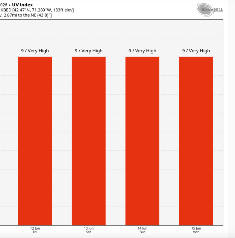
Before we dive deep into what’s on tap for Saturday and Sunday, I want to point out the UV index for the weekend. It’s up to a 9 and in some cases a 10. That’s only about 20 minutes to get a little color in the midday sunshine. The sun is about as strong as it gets the entire year. The first day of summer, and subsequent highest sun angle is on June 21st. So this is it! Make sure to apply and reapply the sunscreen if you’re out and about this weekend and spending time outside.
Saturday
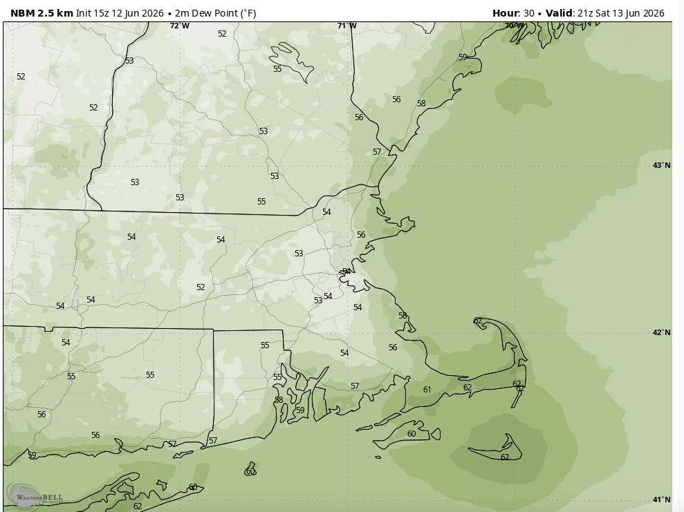
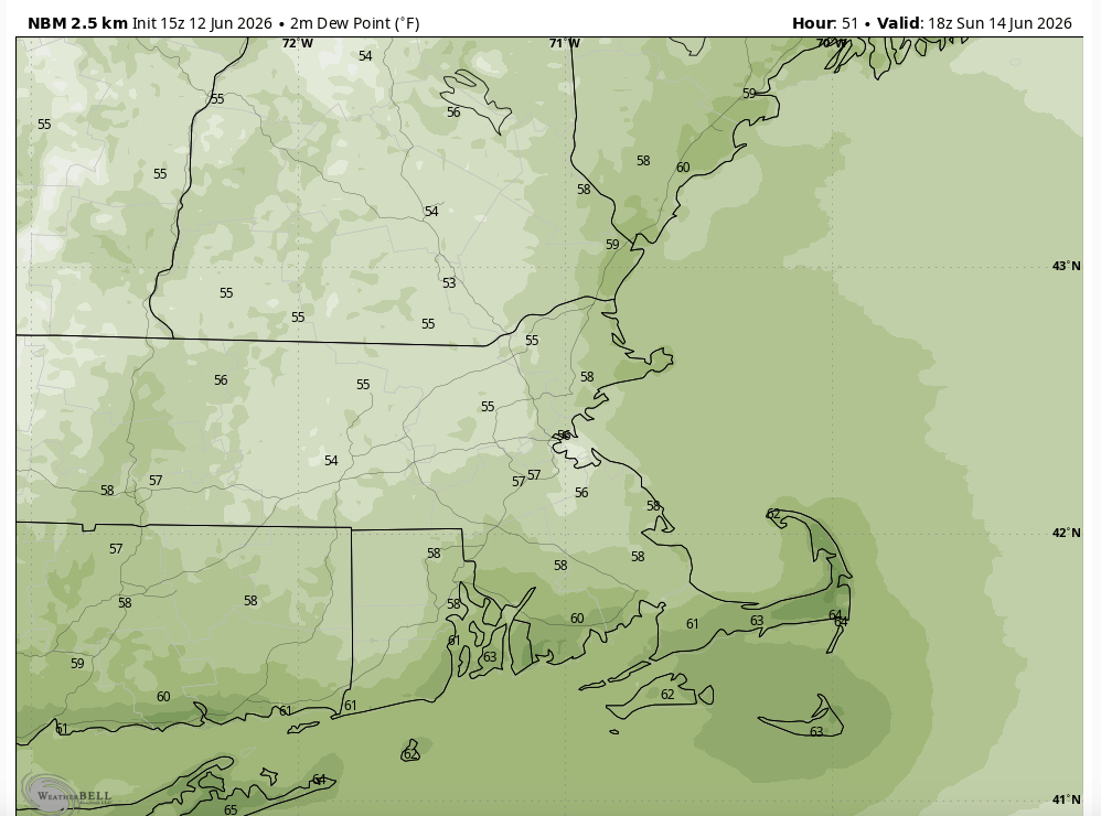
I think the biggest thing you’re going to notice this weekend is the lack of humidity. After a tropical air mass yesterday and today, this weekend dew points will plummet to the 50s. For summer, dew points in the 50s are outstanding. So we’re already in for a nice change Saturday, but everything else is going to come together too to make it just a stellar day!
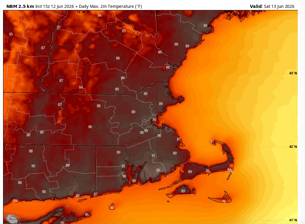
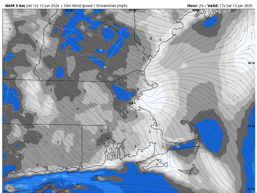
Temperatures will be toasty on Saturday with many towns making it back to 90° on Saturday afternoon! The wind will be from the northwest (not overly strong) but strong enough to knock out the sea breeze Saturday. For those on the Cape and the Islands, a northwest wind is the best wind you can have to get some heat down your way too. A northwest wind will push that heat right across the canal and down Route 6. If it’s not a west or northwest wind, just about every other direction will move across the colder water temperatures and cool you down.
The wind on Saturday will be what I like to call a “Goldilocks” wind. Not too strong where it’s impactful, but not too soft where a sea breeze takes over… it’s just right!
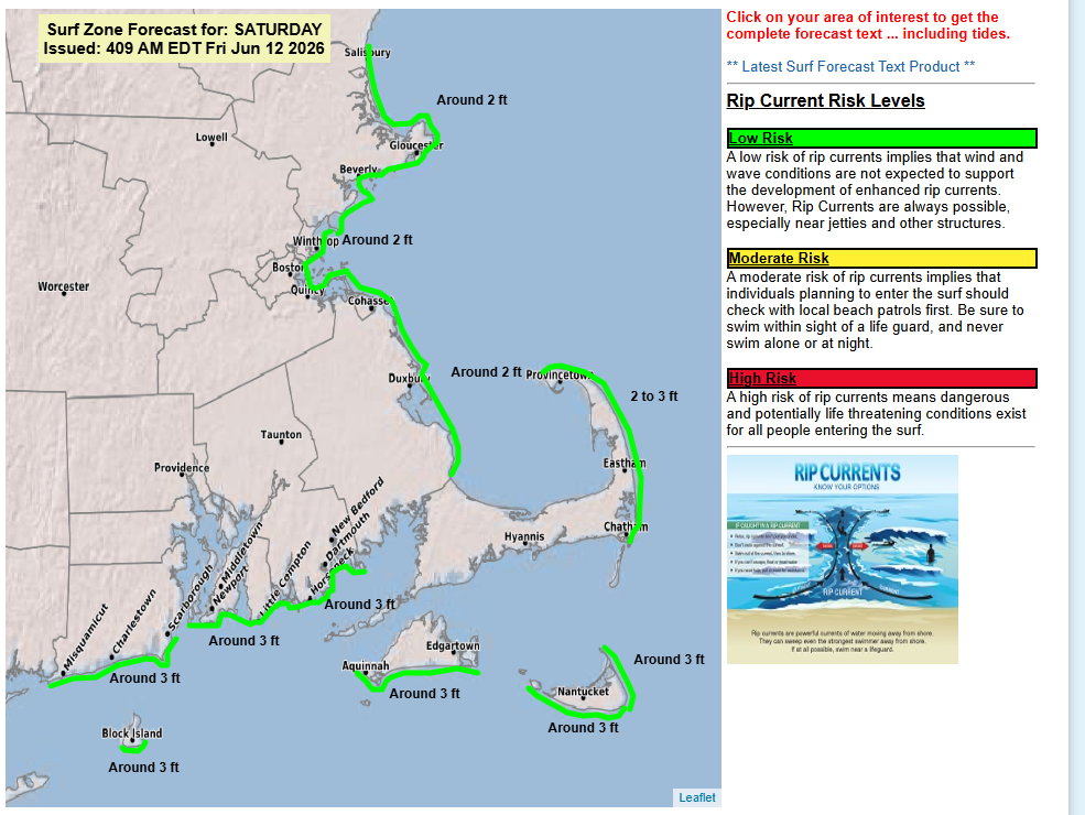
Of the two weekend days, no day is a BAD day to be at the beach, but Saturday is probably the better of the two days, simply because of that lack of wind. In addition to the warmth pushing right out to the sand, the surf is low, only about 2 feet and the rip current risk is low.
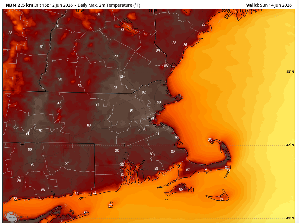
SUNDAY
I think Saturday is a hard day to beat, but that doesn’t mean Sunday is a bad day — not even close. It’s mainly thanks to that “Goldilocks” wind on Saturday that will get a little breezy on Sunday. Not only will the wind speed pick up, but it will change direction. Now if you are not looking forward to the 90s this weekend, then maybe this a good thing! The wind Sunday will shift to the south and also pick up. Sunday becomes a pretty breezy day, from the south to southwest between 10-20 mph.
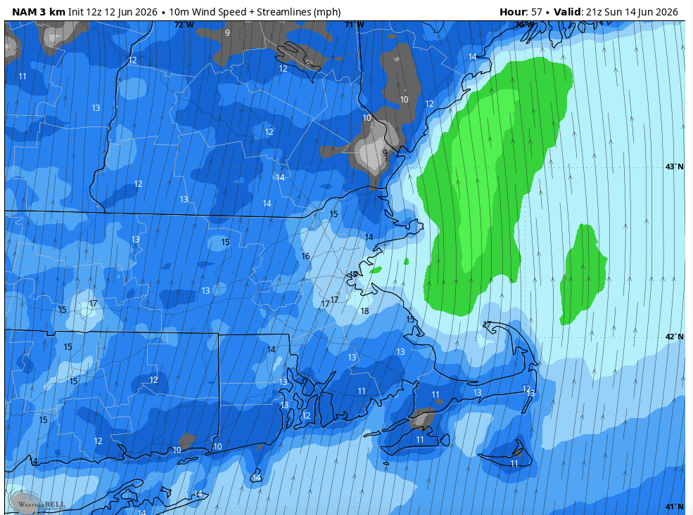
With that wind coming off of the colder water temperatures it will have a cooling effect for some of us — mainly the Cape and Islands. On the eastern coast of Massachusetts, it will still cool you off a bit, but it’s not super dramatic. You’ll probably still see temperatures in the upper 80s versus low 90s inland. There’s a lot of hot air above us so a little sunshine will go a long way with warming us up. Which is why despite the water temperatures in the upper 50s I still think the Cape can get a nice warm day. In the town centers and away from the immediate water, temperatures will still climb to the 80s, but beach temperatures will likely hold in the 70s. So that’s why it won’t be quite as beachy on Sunday — not only colder temperatures, but you’ll fight a breeze too.
Like Saturday, humidity will stay nice and low for Sunday.
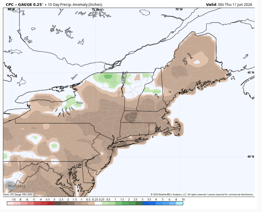
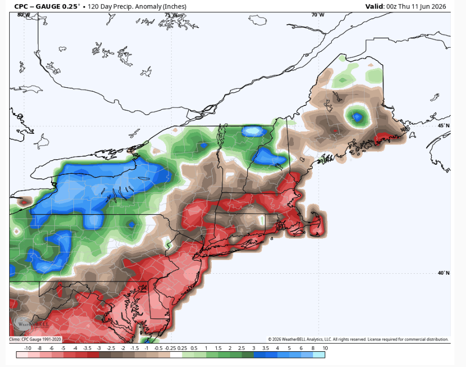
I know nobody wants me to rain on this weekend weather parade, but we do need rain. I’ll just mention it and move on and let us all soak up the weather that’s on the way. The first image is the precipitation anomaly for the last 10 days (the brown shadings generally 1-1.5″ below normal) and the second image is the 120 day precipitation anomaly which is even more extreme (the red shadings 3-5″ below normal with the pick in northeast Massachusetts up to 8″ below normal).