

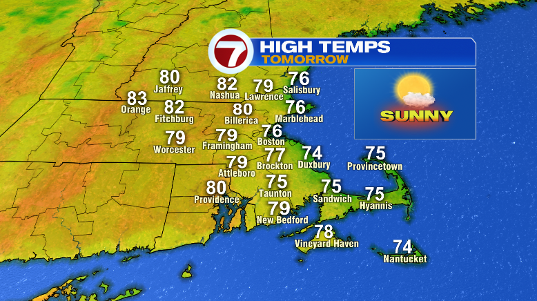
Happy Saturday! It was an absolutely amazing day. Lots of sunshine, a bit of a breeze, highs in the upper 70s and low 80s and no humidity. While your Sunday will be another repeat fantastic day, we are tracking some changes toward the middle of next week.
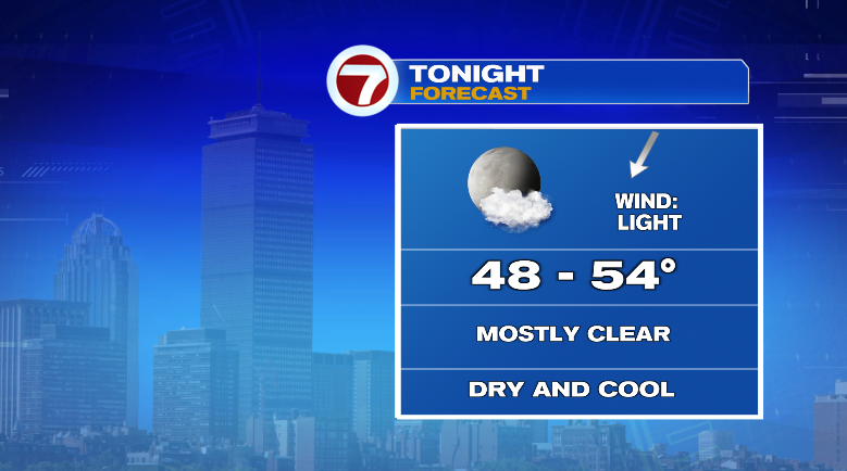
First, under clear skies tonight, temperatures will tumble quickly. We’ll slide from the 70s to the 60s with overnight lows way down to the upper 40s and low 50s. With no humidity, that’ll again make for a great night to open up your windows and get the fresh air going around the house.
Tomorrow will be nice and bright, and that’ll allow a warm-up to the 70s and 80s. Temperatures will be coolest along the coast, but the good news? Humidity stays low for all. Honestly, Sunday will be another 10/10 weather day.
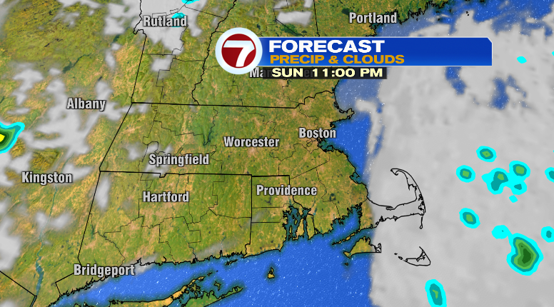
Clouds will roll in Sunday night along southeastern Massachusetts.
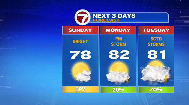
Monday looks mainly dry and it’ll be a bit more humid but still not bad. Highs will jump to the low 80s, and there’s a low-end chance for a spot shower or storm late in the day.
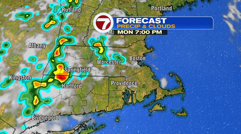
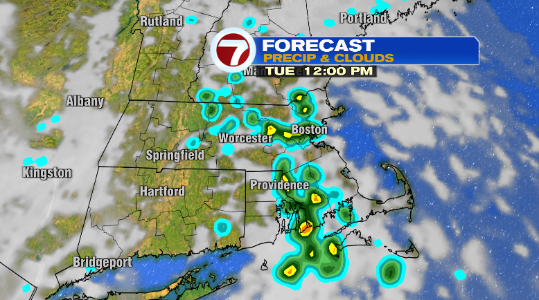
Humidity jumps a LOT on Tuesday. It will be noticeably humid with likely chances for showers and thunderstorms, mainly in the afternoon. Highs will reach the low 80s but the humidity will make it feel so much hotter. I’d go with a rain coat that day due to the risk for lightning and some gusty winds with any storms.
Wednesday will be a repeat of a day. It’ll be warm and incredibly humid with chances for showers and thunderstorms.
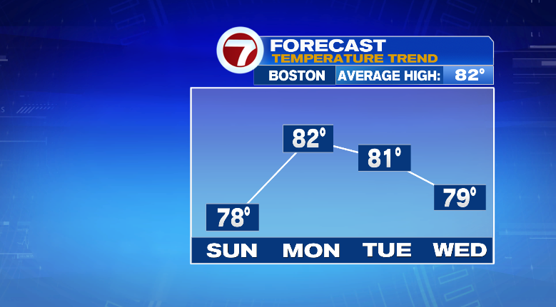
Thursday, there could be some lingering spotty showers in between partly sunny skies. Highs will reach near 80 and it’ll still be humid.
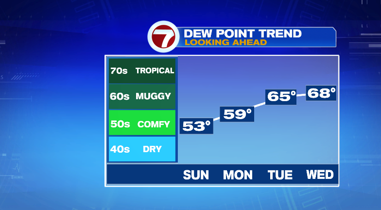
The humidity lingers into Friday with highs back to the low 80s. Most of the day looks dry with an isolated storm chance. Saturday looks partly sunny and in the mid 80s. Stay tuned!