

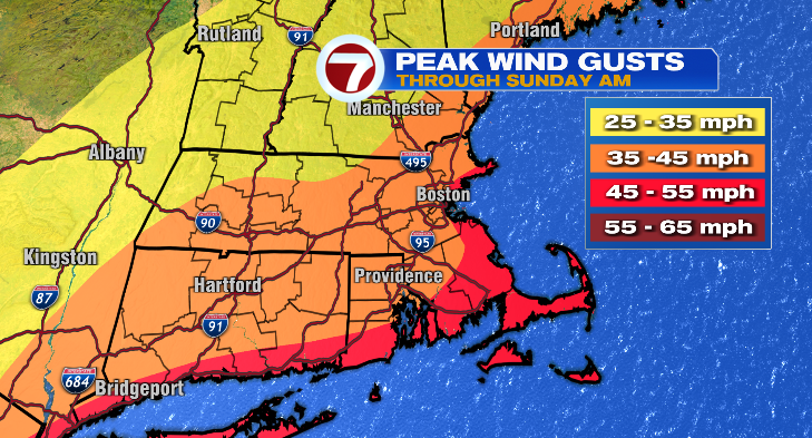
Happy Saturday! I hope you’re enjoying your rainy day plans because you certainly needed them today with our nor’easter in place. Winds have been gusting over 40 mph for most of us, with 50-60+ gusts on the islands. The wind, and the rain, will be lingering well into Monday. Let’s dive into the forecast.
Saturday evening
The rest of your evening expect exactly what we’ve seen out there now: cool temperatures in the 50s, whipping winds, and waves of rain that vary in heaviness. If you’re going to brave the roads, take it very slow, and if you’re going to brave the conditions outside then ditch your umbrella and break out the rain coat and rain boots.
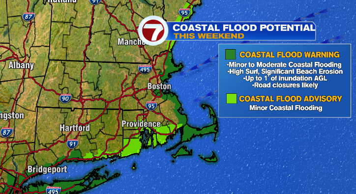
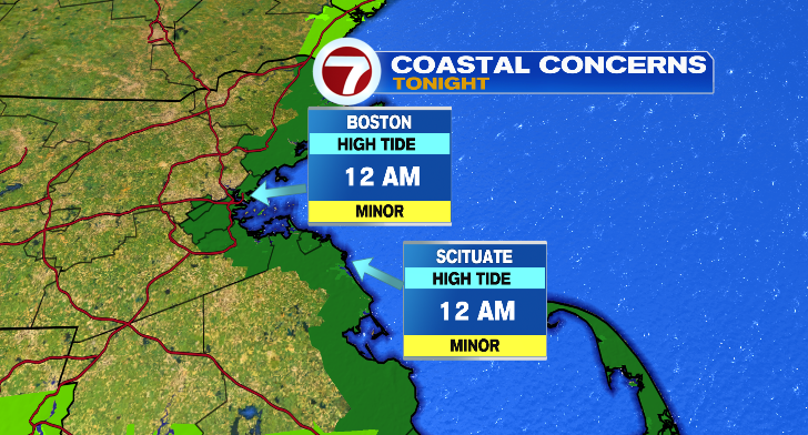
Our next high tide cycle is around midnight tonight, and we’re only expecting minor to near-minor flooding along the coastline, where we have a coastal flood warning in place.
Sunday
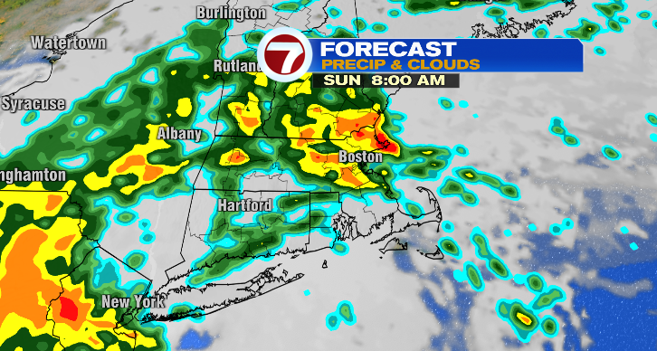
To no one’s surprise, Sunday will be more of the same. Rain will continue to be on and off, with rounds of anything from light rain to heavy downpours at times. The rain and cloud coverage will keep us cool in the 50s and 60s again. The strongest wind gusts will be in the morning, still up to our expected peak gusts of 45-55 mph at the coast and lesser inland. By the late afternoon and evening they’ll diminish further to 25-35 mph and they’ll be less frequent.
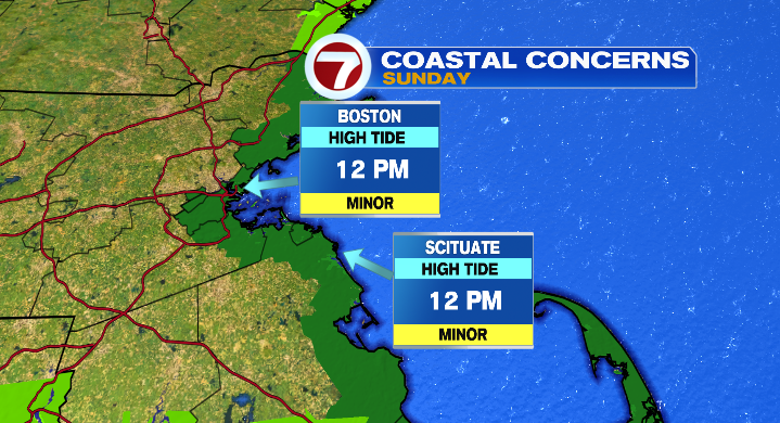
Sunday’s afternoon high tide will hit around noon, when again coastal areas can expect minor to just-below minor flooding.
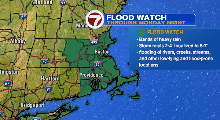
Storm totals from Friday through Monday will near 2-4″ for most, with isolated amounts 5-7″. Since that rain is so spread out, the flash flood risk remains isolated, but still we’re under a flood watch through Monday. Watch out for some water pooling on the roads, and flooding of creeks and streams.
Monday
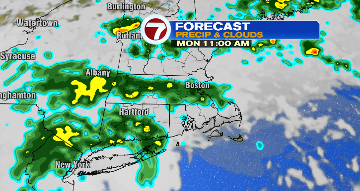
You’ll need to keep the rain gear handy for Monday as well. More of the same: not raining every minute of the day but with rounds of on-and-off rain. The wind will still be present, but to a much lesser extent. I still wouldn’t attempt an umbrella, but gusts will still be up there to 25-30 mph. It’ll still be a cool day with temperatures in the 50s and 60s again.
Tuesday
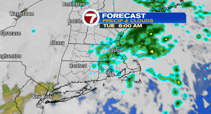
We’ll still see a slight breeze Tuesday, but overall the strong gusts are done by then. Rain may linger into the morning hours, but generally we’ll be drying with mostly cloudy conditions the rest of the day. Temperatures will again hover in the 50s and 60s.
Wednesday
The rest of the week is looking pretty fabulous! Skies will be partly sunny with lows in the 50s with highs in the low 70s.
Thursday
Get ready for a warm-up! We’ll start in the 50s with highs in the mid to upper 70s. Add some partial sun and you’ve got a 10/10 fall weather day.
Friday
Rinse and repeat! Partly sunny, 50s to start with afternoon temperatures in the mid to upper 70s.
Saturday
We cool right back down on Saturday but still comfortable in the upper 60s with a sun/cloud mix. Stay tuned!