Quite the storm blasting across New England early Monday with heavy snow inland and high coastal winds. Also had pockets of minor to moderate coastal flooding Monday morning. Thankfully, that storm peels out of here overnight taking the clouds with it! Unfortunately, the storm is taking the relatively mild air with it as well. (Boston had a high temp on Monday of 49). Here is what the map will look like on Taco Tuesday…
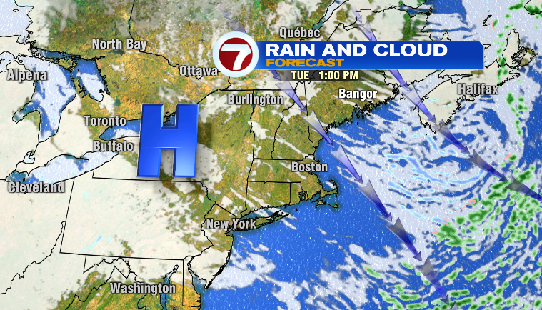
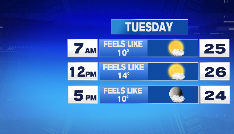
High Pressure close by so that supplies the sunshine but not close enough that we escape the wrath of cold, blustery wind on the backside of today’s storm. Drats. Tomorrow’s cold will not be as bitter or as dangerous as Saturday’s cold but still….it will definitely be a cold January day. Bundle up!
The good news is we will come out of this cold blast as soon as Wednesday midday-afternoon with high temps into the low & mid 40s!
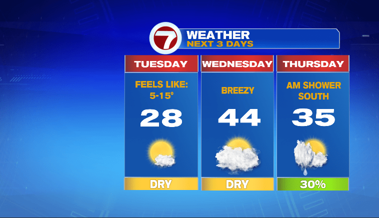
On Thursday, we’ll have a cold front pressing through the area early in the day but with leftover warmth from Wednesday, any showers will likely be in the form of raindrops. Temps for the day will be seasonable, staying in the the mid 30s.
Here’s some good news for ya…daylight! We are on the cusp of seeing daylight really ramp up (picking up 2 minutes a day begins Saturday!) and it only gets better from there!

Enjoy your week!
~JR