Happy Saturday! Wow! What a beautiful day it was. We were noticeably warmer, and that trend will continue into the middle of next week.
First, we saw sunshine, a bit of a breeze and highs into the upper 70s today. Talk about a 10/10 weather day. Sunday will be more of the same! There’s a chance for a spot shower early in the morning before 8 a.m., otherwise we’re looking at more ample sunshine.

Sunday morning will start near 60 degrees with highs into the low 80s. Just a heads up: if you’re heading to the Cape it’ll be cooler in the 70s.
It will be a bit breezy again in the afternoon, but with how warm it’s expected to be, that’s probably going to feel pretty good!

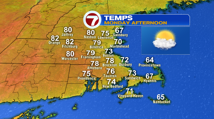
Monday looks dry and partly to mostly sunny. Morning lows drop to the 50s but afternoon temperatures will be warm into the 80s — at least away from the coastline. Near the coastline? Much cooler.
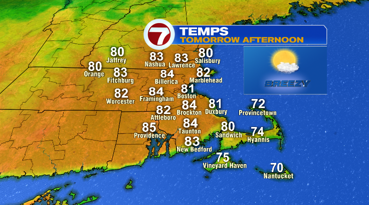
It’s Tuesday and Wednesday that high temperature records in the low 90s will be rivaled. Tuesday looks mostly sunny, breezy and hot in the low 90s.
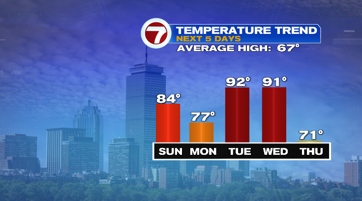
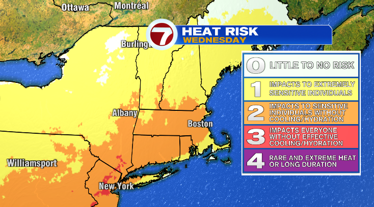
Wednesday will be just as hot, just as humid and just as breezy. However, we also have to watch a chance for some thunderstorms in the afternoon and evening.
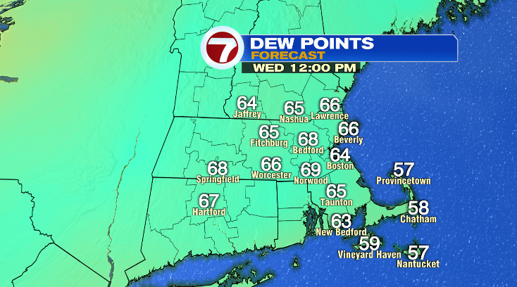
Temperatures in the 90s with high humidity is no joke! Stay hydrated and take breaks from the heat when you can. The heat doesn’t last that long, though. In fact, we’ll see a big temperature drop the rest of the week. Thursday looks partly sunny but cooler with highs only in the low 70s. Friday and Saturday are both quiet but cooler in the upper 60s. Stay tuned!