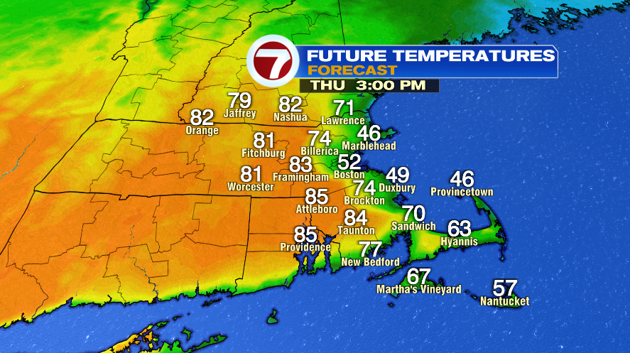
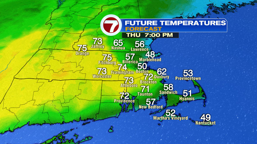
We’ll we’ve done it two days, what’s one more? After the overnight rain moved out, we’ll clear the clouds and get sunshine back for the day today. With the sunshine, temperatures will climb back to the 70s for most of us this morning, then go one of two ways this afternoon. The coastline will cool to the 50s while central Massachusetts could even make the lower 80s. But that east wind will eventually push the cooler air all the way inland by the evening once again. Just like the last two days.

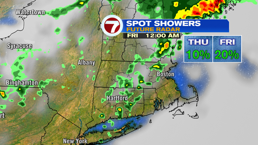
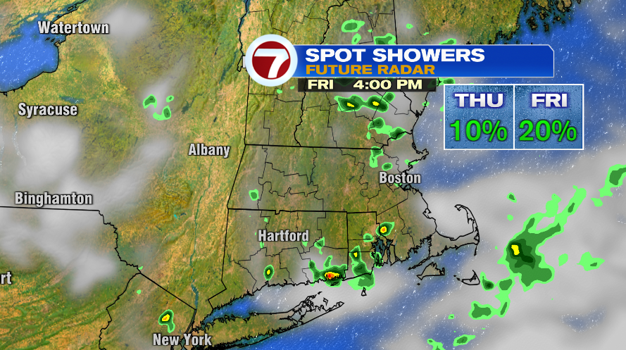
There’s a low risk of a spot shower today, but it’s only about a 10% shot so really it is a dry day today, but just know if you’re unlucky you might get tagged with a few sprinkles. The best chance for that will be Worcester County and southern New Hampshire. There’s a slightly better chance of rain overnight again, and there could be a rumble of thunder or two once again.
Tomorrow the rain chance goes up a little bit compared to today, but it’s still low. The tricky part about tomorrow is while the shower chance is low in coverage area and most of us will probably stay dry, the showers could be heavier or hang around for awhile. So I’d take the umbrella tomorrow because if you happen to be one of those who sees a shower, it may seem a lot worse if it’s a heavier shower and isn’t quick to move away.
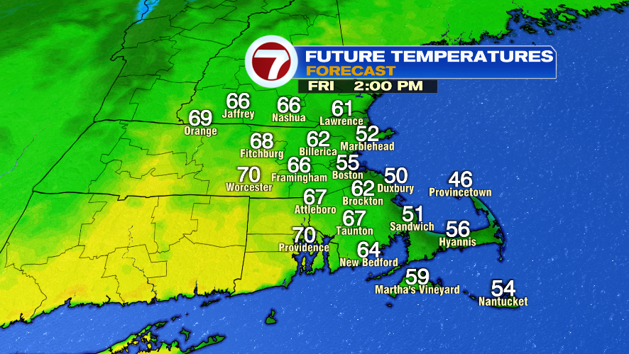
Temperatures for your Friday are again tricky, but I don’t think it’s quite as dramatic as the last couple of days where you literally have a range of 80° to 40° depending on your location. Tomorrow will likely climb to the lower 70s inland, 60s on the coast, and then a cooling from there. So while it’s a contrast inland vs. the coast, it’s not a 40° difference.
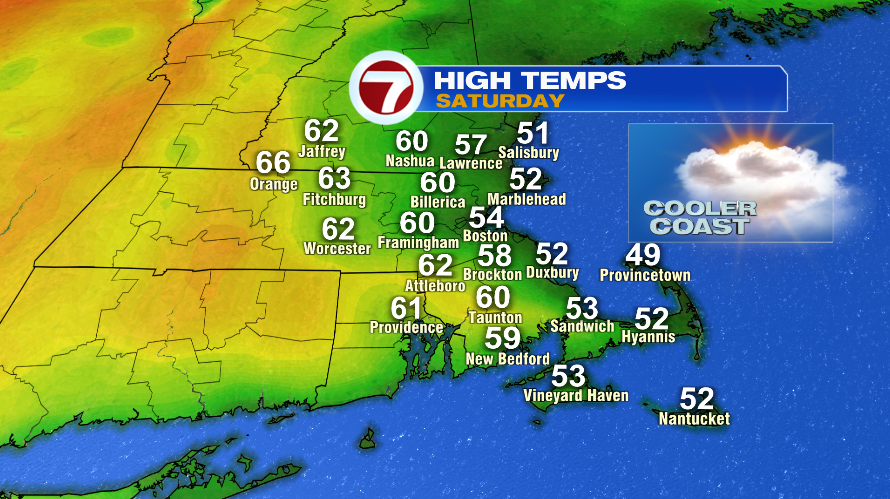
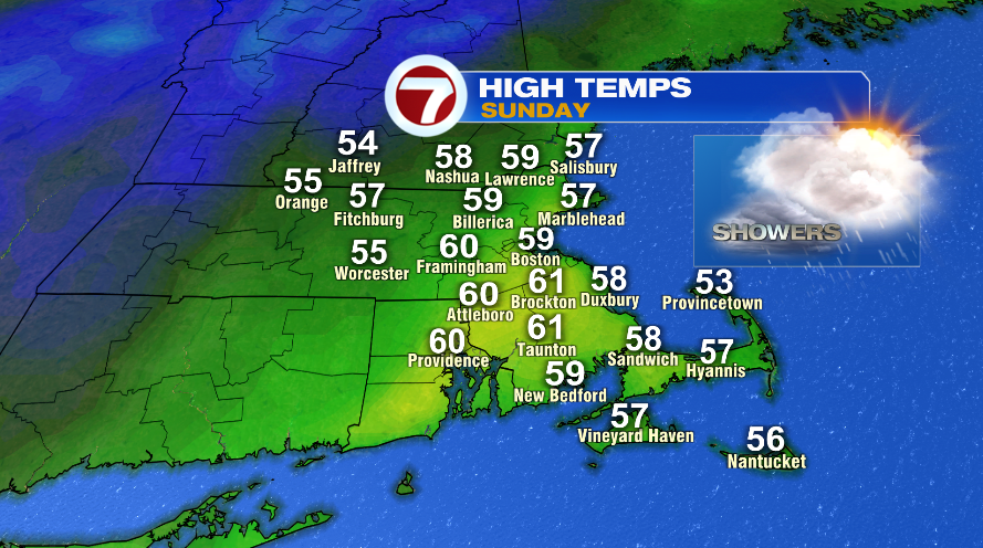
The weekend forecast looks decent. Mentally it seems chilly to see temperatures only near 60° when we’ve been seeing 70s and even 80s, but our average highs this time of year are in the middle 50s. Saturday is probably the nicer of the two days with a mostly cloudy sky, but it’s dry. Sunday will feature showers. The showers will favor the afternoon and evening, though some are possible by mid to late morning too.
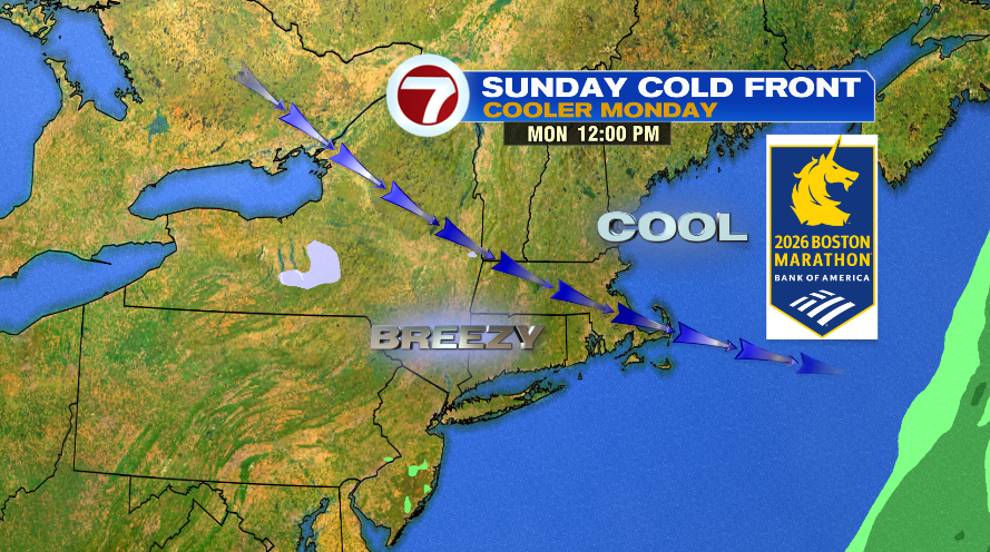
The Sunday showers are with a cold front that will cool us down for Marathon Monday! Depending your plans, you probably have differing opinions on the cool down. Runners are going to welcome the temperature drop, but spectators might find it a bit chilly. Temperatures will likely stay in the 40s Monday afternoon and a breeze on top of it will make it feel colder. For the runners, it’ll be a northwest wind. A true tail wind is a southwest wind, so it’s not that, but it’s also not a northeast head wind. The route generally runs to the northeast, so a northwest wind is kind of a mix between a tail wind and a cross wind.