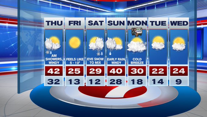
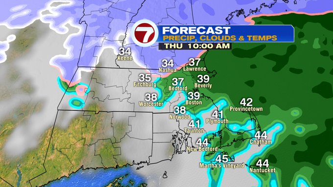
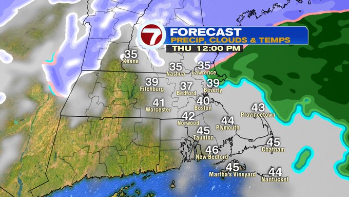
Tonight, we’ll see increasing cloud cover after midnight ahead of our next chance for some snow showers (north of the Pike), rain along and south of the Pike. These showers will stick around through the morning commute, with the rain/snow continuing to shift north through the morning hours as temperatures warm up above the freezing mark.
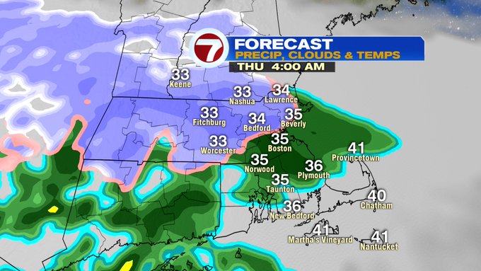
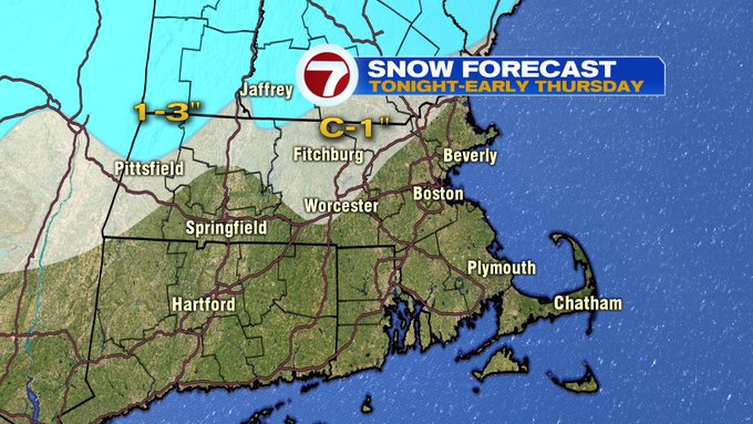
As for snow totals, a coating to an inch is expected for northern Worcester Co. and the higher elevations north and west of 495 and portions of the Merrimack Valley and into southern NH. Slightly higher accumulations for northern Berkshires, southern VT and southwestern NH.
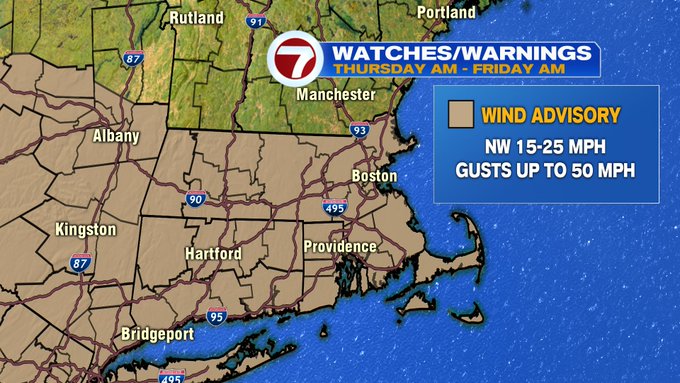
A few rain showers linger until late morning, otherwise these should exit as the system moves out to sea. The wind then shifts to out of the northwest, gusting up to 50 MPH, which has prompted a Wind Advisory to be issued for southern New England from Thursday late morning through Friday morning.

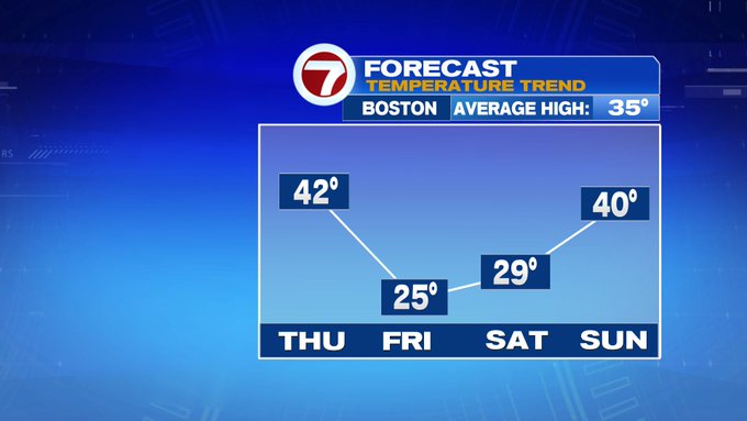
High pressure moves in for Friday, along with bitter cold wind chills. Actual highs on Friday reach into the mid 20s, however, with whipping northwesterly winds, wind chills will likely stay in the single digits through most of the day.


It will still be bitterly cold into early Saturday, however, another system traversing the Midwest early Saturday morning will slip into western MA by Saturday afternoon, with snow sweeping into our area by Saturday evening.


Saturday’s system coupled with the colder temperatures will likely provide more accumulating snowfall, especially for interior MA and for the higher elevations. A couple inches are possible for Boston and areas slightly south of the Mass Pike. We will certainly keep an eye on this system as we get closer.

These snow showers then mix with some rain showers into early Sunday before moving out. The start of the next work week is dry, but cold with highs below freezing and lows into the teens.