

Good morning! While this early Friday morning is off to a somewhat quiet start, it doesn’t stay quiet for long as our nor’easter’s impacts start to settle into to Southern New England.
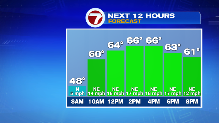
In terms of the quick overview of today: we’ll start with some sunshine, though clouds increase throughout the day. Highs will be in the low to mid 60s, keeping that October-like feel around.
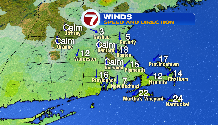
The biggest factors today will be the waves and the wind as our storm pushes north. Keep the wind in mind if you planned to go to Fenway for the Sox double header against the Cubs.

It’ll likely won’t be soggy, but it will be windy for game one (first pitch 1:05 PM), and howling for game two (first pitch 6:05 PM).
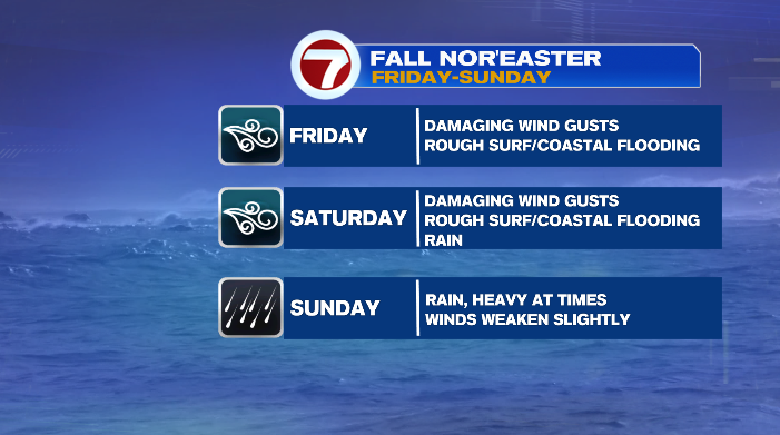
Let’s break this storm down by threat, starting with the wind.
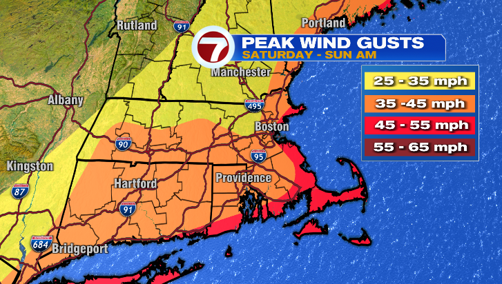
Winds will pick up throughout the day. Generally speaking, the more coastal you are, the higher the wind gusts. By tonight, southeastern Massachusetts (especially the South Coast, Cape and Islands) will see gusts up to 60mph while areas inland will see gusts in the 30s and 40s.
Strong, even damaging winds continue into Saturday, (gusts still up to 60 for most of the day), and with this Friday/Saturday stretch, we do have a High Wind Warning in place for the coast, and a Wind Advisory inland, per the National Weather Service.
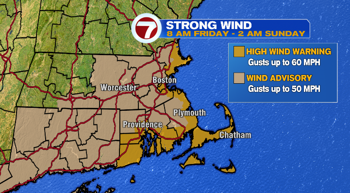
While it will certainly still be blustery on Sunday, the wind will start to die down in comparison to Friday and Saturday.
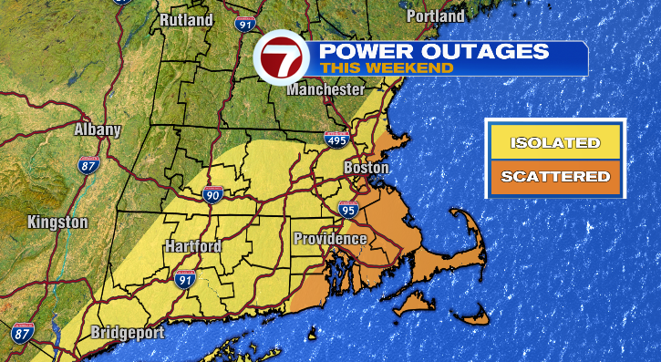
While the gust numbers themselves are concerning, it’s the combo of the strength of the wind, the duration of the wind, and the fact that the leaves are still on the trees that is creating a more troublesome combo. With all of this, we could see small/weak tree limbs come down, and power outages, particularly along the coast.
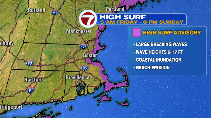
The other issue we’ll already start to see today is the surf. We already have a High Surf Advisory in place as waves could reach up to 17 feet! Combined with the tide cycle over the next two days, this could lead to beach erosion and some coastal flooding Friday and Saturday in particular.
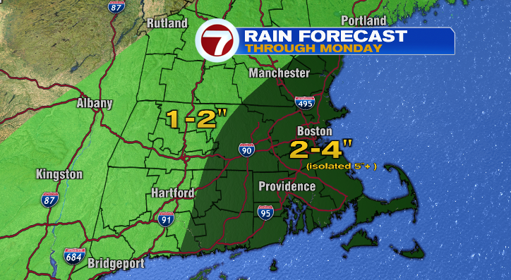
It may seem counter-intuitive, but the lowest-level threat is the rain/flooding from rainfall itself. Why? Because, while we could see a good 2-4″ of rain (even higher amounts for a few, isolated spots) for Worcester County on to the east by the time our final showers wrap up, the rain is spread out over a few days, rather than bunched into a few hours. That’s a little easier for the ground to handle…even beneficial for some areas that could use the rain.
That said, we will start to see those first rain drops by this evening, arriving in southeastern Massachusetts first before becoming more widespread on Saturday morning. The bulk of the rain will be Saturday and Sunday. It will be pouring at times, raining lightly during others, and sometimes it won’t even be raining at all. Point being, the rain will come in waves over the weekend, then taper to scattered, lighter showers on Monday before we dry out Tuesday.
During the storm, highs will only reach the upper 50s and low 60s. More of that October feel.
As mentioned, Tuesday will dry out, and we’ll even see some sunshine along with the clouds. We’ll also warm back up, with highs getting into the mid and upper 60s, and even the 70s by Wednesday.