Well, that was an abrupt change! From mid to upper 70s on Saturday to wind chills in the 20s this morning, the scene is set for a much colder week, and a far cry from the very warm start to November we have had. This chillier air has some staying power too, as the forecast ahead features below average temps for much of the upcoming 7day.
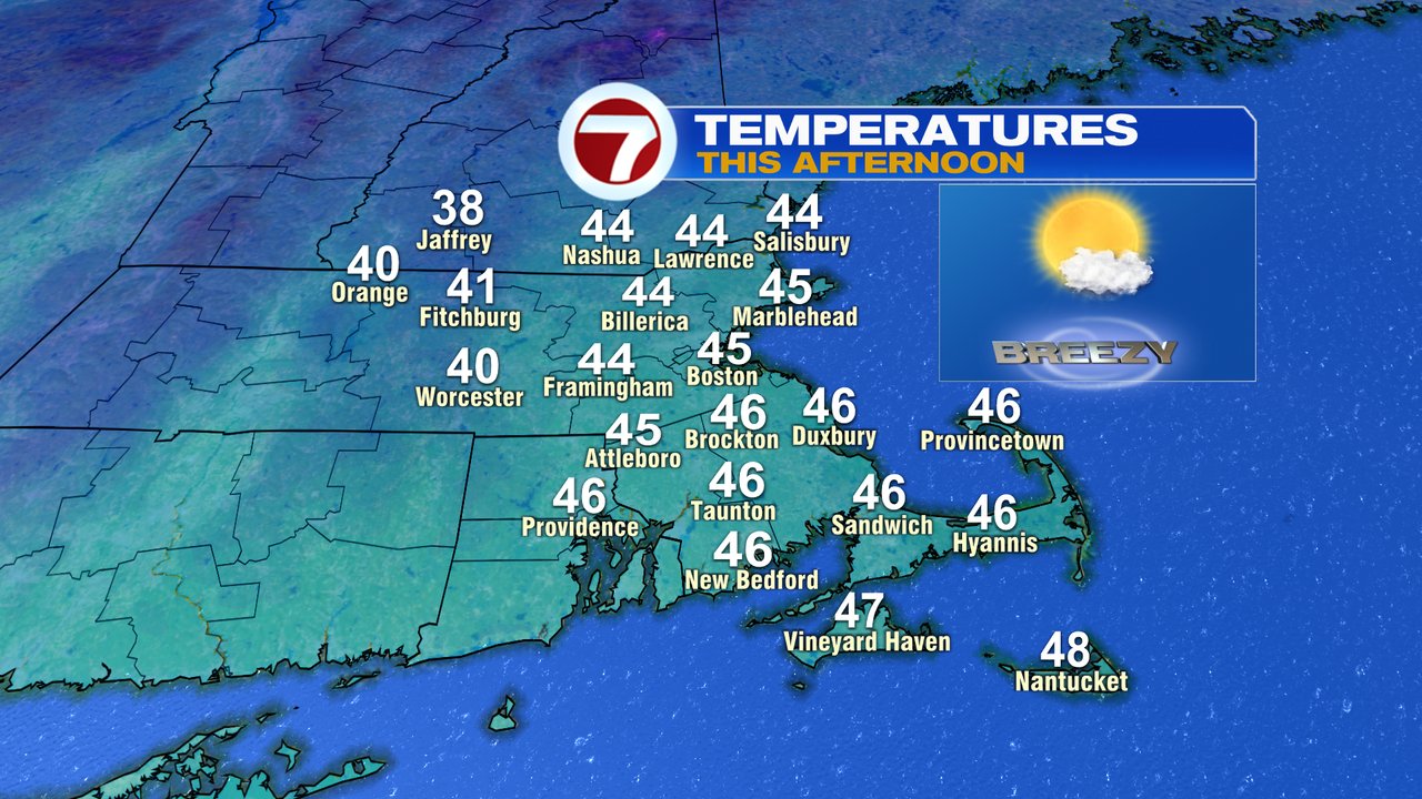
Now that we have the cold, do we get some snow? For some of us, the answer will be yes, just not quite yet. Today will be dry with a mix of sun and clouds, a gusty breeze 20-30mph, and highs in the low to mid 40s. Tomorrow’s temps will be similar, with highs in the low to mid 40s. While we stay dry tomorrow, clouds do increase in the afternoon, foreshadowing the unsettled weather ahead.
Alright, now to that snow. Rain and interior wet snow break out Tuesday night with the best chance to see the flakes fly near and west of 495. Across the lower terrain, near 495, while there may be some slushy coatings on non-paved surfaces, don’t expect much though. 1000 feet up in elevation in Worcester County, there will be a better chance for an inch or two, especially across the northern part of the County. Several inches of snow are possible across the northern Berkshires.

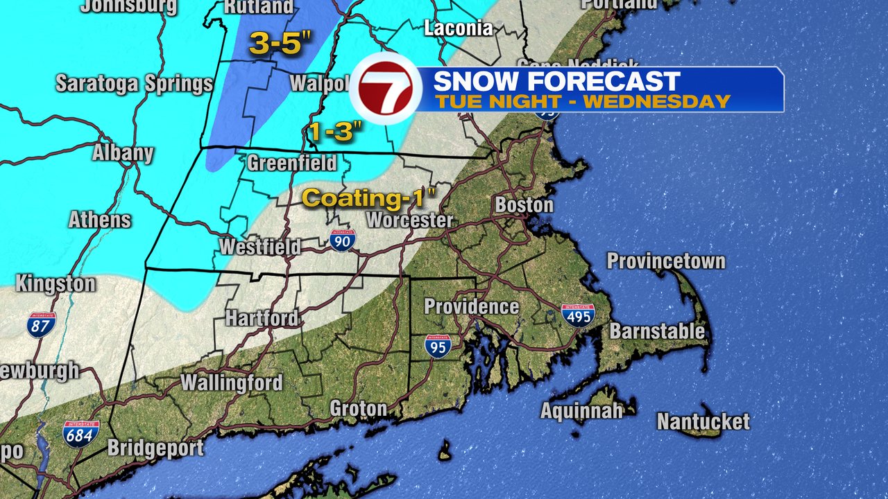
Wednesday morning won’t have snow covered roads as an issue, but there will be wet roads with showers/drizzle continuing. Wednesday is one of those days where temps vary a lot across southern New England from the upper 30s in northern Worcester County to 45-50 in the Boston area to the 60s across the Cape.

Thursday – Weekend, the chillier pattern prevails with highs in the 40s again.