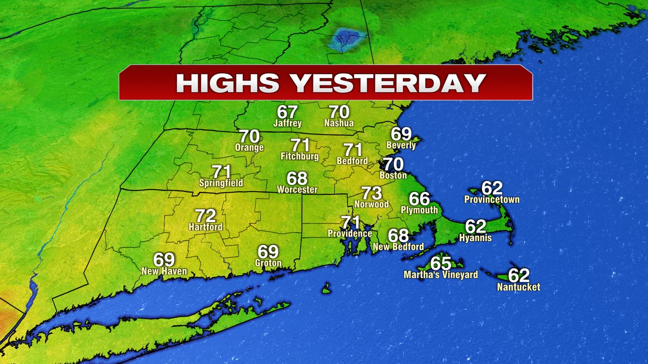
After a fantastic Thursday, the weather starts to slide back downhill as chilly air and clouds win out this weekend. Today, is a step down in that direction with mostly cloudy skies and temps 5-10 degrees cooler than yesterday. That’ll put afternoon highs around 60 near the coast and mid 60s inland. As the day progresses, the coastal temps will likely fall back into the 50s. Despite the clouds, it does look mainly dry through the afternoon.

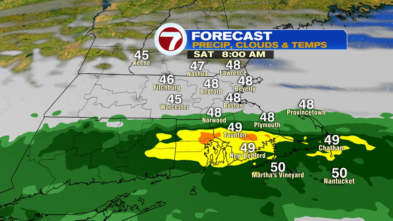
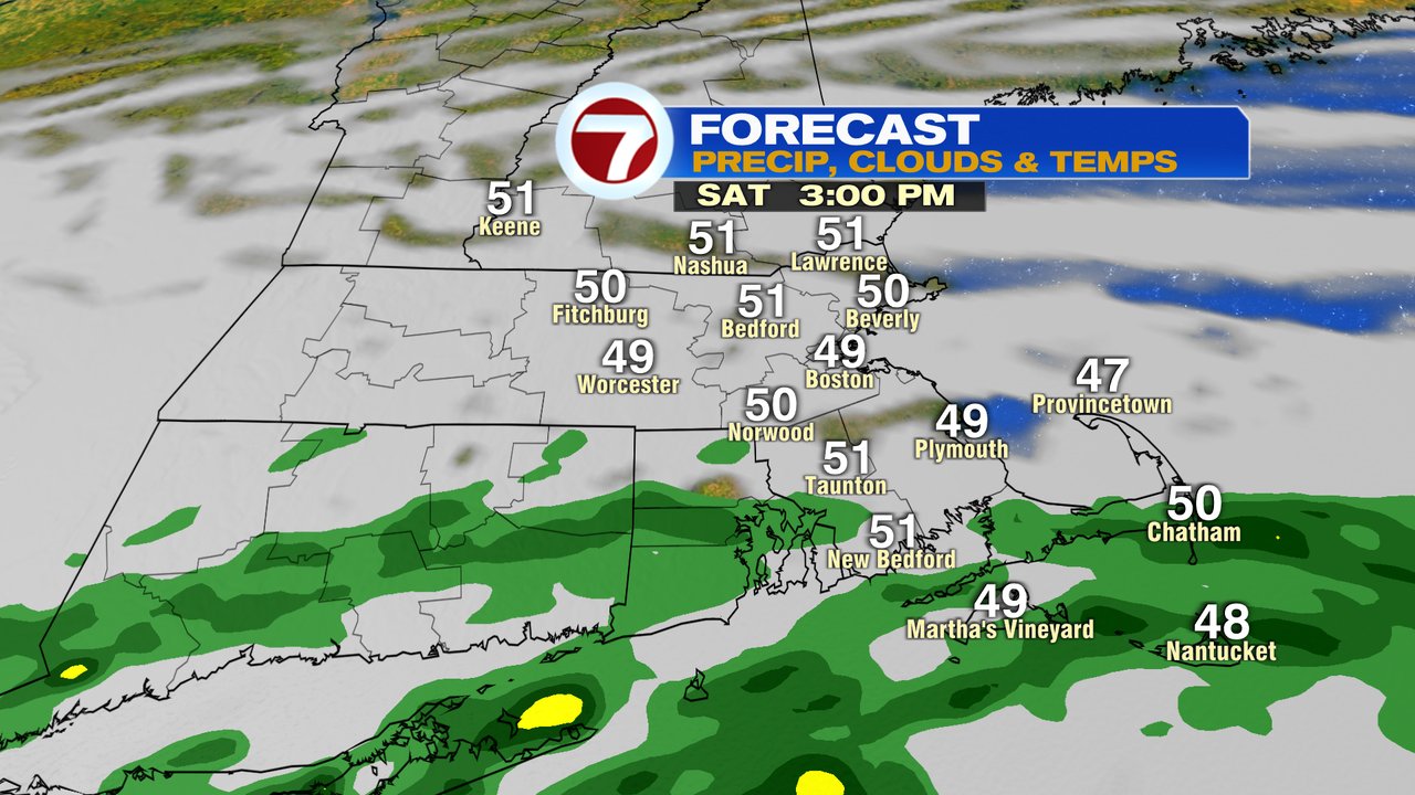
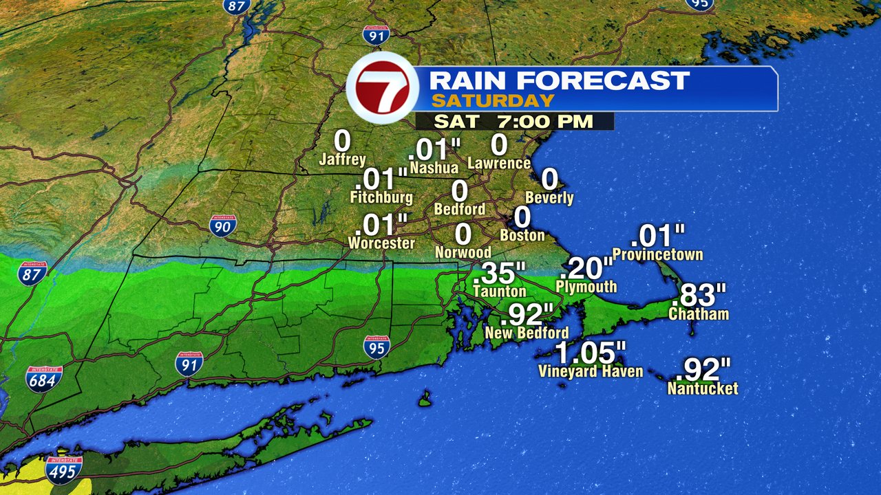
Some wet weather breaks out across Southeast Mass overnight and some early morning showers Saturday may sneak up as far north as the Mass Pike. The highest risk for steady rain however, is near and south of Route 44 in Southeast Mass, RI and CT. No doubt, it’s a chilly day with temps near 50 as northeast winds gusts 20-30mph, locally stronger at the coast.
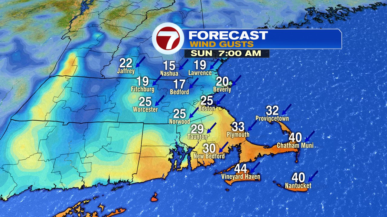
Mother’s Day looks cool and breezy too as temps are stuck in the lower 50s. A few showers are possible across Southeast Mass, otherwise it looks mainly dry. Winds are strongest across Southeast Mass too, with Cape Cod gusts over 30mph.
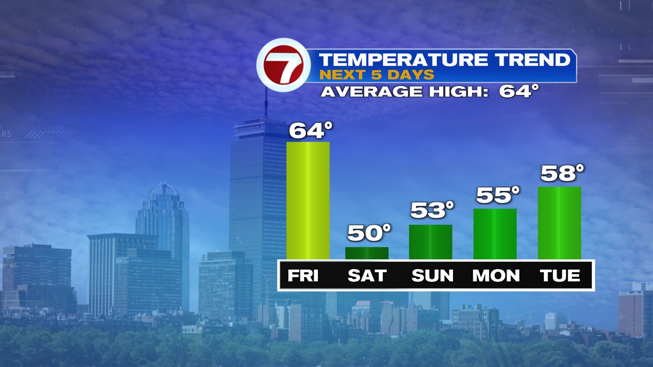
Eventually we do break out the the pattern as late next week looks warm as 70s/80s are possible from Thursday, into next weekend, with warmest temps likely inland. We’ll see if that projected pattern can hold.