Clouds and fog win on out this morning, but overall, we’ll have a mainly dry day as any isolated showers inland are few and far between. Temps today hover in the upper 60s at the coast, but reach the mid to upper 70s inland. A few breaks of sun are possible this afternoon too, so all and all, not that bad of a day.

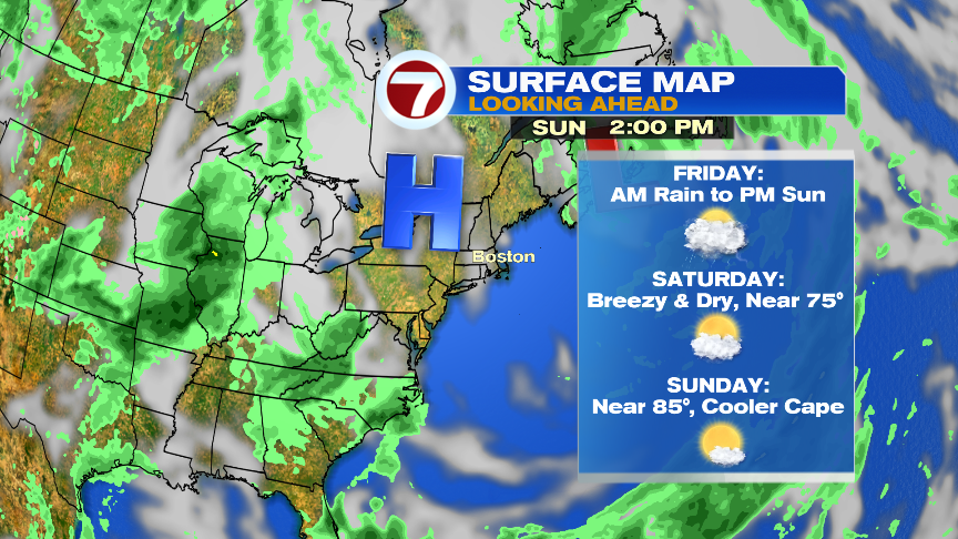
Tomorrow does feature another murky start as clouds and areas of fog once again greet us for the morning commute. In the afternoon, through the night, there will be scattered showers and storms with localized downpours as a wave of low pressure slides through. The highest chance for widespread rain will be overnight Thursday, especially across northern MA and NH. We’ll watch for the chance of localized street flooding then. The good news is that the system seems fairly progression, meaning it’ll clear out by Friday afternoon after a wet start to the day. From Friday afternoon, through the weekend, the weather looks good. It’ll be a bit cool and breezy Saturday, but nice beach weather settles in for Sunday. Monday and Tuesday of next week look warm too.