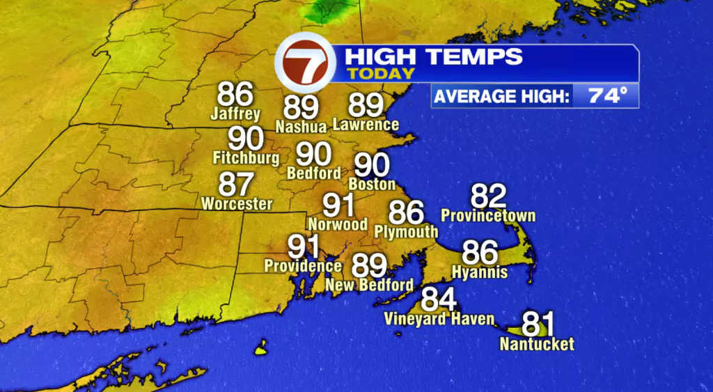
After a 5-day stretch of 90+ degree heat, our heat wave is coming to an end as much more comfortable and seasonable air returns late tonight and settles in for the rest of the week.
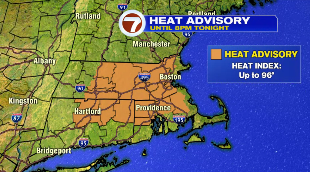
A Heat Advisory still remains in place until 8PM this evening with feels like temperatures up to 96° possible.
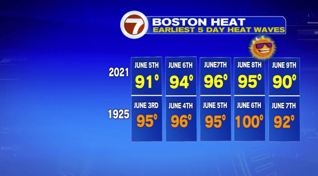
As for that heat wave, it was the second earliest 5-day heat wave for Boston, coming in second to the 5-day heat wave of 1925.
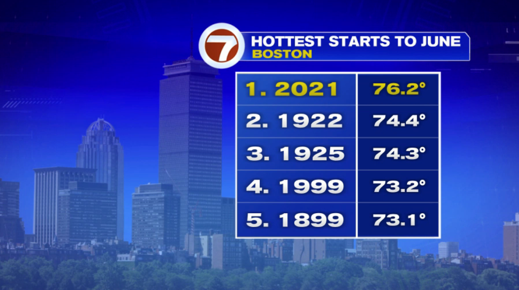
Not only is the second earliest 5-day heat wave, it’s also the hottest starts to the month of June on record.
This evening, aside from a few downpours, some may contain thunder, associated with a cold front that is sliding south, we’ll see lowering humidity and a gradual clearing of the skies as that cold front sweeps through.
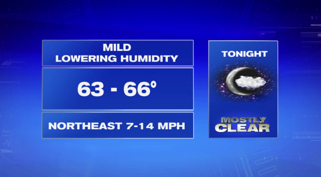
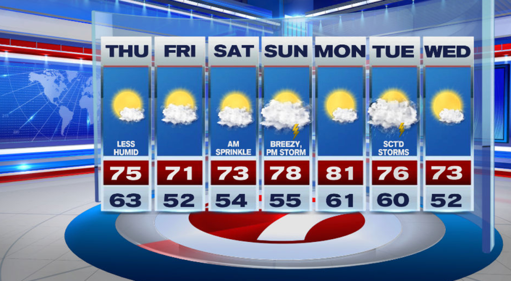
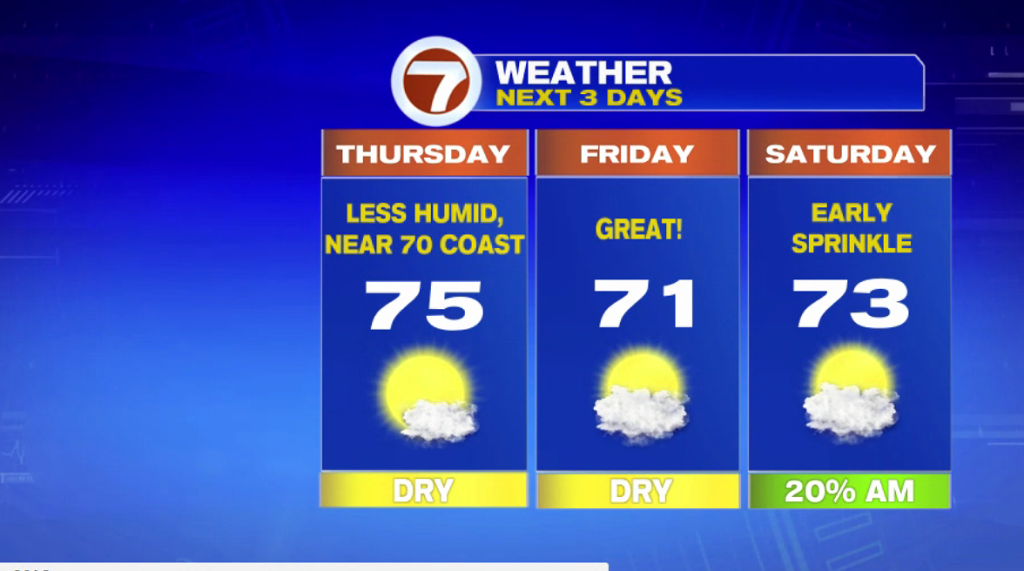
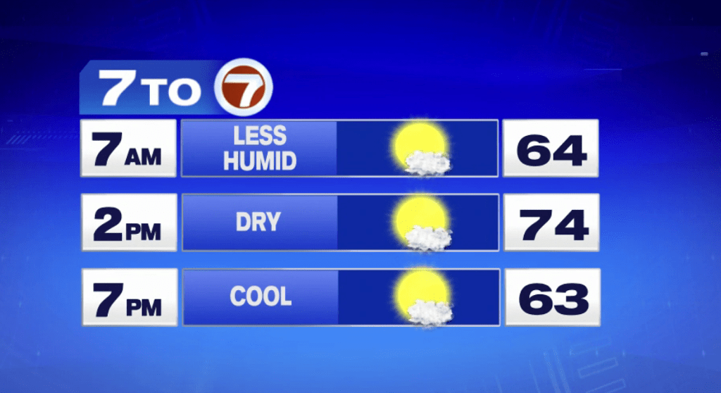
Tomorrow, with less humidity, mostly sunny skies, we return to seasonable highs in the 70s — much more comfortable for any of your outdoor plans compared to the last 5 days.
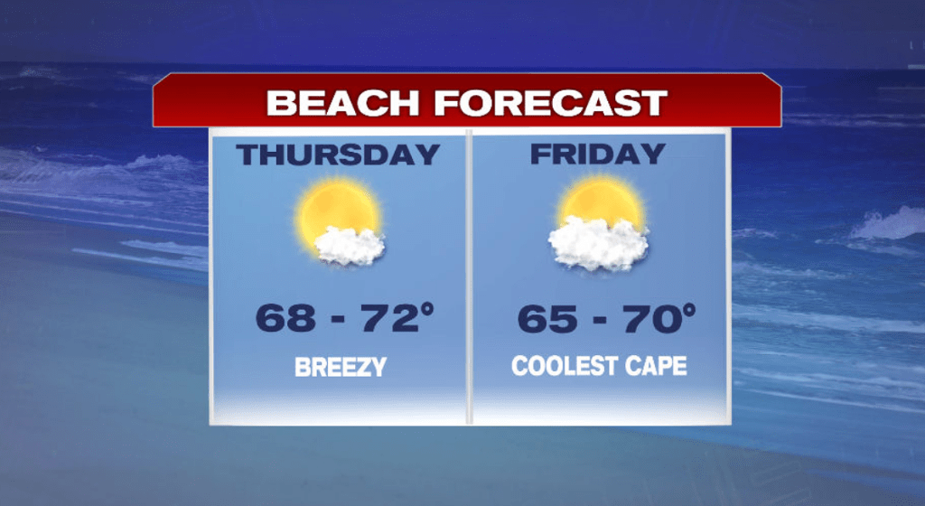
The wind will be out of the N/NE making it slightly cooler at the coast Thursday.
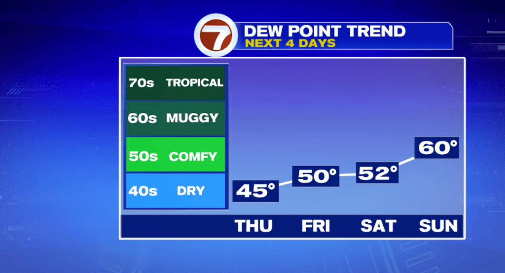
Speaking of how comfortable it will be, dewpoints are the measure of moisture in the air. Dewpoints will be much drier through the end of the week.
Partly cloudy for Friday with highs in the low 70s, slightly cooler at the coast, with the coolest spots at the Cape due to a SE breeze.

If you’re hitting the links any of the next three days, aside from a few sprinkles on Saturday morning, it’s looking great for golfing.

Sunday has a chance for an afternoon thunderstorm, but these will be scattered. We’re not tracking a washout.
Monday is dry with highs in the low 80s followed by scattered storms Tuesday and back to mostly sunny skies Wednesday.