Happy Sunday! It was a summer scorcher today in the 80s. While temperatures may dip a bit on Monday, we’re expecting near-record high temperatures later on this week.
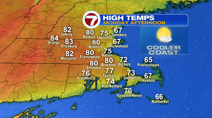
First, evening temperatures will cool from the 80s down to the 60s with morning low temperatures into the 50s. For your Monday? Bright and cooler depending on where you are.
The Cape will be the coolest in the 60s, the coast will be less cool in the low to mid 70s, whereas inland will be warm near 80 degrees.
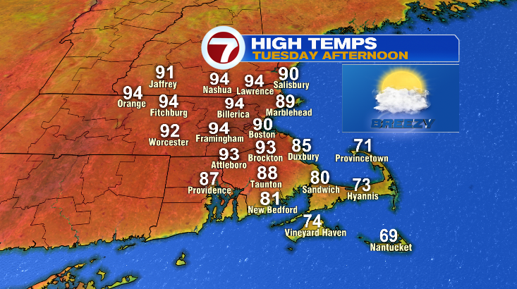
Tuesday is going to be the hottest day this week, and that’s one of the two days that high temperatures will rival historical records. While the day starts in the 60s, highs will jump way into the low 90s. Skies will be partly sunny with a low-end chance for a shower or storm in the afternoon.
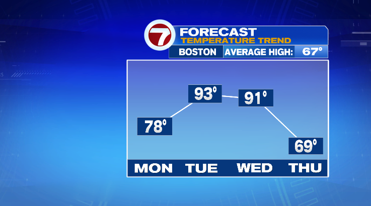
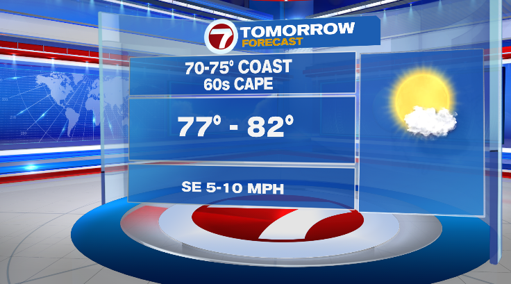
Wednesday is another day that we’ll get close to records with highs still well into the low 90s. It will be noticeably cooler on the Cape.
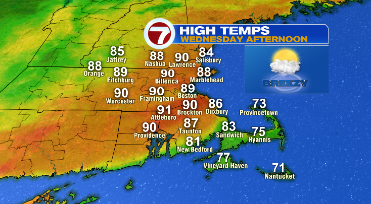
Wednesday will be breezy and partly sunny.
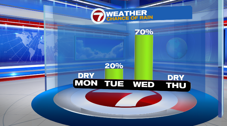
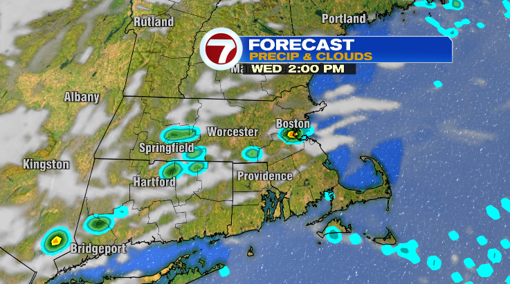
There’s a chance for some spotty showers and thunderstorms in the afternoon and evening that we’ll be watching closely.
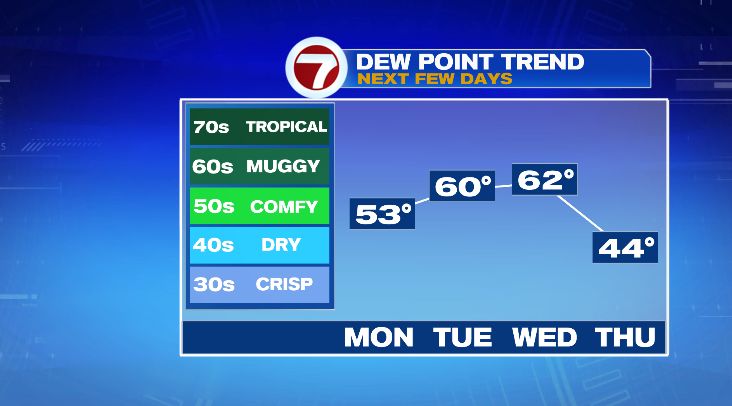
As usual, it’s not just the heat…it’s the humidity. Dew point temperatures are forecast to jump into the 60s Tuesday and Wednesday which will only work to make it feel hotter. Take breaks in air conditioning if and when you can.
The next question we have to answer is… will this last? No! We’re expecting a major temperature (and humidity) drop on Thursday. The day starts off in the 50s with highs in the upper 60s under partly sunny skies. Friday morning looks chilly in the 40s with highs in the mid to upper 60s with a sun/cloud mix. Next weekend looks cool, too, with lows in the upper 40s and highs in the upper 60s with chances for rain. Stay tuned!