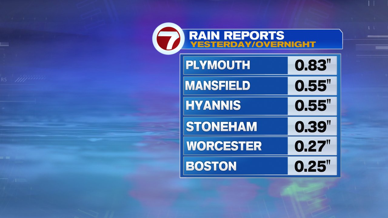
With many locations picking up 0.25-0.50″ of rain overnight, and early morning drizzle to kick off this Tuesday, it is a damp and dreary start to your morning. With that said, spotty light rain and drizzle does taper off by mid to late morning as drier air slides in. Clouds even occasionally break for some sun this afternoon as temps hold in the low 50s at the coast, but run mid 50s to near 60 inland.
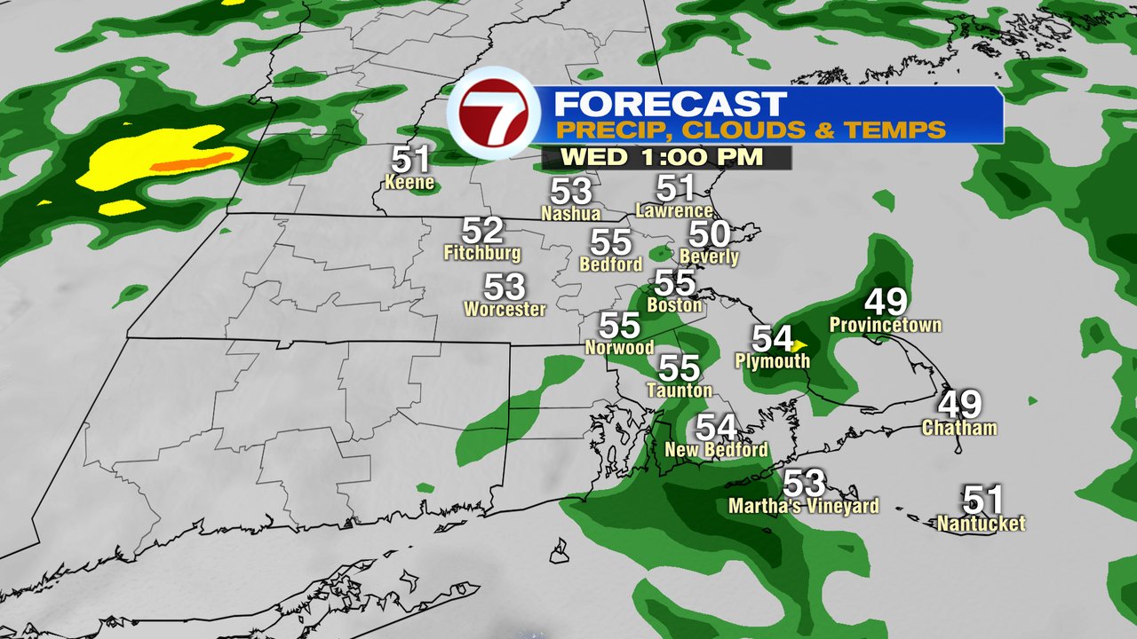
Rain moves right back in tomorrow as scattered showers are in and out through the day with temps in the 50s. Rain tapers off early in the evening, right around the time the Sox get set to take the field.
As drier air moves in at night, it will set up a stellar day on Thursday with highs near 70 inland, 60-65 at the coast, under a mostly sunny sky.
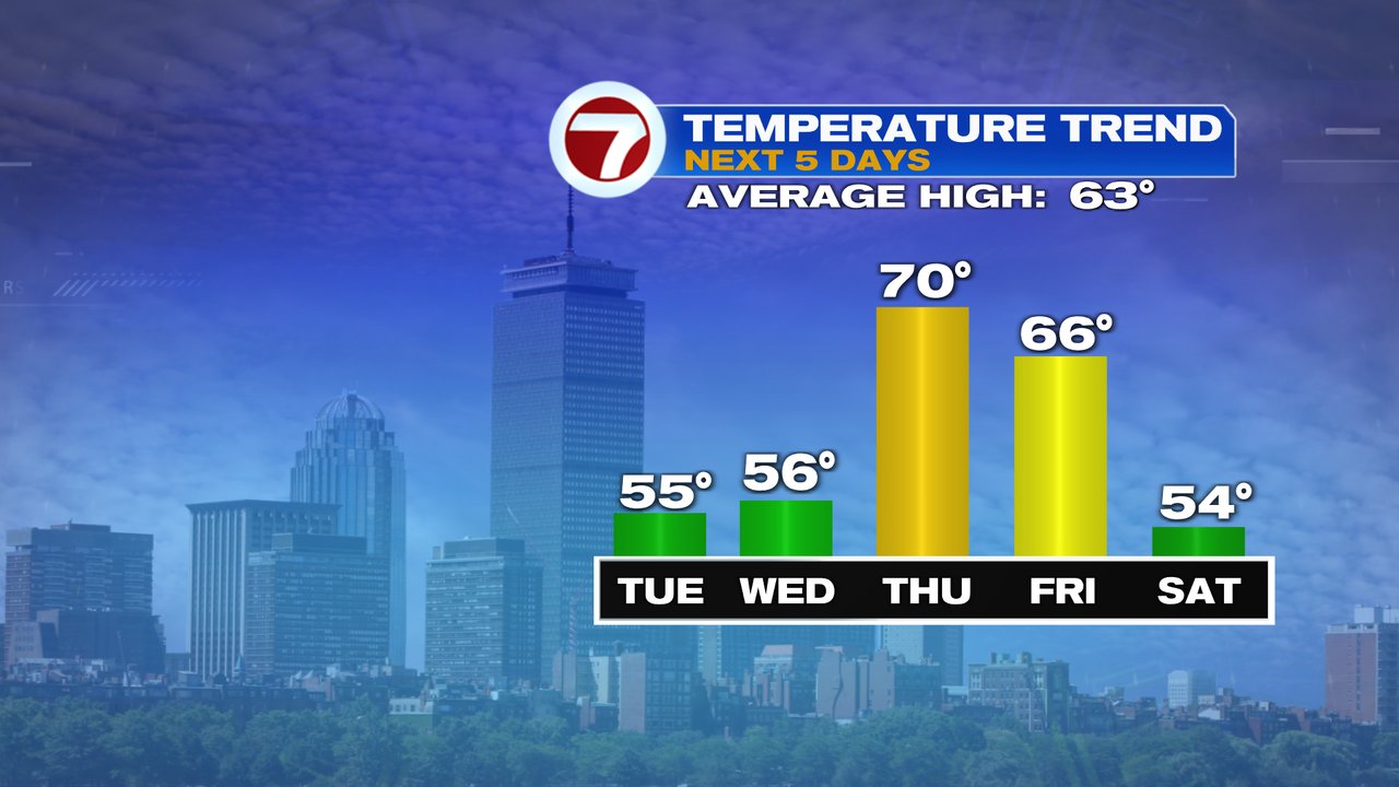
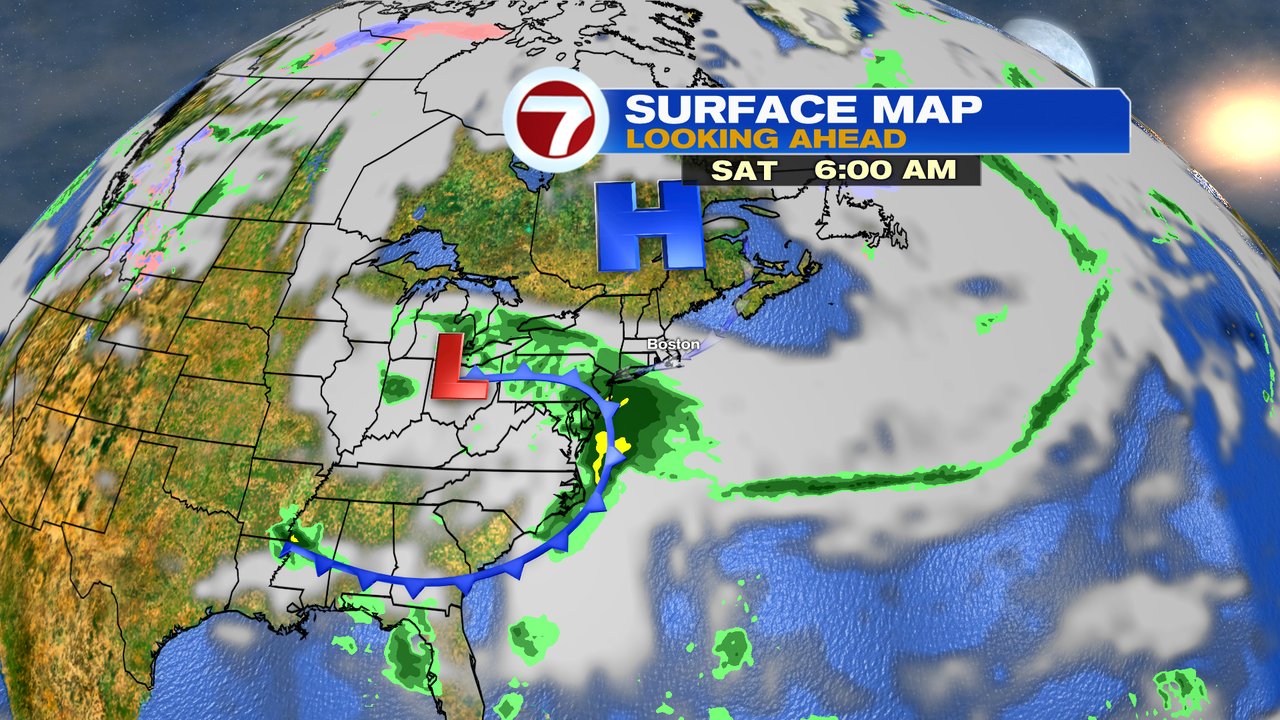
Sunshine fades behind mid to high level clouds Friday as temps still run into the 60s. We’ll have to watch to see how close a shield of rain gets to southern New England from a storm moving east, out of the Ohio Valley. The highest chance of some wet weather is south of the Pike late Friday – Saturday, but even there, it could stay dry if the storm is far enough south. It does look cooler over the weekend though with temps in the 50s Saturday and Sunday.