Editor’s Note: Tonight’s blog was penned by 7Weather intern Owen Vetree ~JR
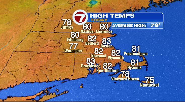
Hello and welcome back to the blog. It is June 24th and today turned out to be a beautiful day as expected. Most areas saw highs in the low to mid 80s, with only the islands still in the 70s. Below are the observations from today, and you’ll also see our average high temperature at 79 for Boston. We were a little above average, but I’d still say it was a typical day for our area this time of year.

Now that we are 3/4ths of the way through June, we have a good idea for how the month as a whole will finish in terms of temperature and precipitation.
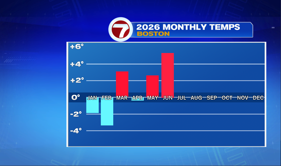
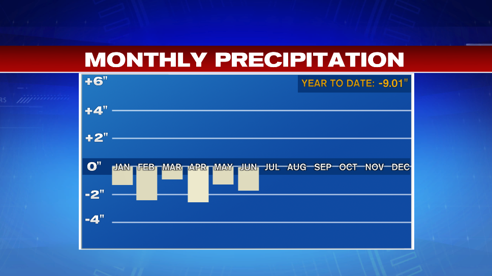
June so far is almost 5 degrees above average for temperature and nearly 2 inches below for precipitation. You might notice in the temperature graph that we’ve had an equal amount of below and above average months. However, the warm months are further from the mean than the cool months which puts us slightly above average for the year there. Alternatively, the precipitation graphic depicts less than normal amounts for all 6 months so far this year. When adding all the deficits together, we get a total rain debt of 9 inches for the year. It is not hard to see why we are in a drought. Despite all the snow we got in January and February, we were still solidly below average both months. This is because snow does not really hold all that much water, especially the fluffier snow we received this year. We also, typically see a few rain storms in our winter months, having such a high percentage of our precipitation fall as snow is unusual.
Both of our departure figures for the month of June are unlikely to change much over the last week of the month. Our temperatures look to hold just a few degrees above normal for most of our remaining days. We have a high chance of picking up some rain over the next week but the chances of it being significant enough to close the gap noticeably remains low.
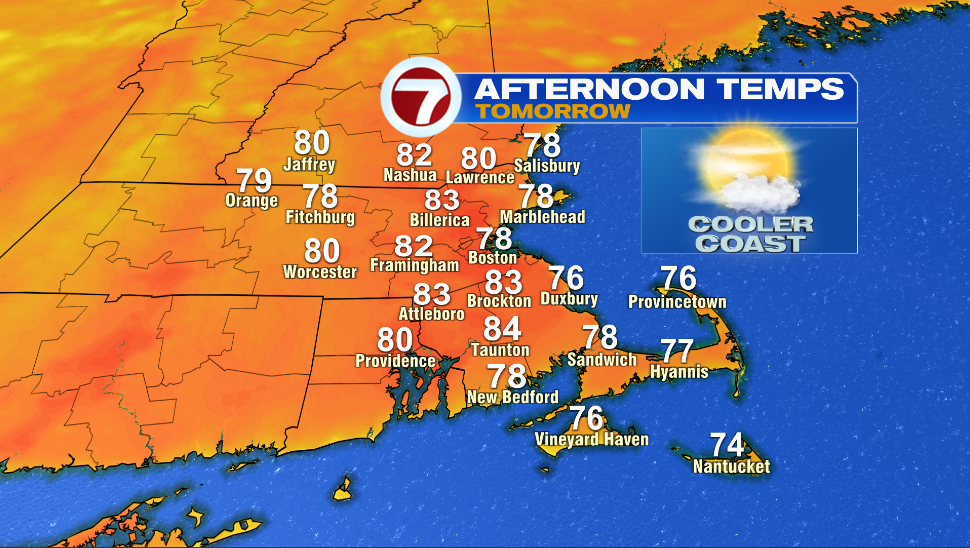
Tomorrow will be very similar to today with no chance of rain, although a light sea breeze will hold highs back a few degrees along the immediate coast.
Friday on the other hand will be much different from the two days preceding it.
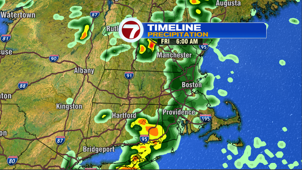
A weak area of low pressure will track to our north and bring a fairly narrow line of rain through our area during the morning hours on Friday. Once this moves through, skies will likely clear out midday. The surface heating of the sun will create the instability that thunderstorms use as fuel. This will open the door for some showers and thunderstorms to develop Friday afternoon.
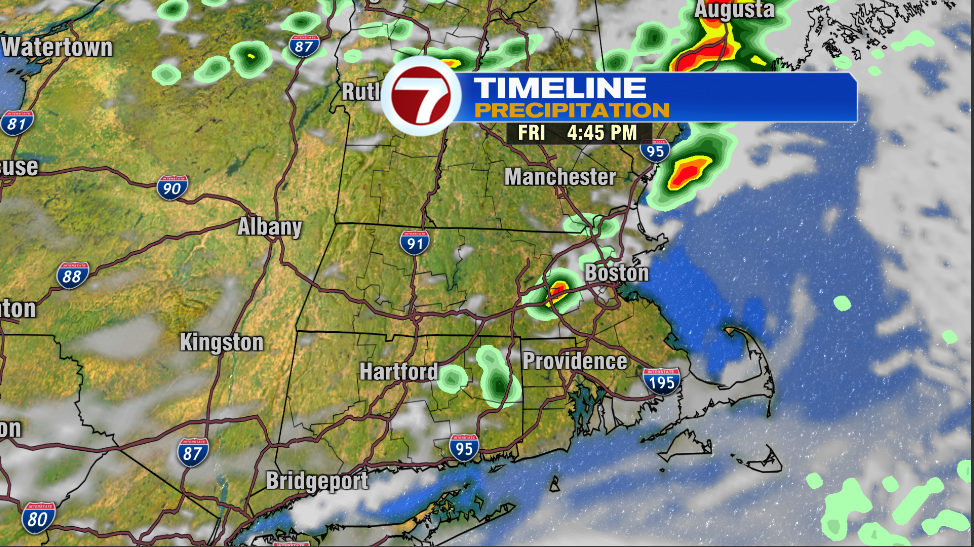
Afternoon highs will reach about 80. Dewpoints in the mid 60s will give that muggy feel you might expect on a day where thunderstorms are a part of the forecast.
The upcoming weekend is looking pretty good despite the slight afternoon rain chances for both days.
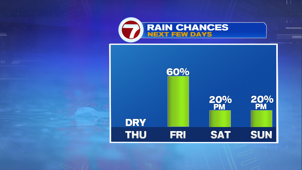
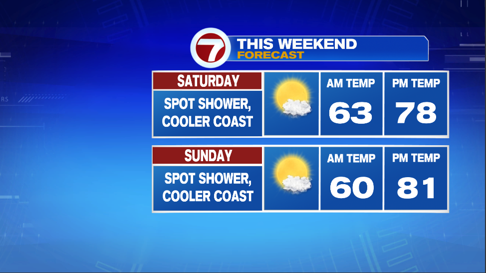
Both days look very similar. There is a 20% chance of a shower or two both days. Dewpoints in the lower 60s might make it feel a tad sticky, but it won’t be too bad especially with temperatures around 80. If we were talking about 90 that humidity would be more noticeable. Both days feature the potential for instability driven showers in the afternoon hours once we warm up a little bit. Saturday is a little more complicated as a system will be tracking to our south. It looks like a miss to our south is the most likely outcome, however there is about a 20-25% chance that it makes it far enough north to give us some steadier rain. The south coast has this best shot at seeing this while the odds for areas north of the pike are very limited.
~Owen