Today was a nice, comfortable start to the work week, but from here on out we’ll be returning to the mid-summer weather with heat, humidity and pop up storms. If you have plans this week, yes we’ll have storms, but these are going to be isolated/scattered so no day is a washout, and not every town will see a shower or storm every single day this week.
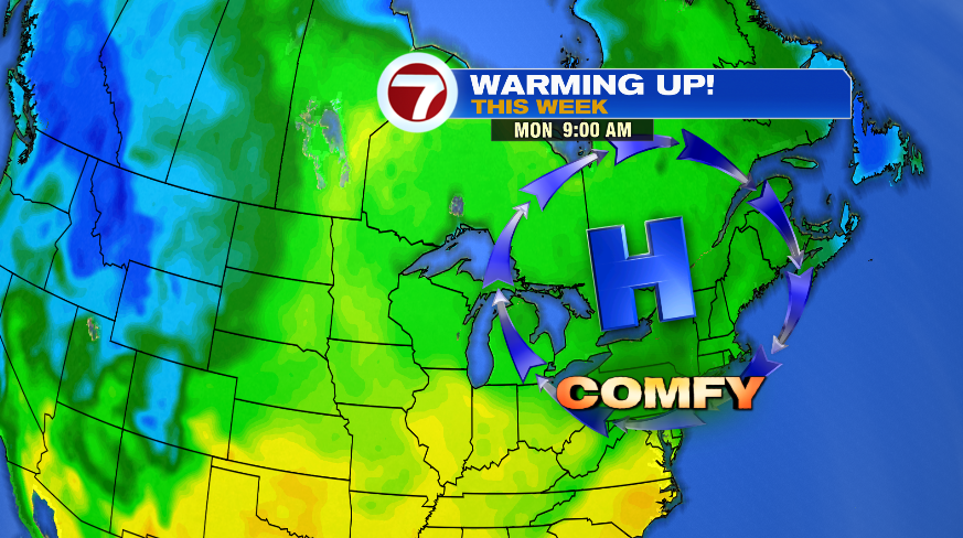
An area of high pressure sinking in from Canada kept things bright and comfortable today, but that same area of high pressure will flip our wind the next few days and send in the warmer temperatures.
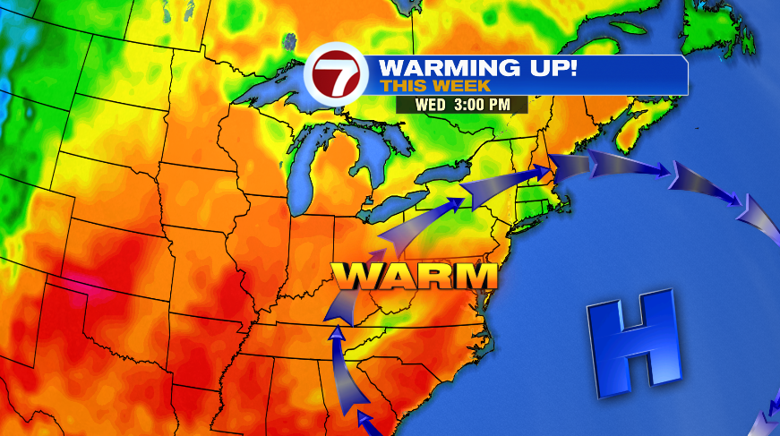
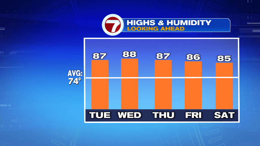
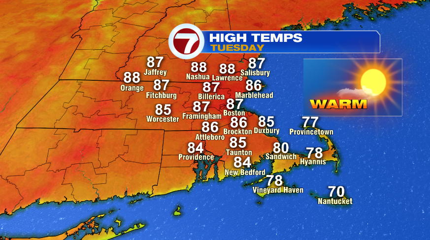
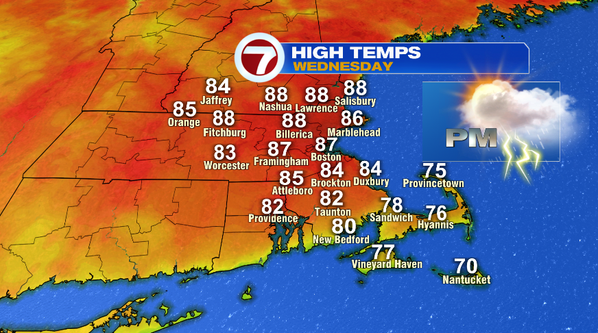
You’ll notice quite the jump already tomorrow as we trade the 70s from today for the 80s tomorrow. We’ll keep the bright skies around again tomorrow too. Wednesday we return to the 80s with a small chance of a pop up storm in the evening hours. The 80s and the storm chances will remain for the rest of the week.

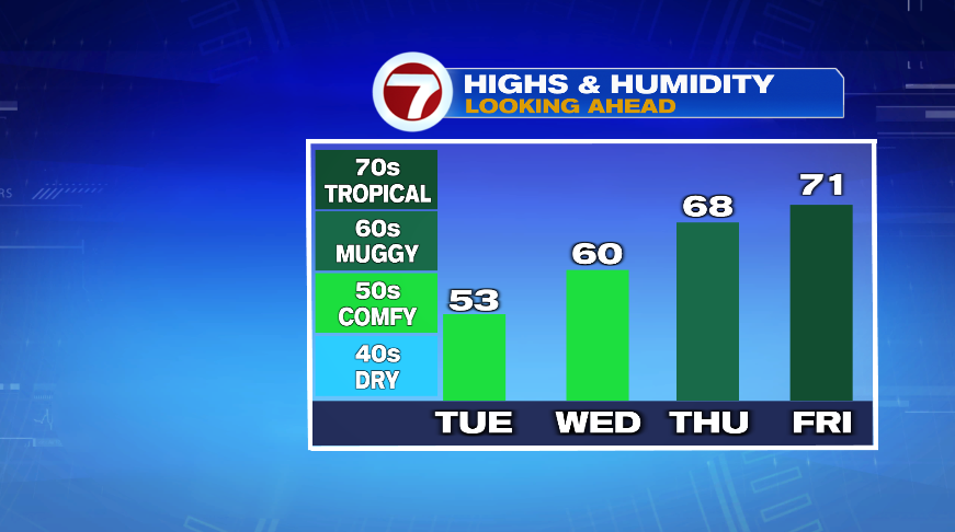
Of course the true summer feel also means humidity making a return. Today was about as comfortable as it gets humidity-wise in the summer with dew points in the 40s. Those dew points will climb the next several days. It’s still decently comfortable tomorrow with the stickiness and mugginess returning for the second half of the week.
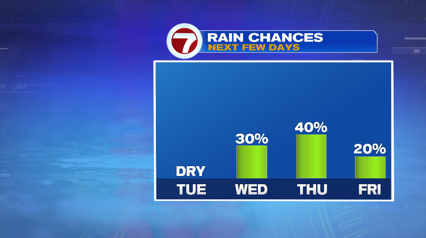
As the humidity and moisture goes up, so does the rain/storm chances. Like I mentioned earlier, while many days this week have storm chances in them, they’re hit and miss stuff and not every town will see a storm every single day. Tomorrow stays dry with our most likely chance for rain on Thursday. But that’s still only a 40% chance.
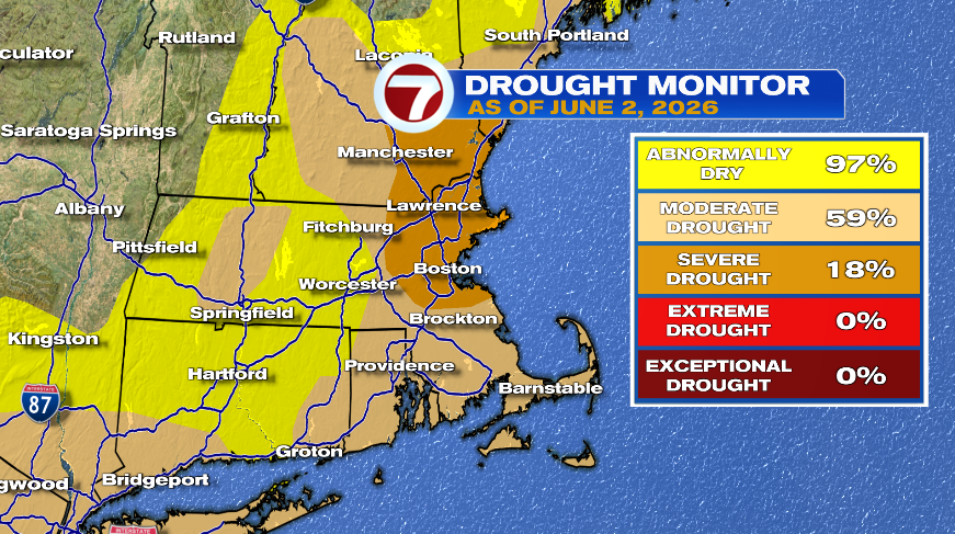
We actually could use more widespread rain than what’s on the way. These hit and miss thunderstorms aren’t enough to provide any widespread relief for the drought that’s developed. If your backyard happens to see a couple storms each day, good for you! But for any drought monitor relief, this week isn’t it, especially with the warmth/heat that’s developing and sticking around.