Is today the nicest? No. Is it the nicer of the two weekend days? Absolutely, so take advantage of it when you can!
We are starting out with mist & drizzle this morning for the coast, and stubborn clouds for most of the Bay State thanks to a breeze from the northeast driving moist ocean air our way. While it won’t be misty and drizzly all day, the clouds will be tough to break, especially for coastal cities. Inland cities have a chance at just a tiny bit of sun, but clouds will be stubborn and tough to break.
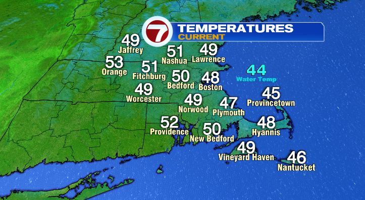
Temperatures are starting out in the upper 40s and low 50s today, and the numbers don’t budge too much with the pattern we’re in. Highs will stay largely in the 40s for the coast, while inland cities will top out in the low to mid 50s. Close to average, but a bit cool for this time of year.
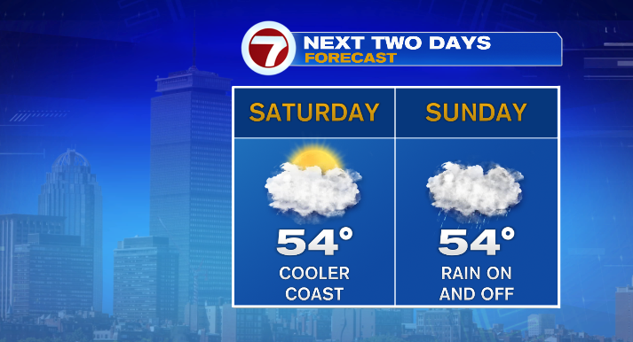
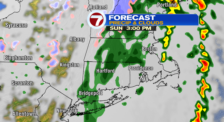
The weather becomes less favorable for outdoor activities. We have a soggy Sunday on tap thanks to an incoming cold front. This will lead to showers starting close to sunrise, then more widespread, heavier rain during the late morning and early afternoon.
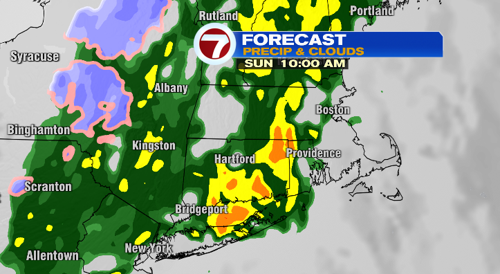
We may even hear a rumble of thunder during that time as well. The summary: plan for rain on and off from morning until around 4 PM or so– at that point showers start to ease up, though they won’t be totally gone until nighttime.
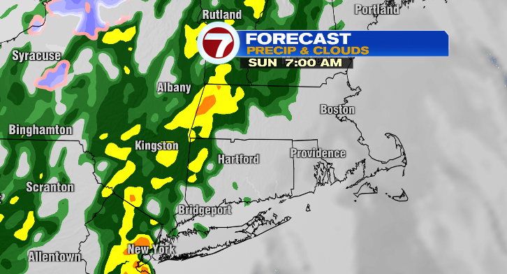
That means for those headed to the Garden for the C’s first playoff game (woo!), you’ll want some sort of rain gear on your way in and on your way out (boo).
Now for the big-ticket item: Marathon Monday. This forecast definitely favors the runners over the spectators… but I suppose that’s the way it “should” be since they’re the ones who’ve put in the work! We’ll start the day chilly, with temperatures in the mid to upper 30s in the morning, and right around 40 degrees when the first wave kicks off around 9 AM. Highs will be in the upper 40s by the afternoon– runners certainly won’t have to worry about beating the heat as they head up Heartbreak Hill.
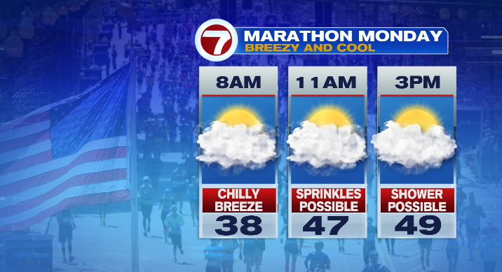
That said, if you’re not working up a sweat and hanging on the sidelines, you’ll want some layers. Not only will it be a below-average day temperature-wise, but it’ll be breezy with gusts in the 20s, and mostly cloudy for a decent part of the day. We may also see a few sprinkles, or an isolated shower.
Tuesday is dry and mostly sunny! Temperatures will still be cool with highs topping out in the low 50s. Wednesday will be milder (upper 50s) but we’ll see more clouds, with a stray shower possible.