Nothin’ but good news this weekend! If you’ve been waiting for summer to arrive in Southern New England, well, here ya go!
We’ll start with temperatures today, which are already getting a nice boost into the 60s this morning. By the afternoon, with the help of a west-southwest breeze (gusts in the teens and 20s today) and tons of sunshine, we’ll be in the low to mid 70s. A few spots, largely in Norfolk and Middlesex Counties, even have a shot at the upper 70s. Our temperatures will be indicative of mid to late June!
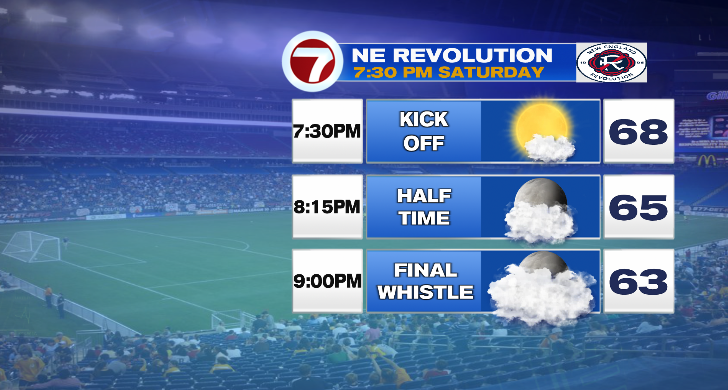
Whether you’re heading to midday graduation events, or the Revs game later this evening, the weather will be incredibly comfortable for this time of year!
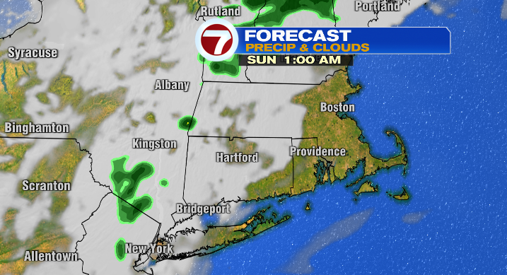
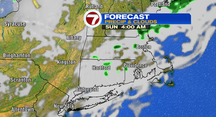
Timing is really on our side this weekend too, as we have a small disturbance that’ll pass through the region late tonight and early tomorrow morning. We’ll see more clouds after sunset, and a few, very spotty showers between about 2 AM – 6 AM.
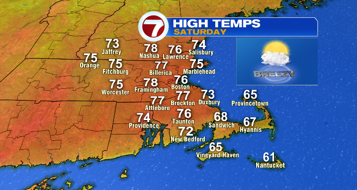
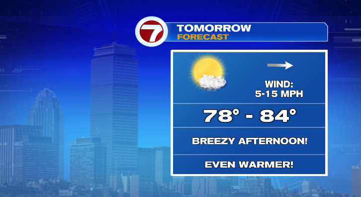
By mid-morning Sunday, even the clouds are gone, and we’re back to a beautiful, breezy (gusts up to 30 mph), mostly sunny day. Temperatures get an additional boost, and we’ll be in the upper 70s and low to mid 80s across the area!
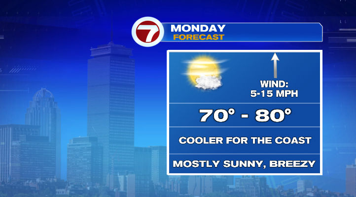
We keep the warmth rolling on Monday. The day will be mostly to partly sunny, but thanks to a back-door cold front (essentially a cold front that moves east to west instead of west to east), the coast will be cooler. It’s all relative though, as even those “cooler” spots will still be in the mid to upper 60s. A few coastal towns could even hit 70. Inland, temperatures will be between 75-80 degrees.
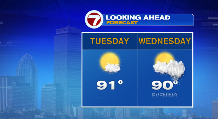
However, let me just say that I think there is such thing as too much of a good thing. Thanks to a big ridge of high pressure building over the region, and the heat building and building underneath that ridge, temperatures will skyrocket mid-week. Highs on Tuesday and Wednesday will be in the upper 80s and low 90s– phew!!
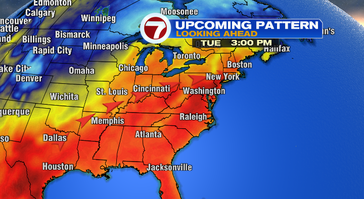
Tuesday will be mostly sunny with a chance of a pop-up shower or storm in central and western MA. Wednesday will start out partly sunny, but an approaching cold front will spark a few thunderstorms in the evening. The cold air behind that front will help break the heat– temperatures Thursday and Friday will be closer to 70.