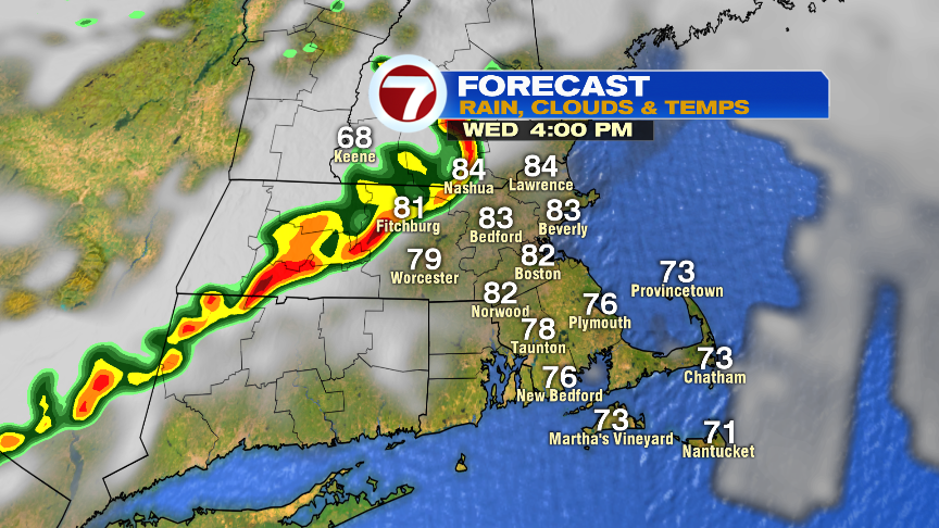
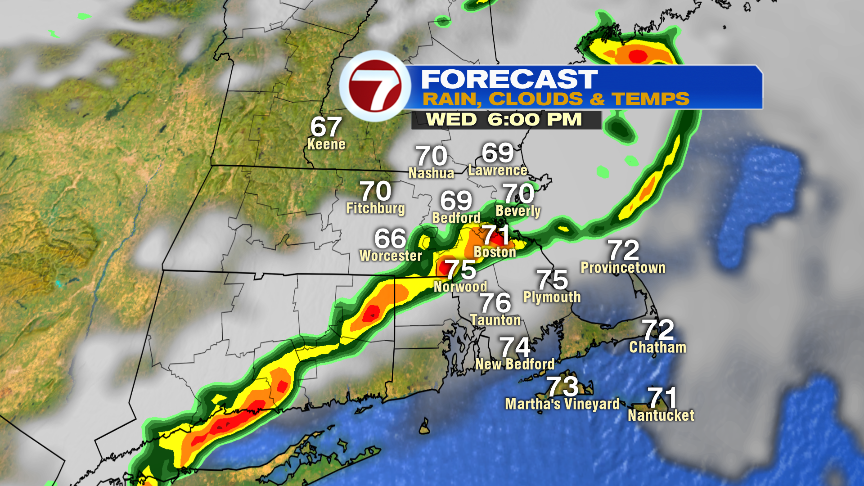
Patchy low clouds and fog this morning will yield to a breezy day with breaks of sun, higher humidity, and a warm afternoon. Temperatures top out in the low to mid 80s. Scattered storms develop this afternoon around 3-4pm out in northern Worcester County and southern N.H. and then move inside 495 between 4-8pm. Boston metro area… heads up around 5-7pm. Not only can localized downpours slow down the evening commute, but some of the storms will be strong with damaging wind gusts. The highest risk of severe storms is northwest of Boston, especially outside 495. Although the risk of large hail and tornadoes is low, it’s not zero, as there will be some rotation to the atmosphere. We’ll dry out tonight and lower the humidity into tomorrow as highs tomorrow hold near 70.

The latest on Hurricane Dorian has a category 2 hurricane running north, off the Florida coastline today.
As Dorian approaches the Carolina coast Thursday, there is concern that it’ll make landfall along the Carolina coast. Especially vulnerable to it will be from Morehead City to Cape Hatteras. If that’s the case, destructive winds move onshore there, as well as a storm surge. In addition, flooding rains develop along the coast and just northwest of it’s track.
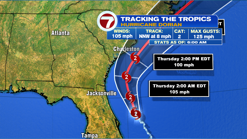
We’ll focus on the track closely here too by Friday night, as Dorian makes a pass just to our Southeast. How close it gets will dictate how much wind and rain we get.
As Dorian moves south and east of us, it starts to transition into an extratropical storm Friday. That expands the heavy rain shield on the northwest side of the storm, while the hurricane force winds stay along and east of it’s path. If Dorian does track just southeast of Nantucket, it’ll act like a nor’easter for us with strong northeast to north winds (gusts 40-60mph) across Southeast Mass with a period of heavy rain there too. The strongest winds would be closest to the storm, i.e. Nantucket.

Giving the current projections, below is what I expect for wind gusts and rain. A track closer to us, bumps these numbers up. A track farther away, knocks them down a bit. Regardless of exact track, very high surf and high rip current rips will extend through the weekend.

