

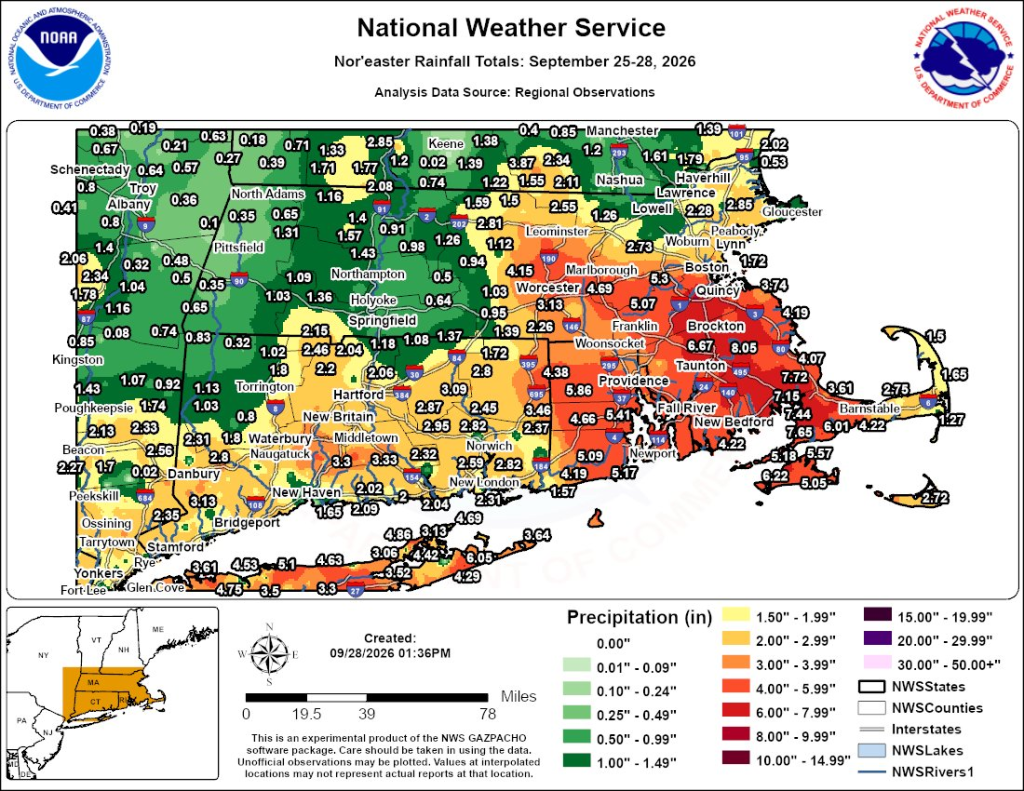
After days of rain and onshore winds, the storm has finally departed southern New England. Rain totals were impressive near and south of the Pike, where 4-8″ fell.
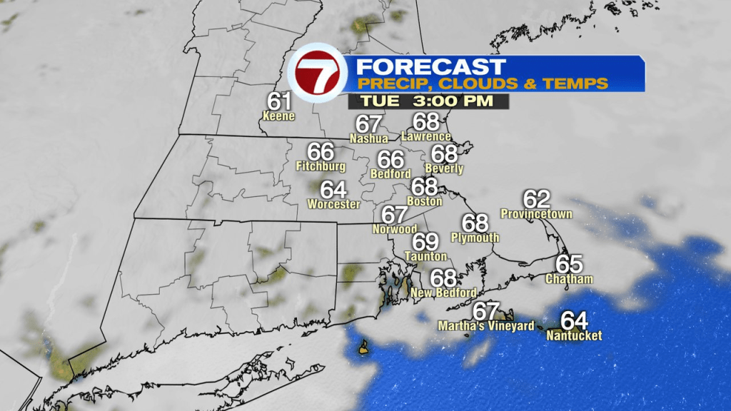
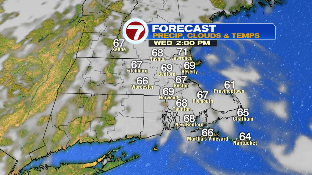
As we dry out today, it’ll still be mostly cloudy, but temps will run up into the mid to upper 60s with a breeze out of the west. Tomorrow will be similar, just a bit milder.
The big difference in the pattern is felt Thursday and Friday with highs in the lower 80s. Factor in a bit of humidity, and it’ll no doubt feel more like late summer again.
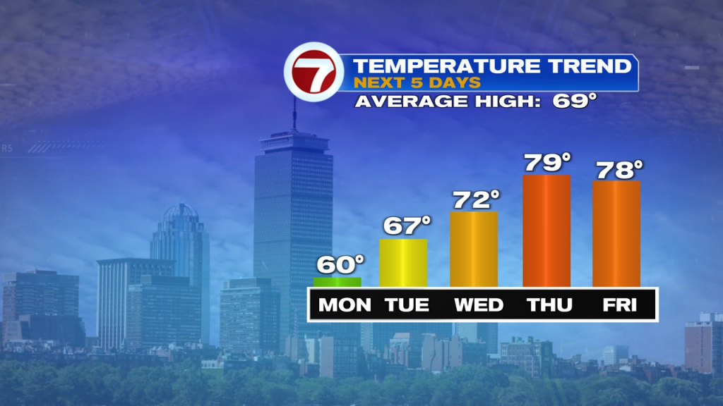
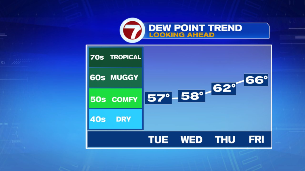
Those late summer patterns are fleeting this time of year, and this stint won’t be an exception. After two days of warm air, we’ll return to more seasonable weather for Saturday with highs back into the mid to upper 60s. To get there, a cold front does come through Friday night with a round of showers.
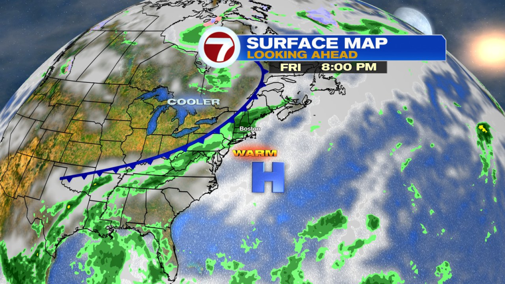
We’ll also watch the chance of a wave of low pressure to bring in some more showers by Sunday afternoon, but this far out, that’s not a lock.