Yes, you read that right!
No, there’s no reason to be alarmed.
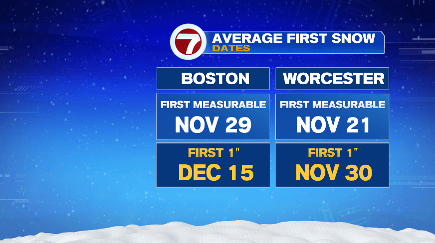
And yes, this is completely normal to start to talk about flakes as we head deeper into the month of November. First measurable snow means at least 0.1″ of snow and first 1″ is pretty self explanatory. As you can see, this is right in the ballpark of what we would expect, especially in Worcester County.
Alright so you obviously can’t have snow without the cold. We’ll have cold air moving in for the end of the week, but the core of the cold is not timed well with the arrival of the storm. As the cold air dips out of Canada, we’ll have an off shore storm passing by New England. At this time stamp, we’d want the cold air to be over the Northeast, not the Midwest, for a more widespread snow.
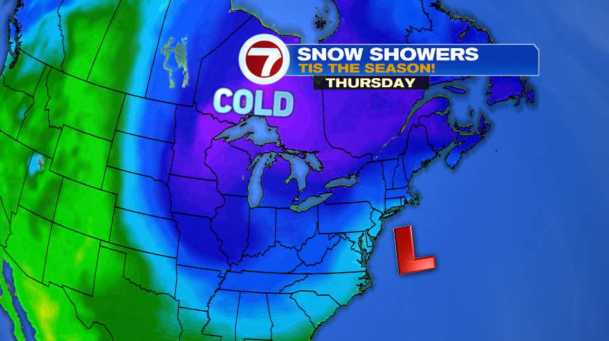
The colder air for us doesn’t arrive until Friday, as the storm is passed us. So it’s almost as if the cold air is chasing after the storm, rather than being set in place for the storm’s arrival. That set up gives us just enough cold air to see the flakes across the higher terrain. Now, that said, as the storm exits our wind will turn to the north and allow more of the cold air to move in as the storm departs. At that point we may see a few flakes, even at the coast, right as it’s all winding down.
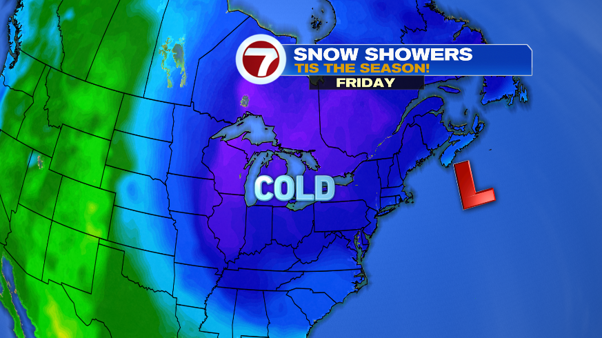
Here’s some future radar snapshots. You see initially Friday morning and even at noon Friday, the snow is confined to the highest terrain, MAYBE to about 495. And this doesn’t mean accumulation, just that you’ll see some snowflakes. Then later in the evening we may get just cold enough to see a few snowflakes (briefly) closer to the coast.
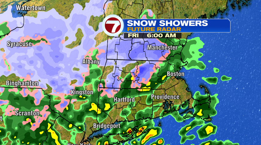
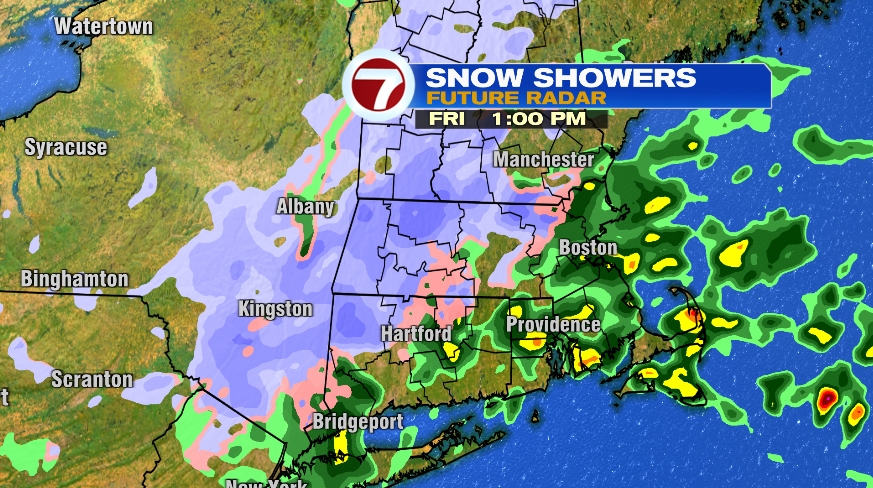
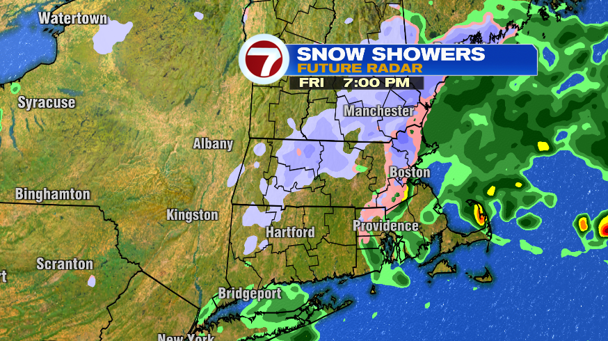
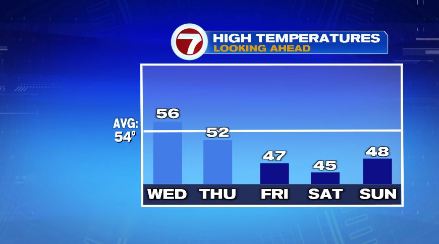
That cold air, by the way, you’ll feel it Friday and Saturday. Friday is probably one of those days where our highs are in the morning and fall through the day. That’s why later in the day we may get just cold enough to see the snowflakes closer to the coast. Saturday not only keeps our highs about 10 degrees below normal, but there will be a chilly breeze on top of it.