Got fog? While thunderstorms are mostly a miss to our south this morning (grazing the Islands), the fog is not. With little wind, a soupy air mass, with dew points and temps matching or nearly matching, has allowed for fog to form. Some of it is locally dense with visibility running 0.25 mile or lower at times.
The fog and low clouds will burn off or lift by mid morning (8-10am) and the sunshine sends temps up quickly from there. Highs this afternoon max out in the low to mid 80s, albeit a bit cooler at the coast. The humidity will drift down a bit too as dew points fade back into the lower 60s.
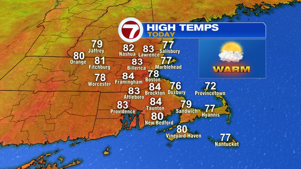
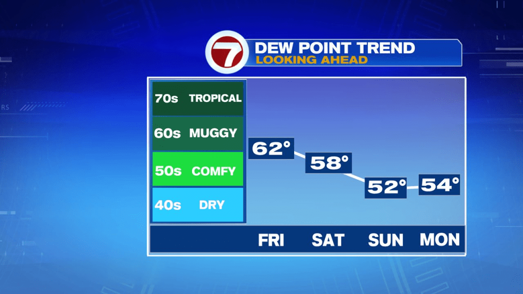
Tonight is more comfortable as temps slip back into the upper 50s and low 60s.
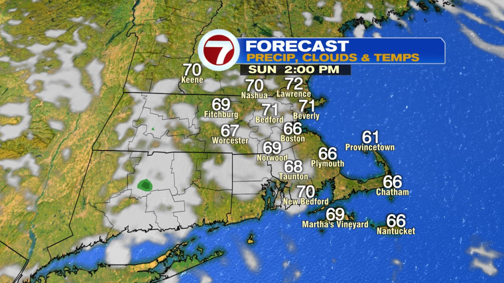
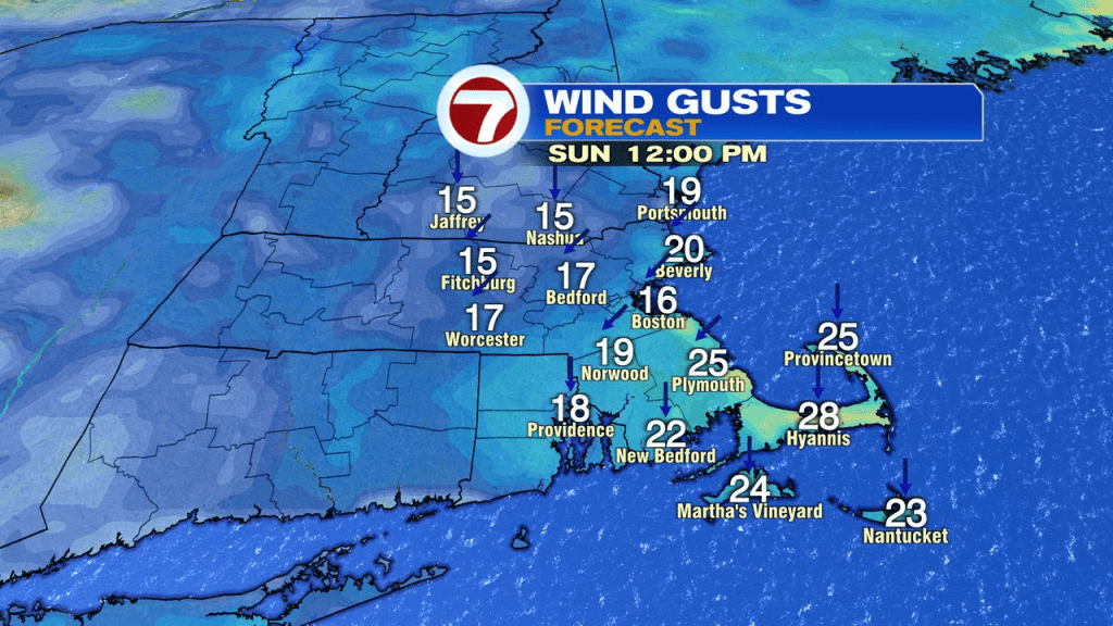
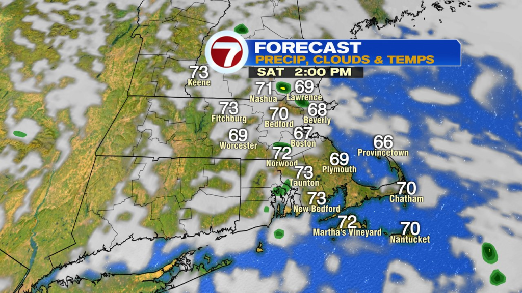
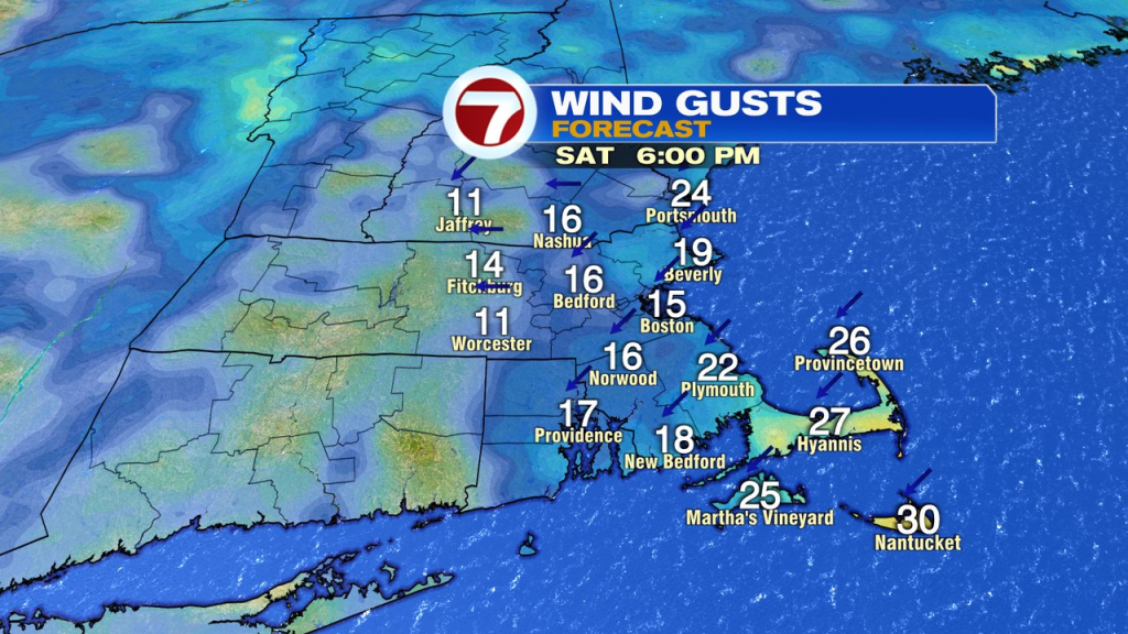
Early sun tomorrow yields to building midday/afternoon cumulus clouds. Humidity and temps lower too, and with some chilly air and a disturbance aloft swinging on through, we’ll watch for a few scattered afternoon showers to pop-up as well. They do tend to favor interior locations and will be brief. A cool breeze will develop along the coast with the strongest gusts, 25mph, across the Cape and Islands.
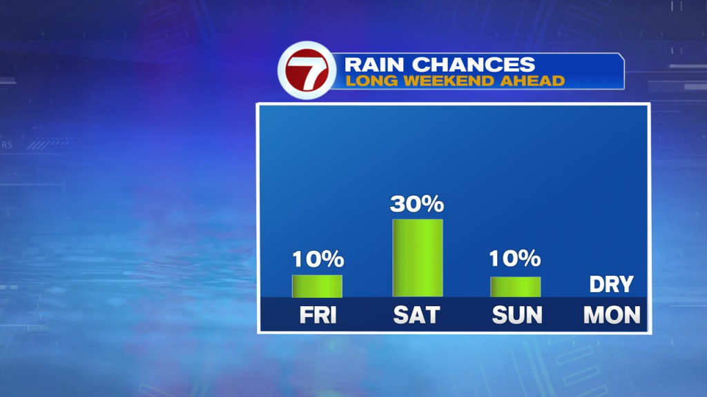
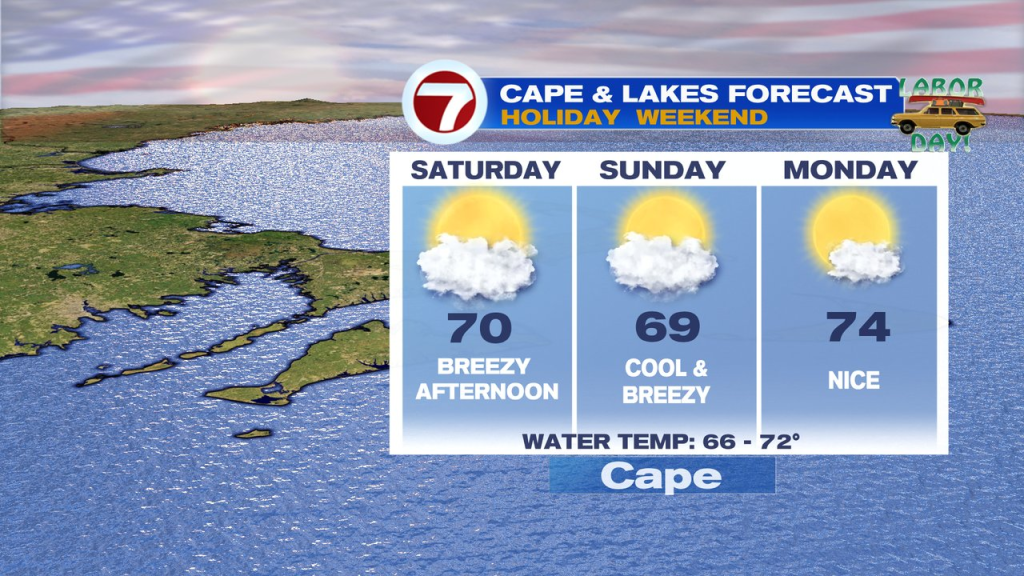
Sunday is cool, but mainly dry with a northeast breeze prevailing. Labor Day will feature dry air again and a bit milder.