We’re winding down for another warm evening after another hot day here in Southern New England. It’s a gorgeous, summery evening if you want to spend the end of your Friday out and about.
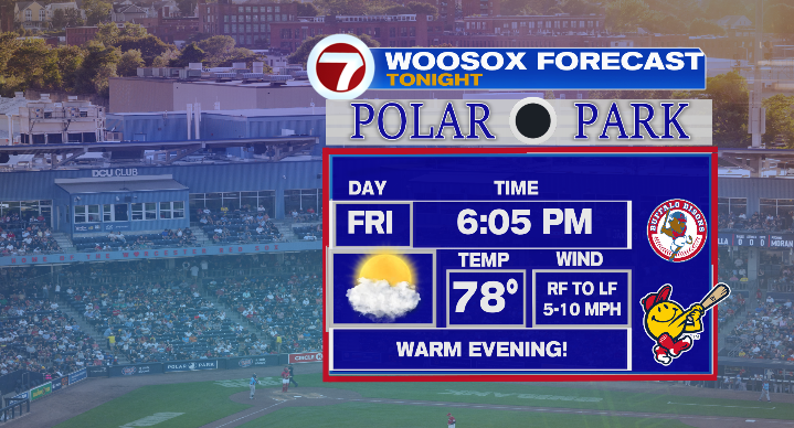
For those heading to the Woo Sox game, it’s a perfect night for the ballpark! Temperatures will be right around 80 for the first pitch at 6:05 PM, and cool down from there. By the time the game is over and the fireworks at Polar Park begin, temperatures will be in the upper 60s.
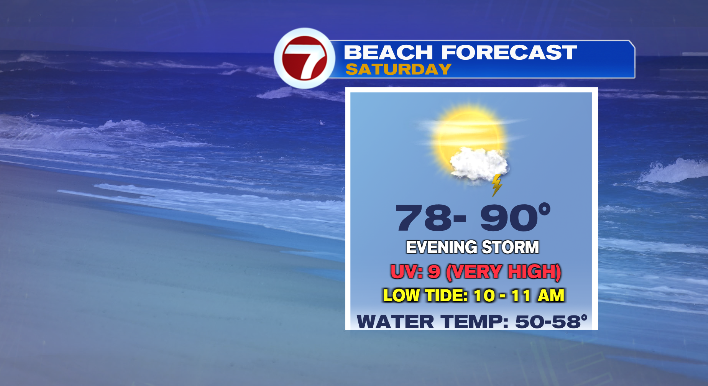
By the time we reach Saturday morning, lows will have hit the upper 50s and low 60s… but temperatures don’t stay there for long! Expect another hot day with highs in the 80s & low 90s for most. If you’re looking for relief from the above-average heat, the Cape & Islands is the place to be (temperatures will top out in the 70s & low 80s). In fact, whether you’re headed down the Cape or up to the North Shore, most of Saturday will make for a stellar beach day! That said, stay weather aware! The building heat and humidity will act as fuel for thunderstorms as our next disturbance rolls in during the second half of the day.
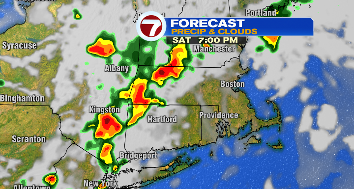
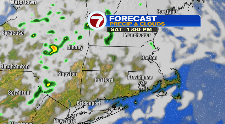
While a stray shower or storm could pop up in the early afternoon, particularly for southern New Hampshire and western Massachusetts. But t-storm chances for central and eastern Massachusetts are considerably higher after 5 PM.

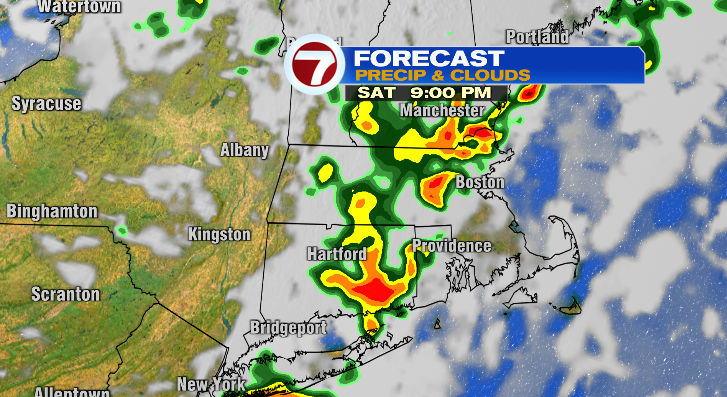
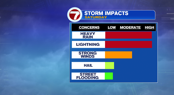
A few of these storms could pack a punch, with thunder/lightning, heavy rain, gusty winds, and an isolated chance of some small hail.
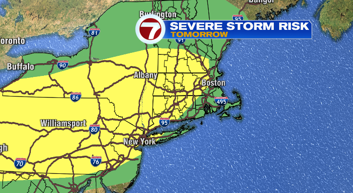
For that reason, the SPC has put New England in a level 1 (Marginal, green) & level 2 (Slight, yellow) severe weather risk.
Sunday will be cooler, though still above average with temperatures in the upper 70s and low 80s. It’ll be a muggy day as well, and we have another chance of rain with showers and a thunderstorm or two possible during the day.
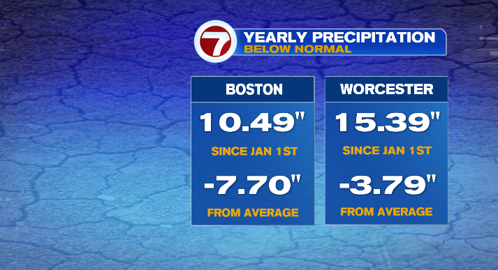
I have no doubt that after all the sunshine and summerlike weather during the weekdays, this isn’t exactly the news you’re looking for. This will be the sixth weekend in a row we see rain! However, as ironic as it seems, we actually do need the rain! Boston, Worcester, and many other Massachusetts cities are in a precipitation deficit right now.
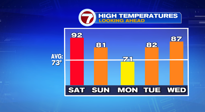
The extra jab comes from the fact that, while cooler, Monday looks beautiful. We’ll be mostly sunny with highs in the low 70s and upper 60s. We’ll warm back up from there as the workweek goes on. Highs on Tuesday will already be back in the low 80s, and we’ll be in the mid to upper 80s by Wednesday! The workweek (of course) also looks mainly dry.