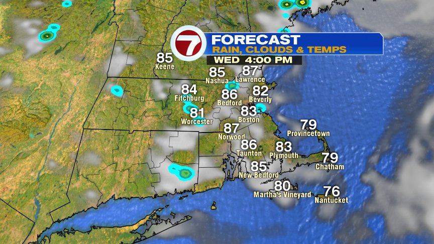
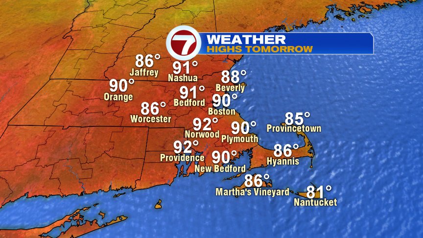
While the pattern quiets for a bit the next couple of days, we still can’t completely rule out a spot shower/storm today and tomorrow, but coverage area is more like 10% vs. the widespread action we’ve seen the last few days. With more breaks of sun in the forecast after patchy low clouds and fog in the morning, both today and tomorrow will warm up quite a bit. Highs today top off in the mid to upper 80s and we crack 90 tomorrow in many towns and cities. Mid to late afternoon tomorrow will feature sea breezes kicking in, dropping temps at the coast back to the low to mid 80s.

The storm risk goes up Friday into Saturday and behind that front, we’ll cool off and lose the humidity. Highs Sunday-Tuesday next week run mid 70s to low 80s, coolest at the coast. Humidity lowers enough that overnight lows fade back into the 50s and low 60s early next week. Finally, a nice break from the muggies!

Have a good day!
@clamberton7 – twitter