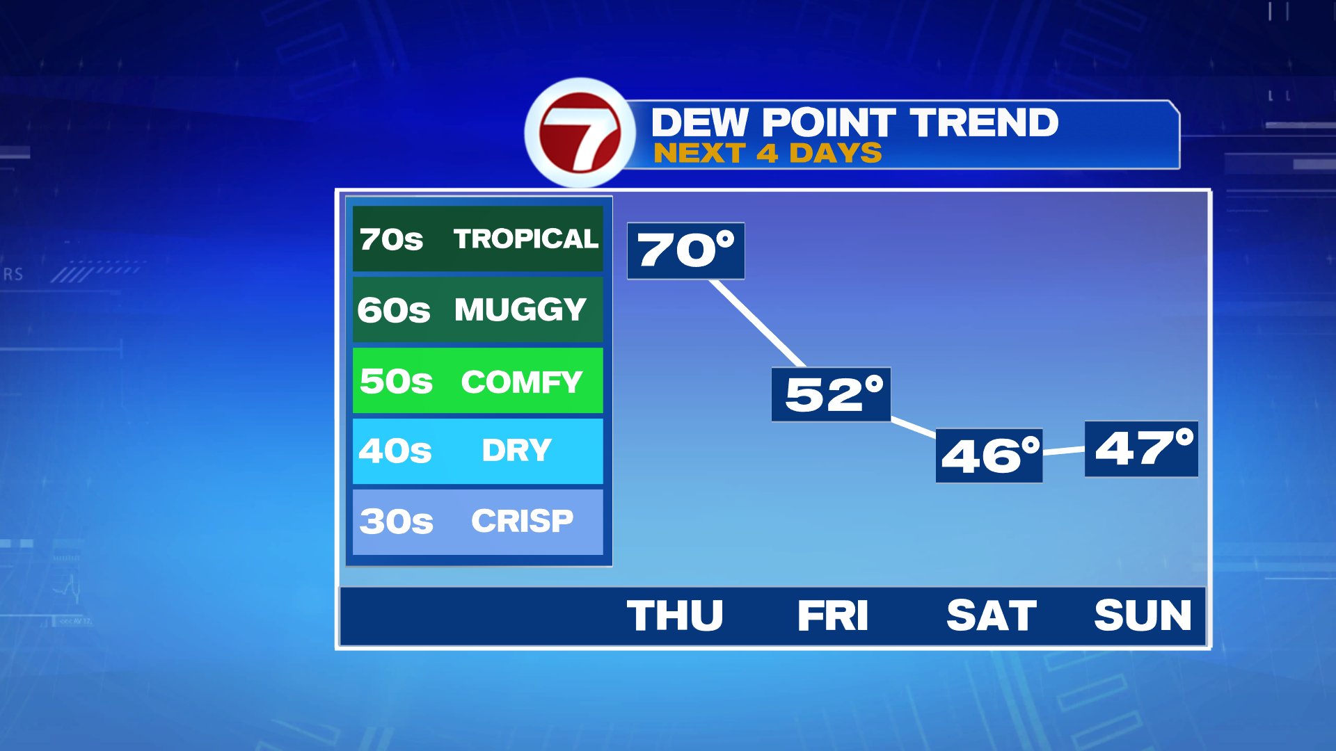
South wind is in and humidity ramps up today as temperatures near 80 and dew points surge to near 70. That tropical feel to the air indicated that the atmosphere has plenty of moisture in it, and not only is that true near the surface, but also in the mid levels too. With plenty of water vapor to work with, showers and storms that do form this afternoon will be capable of producing localized downpours. Storms start after 1pm near and northwest of 495 and around and after 3pm east of 495. While the storms are hit or miss, meaning not everyone gets wet, 60-70% will likely catch some rain this afternoon, through this evening.
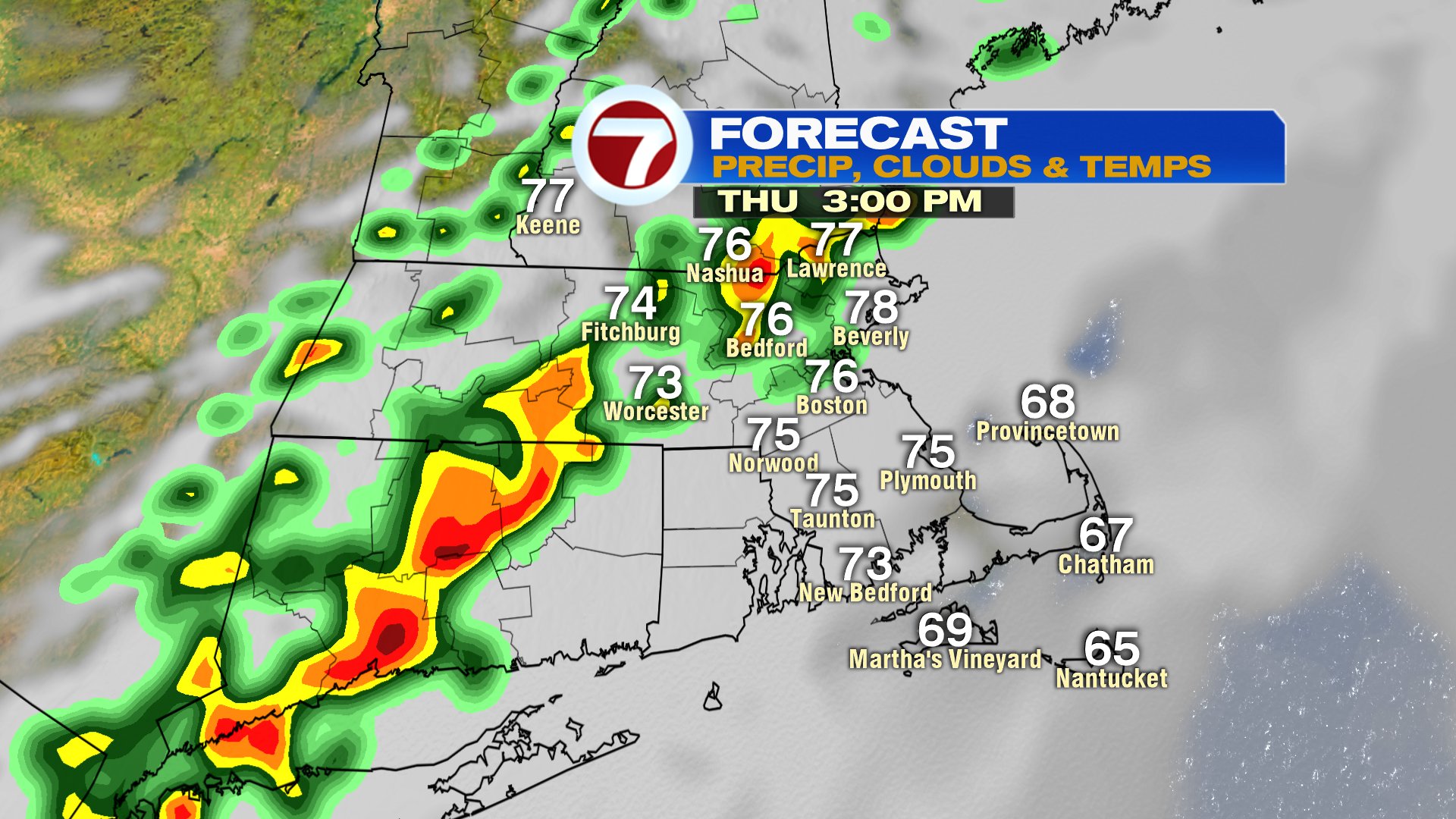
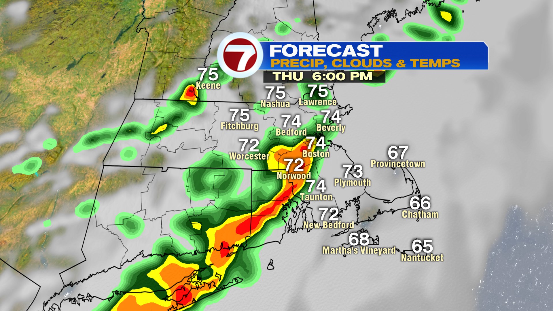
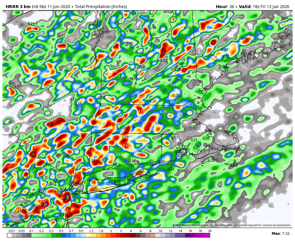
In terms of rain totals, the numbers will be all over the place. If you get stuck under a heavy thunderstorm for 30-45min, it’s a quick 1-2″ of rain, while others towns pick up next to nothing. Don’t take the map below at face value for each location, it’s just a visual on how variable the rain totals will be.
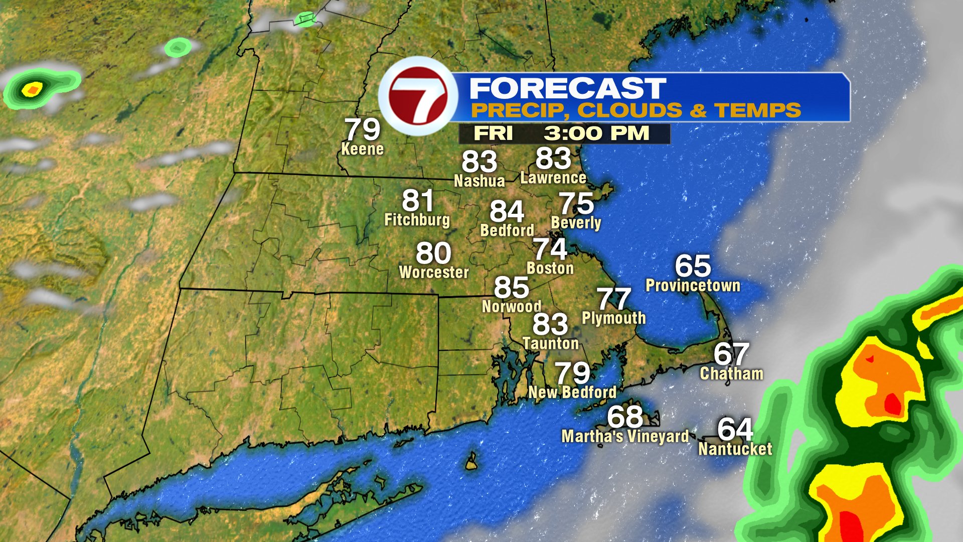
Any early morning showers across the Cape tapers off tomorrow, yielding to mostly sunny skies and lowering humidity. It’ll be warm in the afternoon, mid 80s inland, mid 70s at the coast. We’ll cool off over the weekend, and while a few isolated showers are possible by Sunday, much of the time is rain-free.