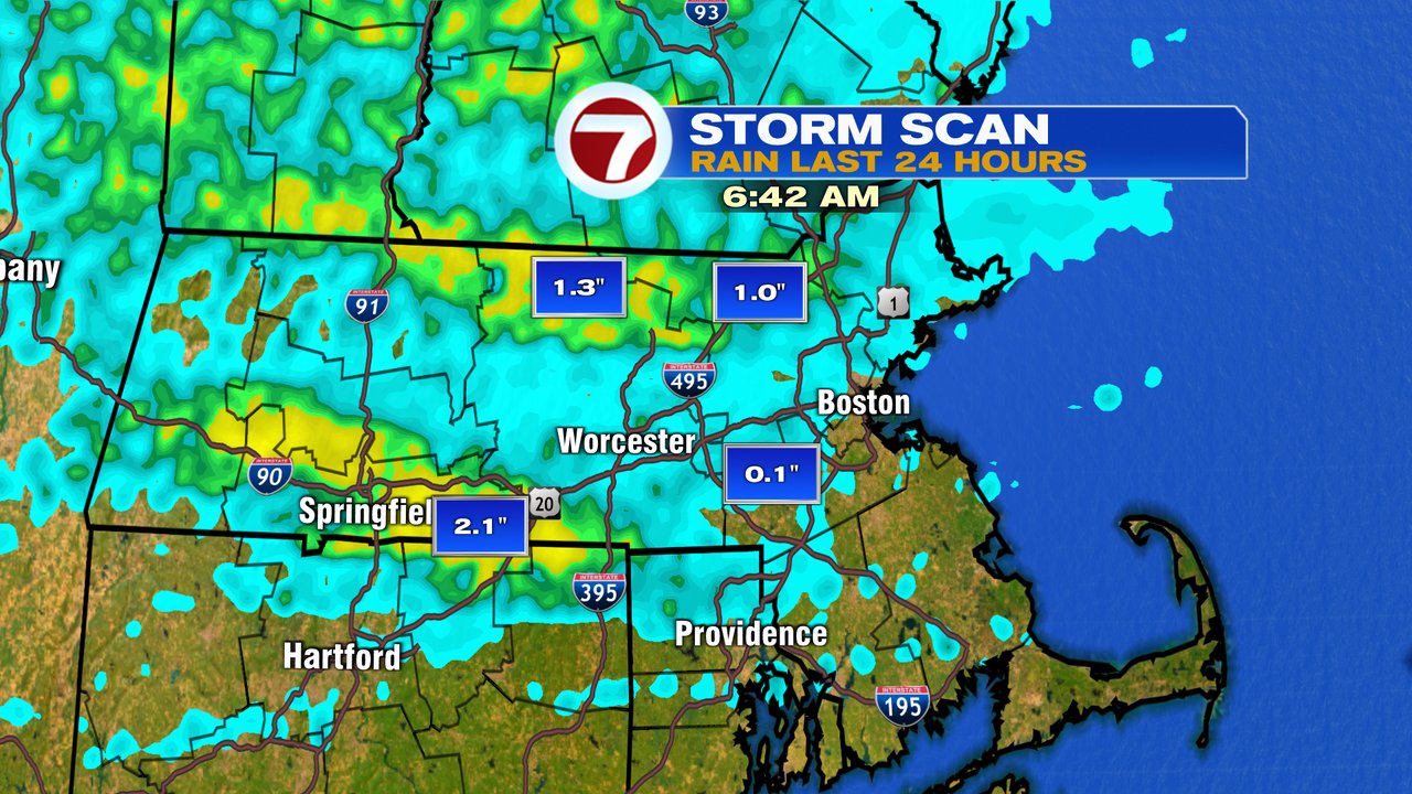
Showers and storms that rumbled through New England last night dropped beneficial rains for some, and nothing for others. That’s have it often plays out with summer storms, as last night’s winners tended to favor locations inland. You can see on the map below the areas that picked up the most, near 1″ or more.
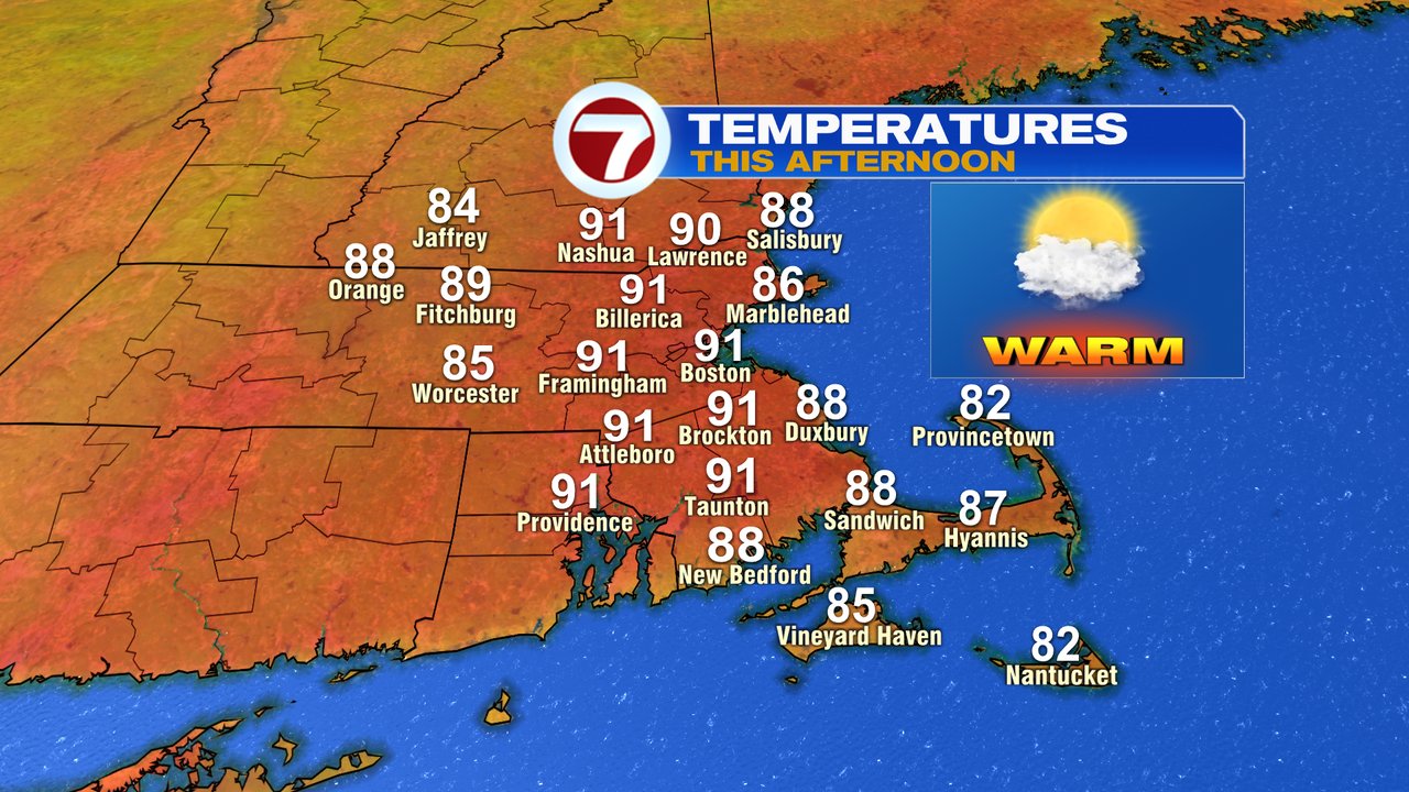
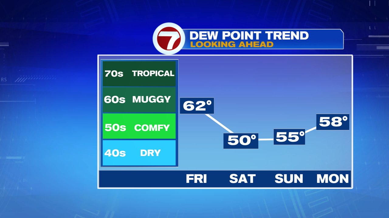
While the rain showers wrapped up early this morning, the high humidity is still prevalent. That will change by this afternoon though as dew points drop from near 70, back to the upper 50s and low 60s. It’ll be a hot one too with highs close to 90. I don’t expect thunderstorms this afternoon, so it’ll be a nice beach/pool day ahead.
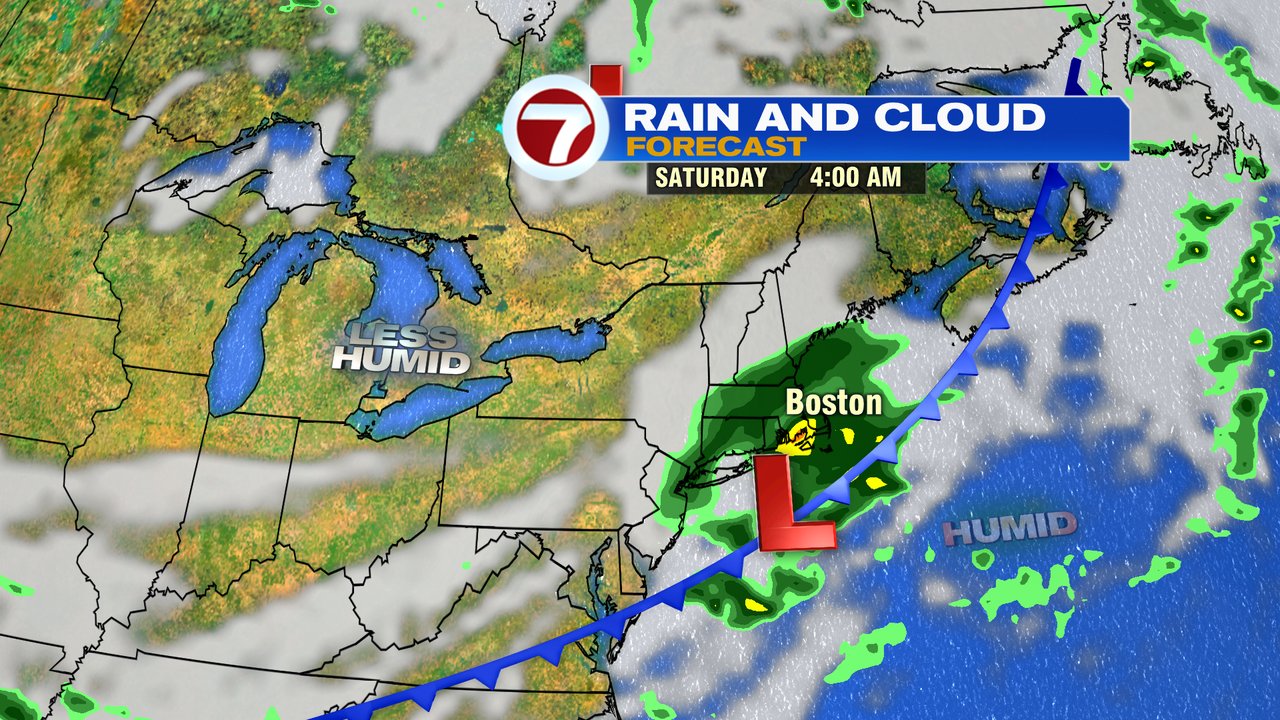
Tonight, we will have the chance for some showers late as a wave of low pressure rides along a front that’s just to our south. While the heaviest rains may stay just off the south coast, some showers are likely predawn tomorrow, through sunrise. The highest chance for them is across Southeast Mass.
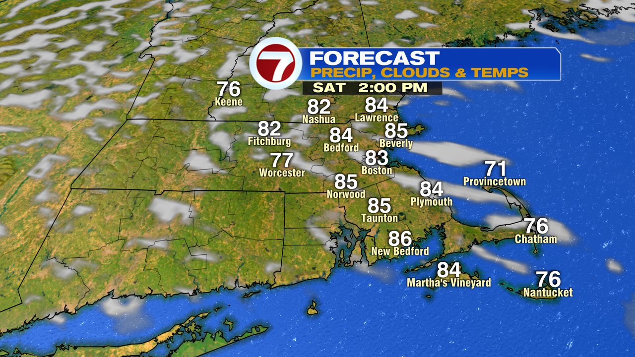
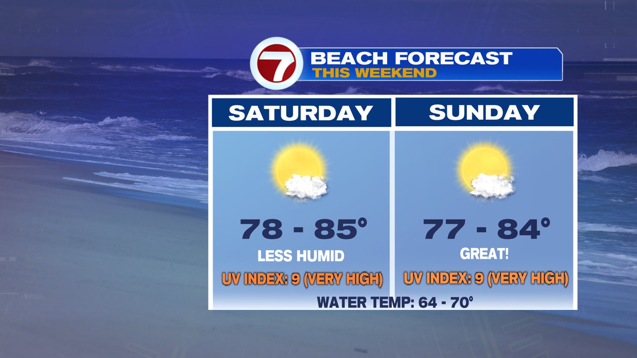
Those showers end quickly early tomorrow and sunshine wins out by mid morning. Humidity will be lowering too as dew points head for the low 50s. Great weather for a cookout, tee time or to head to the pool or beach as highs run in the mid to upper 80s. Temps run mid 80s to 90 Sunday with more sunshine and localized sea breezes kicking in. Another nice summer day!
Next week looks hot, near or just above 90 Monday – Wednesday and perhaps mid to upper 90s Thursday. A few pop-up storms are possible Tuesday and Wednesday afternoon.