Isaias this morning remains off the Florida coast as a strong tropical storm with winds sustained at 70mph. The forecast from the National Hurricane Center does have it picking up a bit of strength before making landfall tonight near the South/North Carolina border. Once it reaches the Carolina coast, it’ll start to race north to northeast and be into western New England by tomorrow evening.

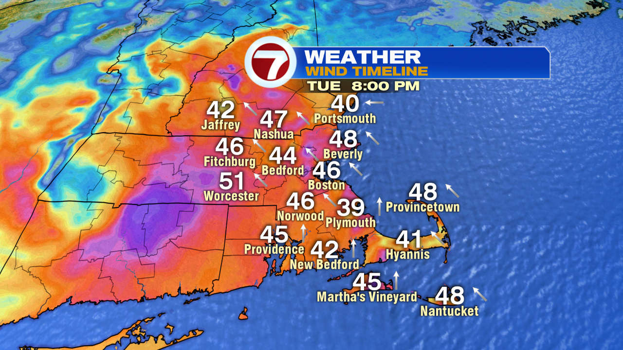
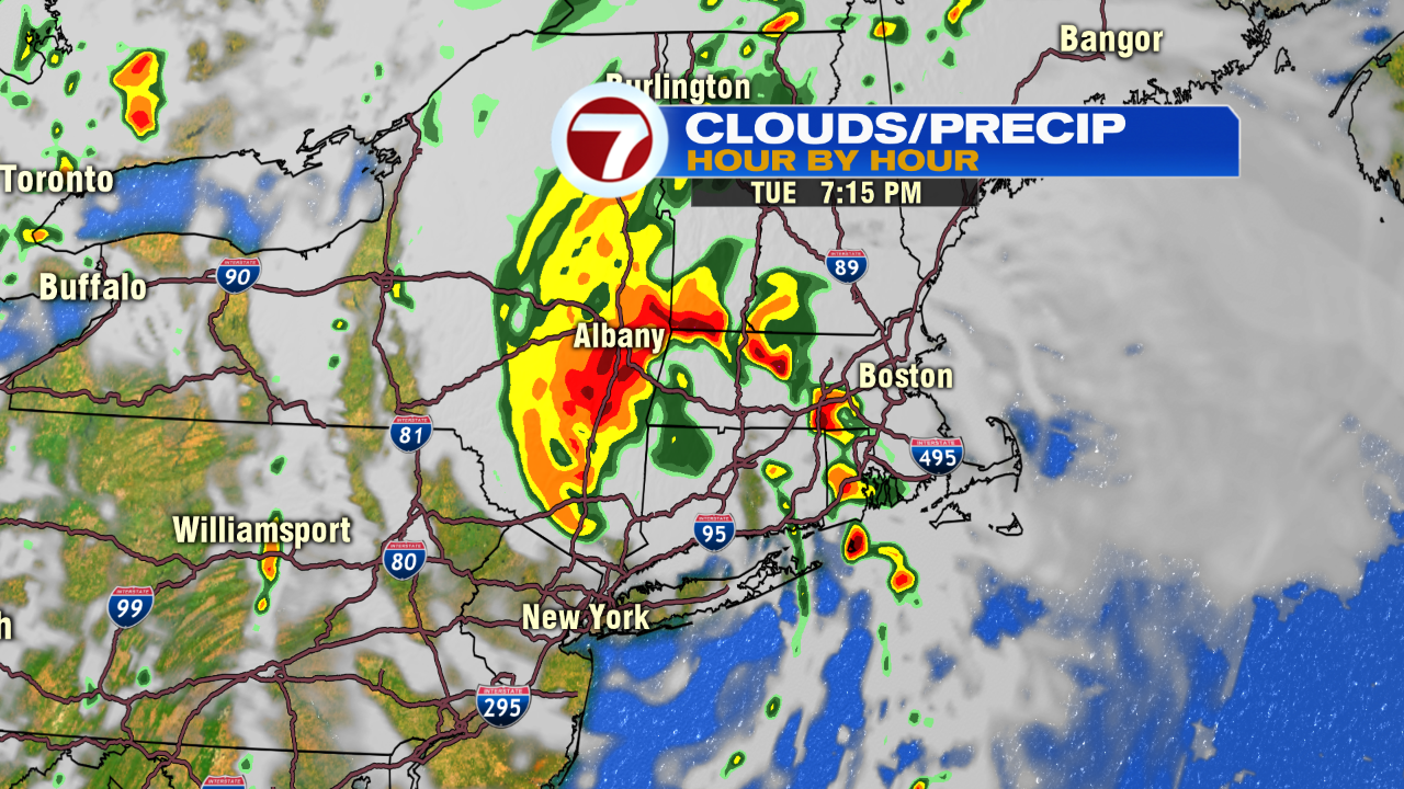
With many of us on the east side of the storm, we’re on the windier side of it, with gusts late tomorrow and tomorrow evening likely to be in the 40-50mph range. The atmosphere tomorrow evening (5-10pm) will have plenty of spin to it, which will enhance the threat of localized severe thunderstorms. We do need to watch for a period of scattered storms that line up late tomorrow, east of the center of circulation. It’ll be in these storms that locally isolated damaging gusts 60-70mph or even an isolated tornado is possible. That’ll yield pockets of scattered tree damage and power outages. In terms of rainfall totals, it won’t be a huge drought buster inside 495 as many towns and cities pick up less than an inch. Back into the CT River Valley and much of western Mass, 1-3″ is likely with locally higher totals in eastern New York and 3-5″ for parts the mid-Atlantic.

The storm is gone by Wednesday morning as dry weather moves back in for much of the 7 day forecast.