We’ve had no measurable rain for almost three weeks, and now that stretch will now come to an end. For some of us that will be tomorrow, for the rest that will be on Friday. So hopefully you enjoyed what we had out there today with sunshine and *near* record temperatures! Maybe it was too warm for some of us… As of 3pm we are just shy of tying records in both Boston and Worcester, but certainly today was in record territory.
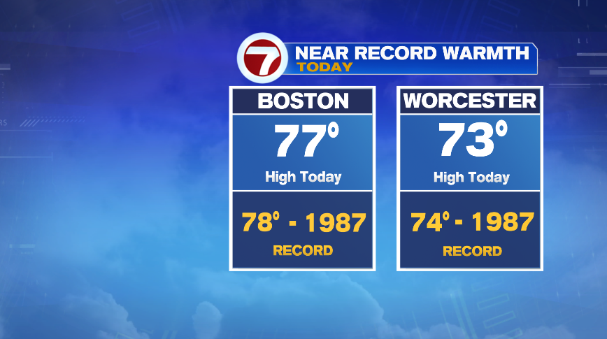
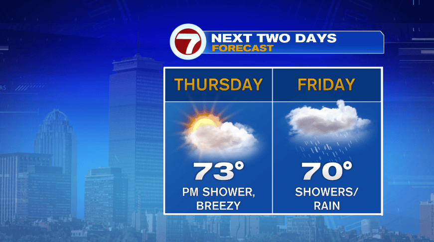
While some changes start to develop overnight and tomorrow, tomorrow is still a warm day. Clouds will increase tonight and tomorrow becomes a mostly cloudy day, unlike our day of nearly straight sunshine today. Despite the clouds we should make it back to the middle 70s tomorrow afternoon. Records tomorrow are warmer than today, making setting or tying records tomorrow unlikely.
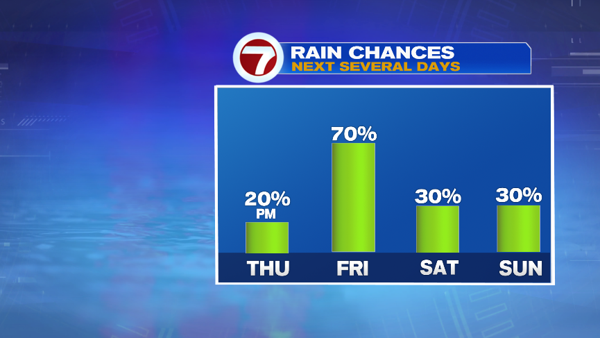
The clouds are ahead of rain that will return on Friday. There’s a small chance (20%) of an afternoon shower tomorrow, so some of us will break our dry streak tomorrow. If you manage to make it through Thursday, then it will come to an end on Friday.
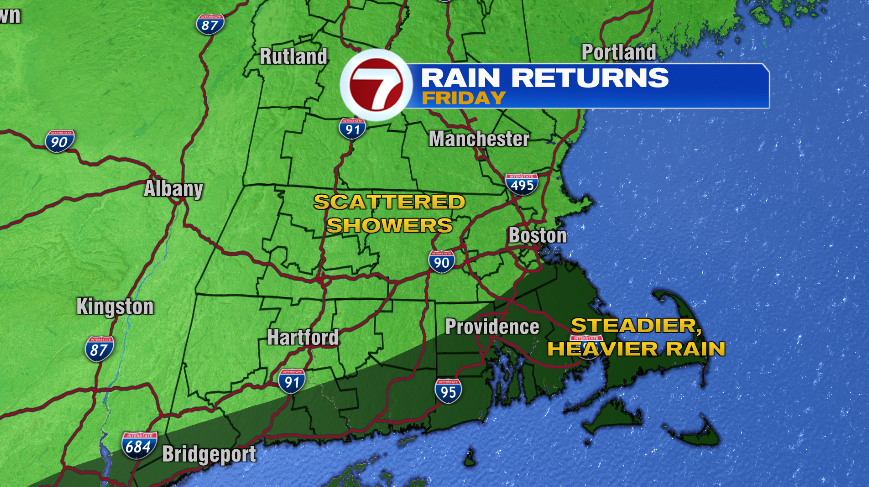
Friday is a tricky day. For some of us, it’ll basically be a washout of a day with steadier and occasionally heavy rain all day long. For others, it’ll will be on and off showers, keeping a good chunk of the day cloudy, maybe a little damp, but also several dry hours. The axis of heavy rain has shifted from setting up over the 95 corridor during the day on Friday, to just east of there, targeting Southeastern Massachusetts and the Cape with the steadier rain.
Again, if you aren’t there, that doesn’t mean you’re totally dry. You’ll still have showers on Friday and a lot of clouds, but you’ll have a lot more dry hours than where the heavier stuff sets up. This is as of Wednesday afternoon, so by Friday, this could wobble around a little bit more. It could continue that trend eastward, saving more of us from a washout Friday, or it could wobble back west toward the 95 corridor. Stay tuned through the day tomorrow and we’ll be even more confident on that heavy stripe of rain.
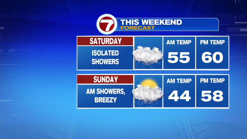
That rain is on a cold front that will bring in colder air for the weekend. Temperatures on Friday actually aren’t that bad — getting close to 70°, which is still 15° above normal. By the weekend we’ll see our temperatures settle back down to levels more typical of early November. Both Saturday and Sunday will bring the chance of a few showers as our storm lingers, but they are not washout days. Just know that if you’re out and about this weekend, the risk of a passing shower will remain, but it’s not nearly as wet as Friday looks.