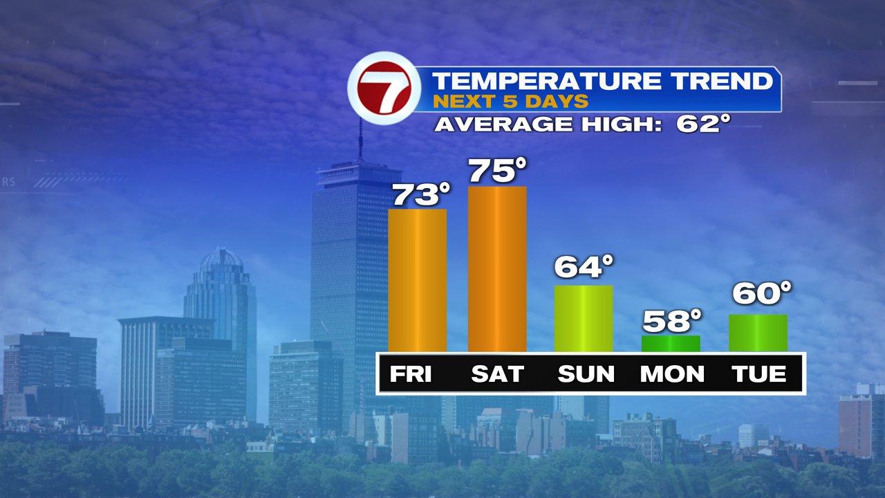
We certainly put another mild day in the books yesterday with highs once again running in the mid to upper 70s, which is close to the average high for late August. Despite the stretch of warm weather that we’ve had, there is a steep step down in the pattern, pushing the highs back into the upper 50s by Monday, closer to the averages for late October. To get there, a cold front sweeps on through with showers and storms over the weekend.
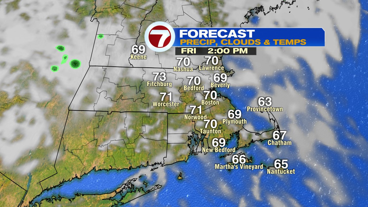
Mild air still wins out today with highs in the low to mid 70s with a mix of clouds and breaks of sun. A spot sprinkle is possible, but much of the day is dry. It’ll feel muggier too, with dew points near 60.
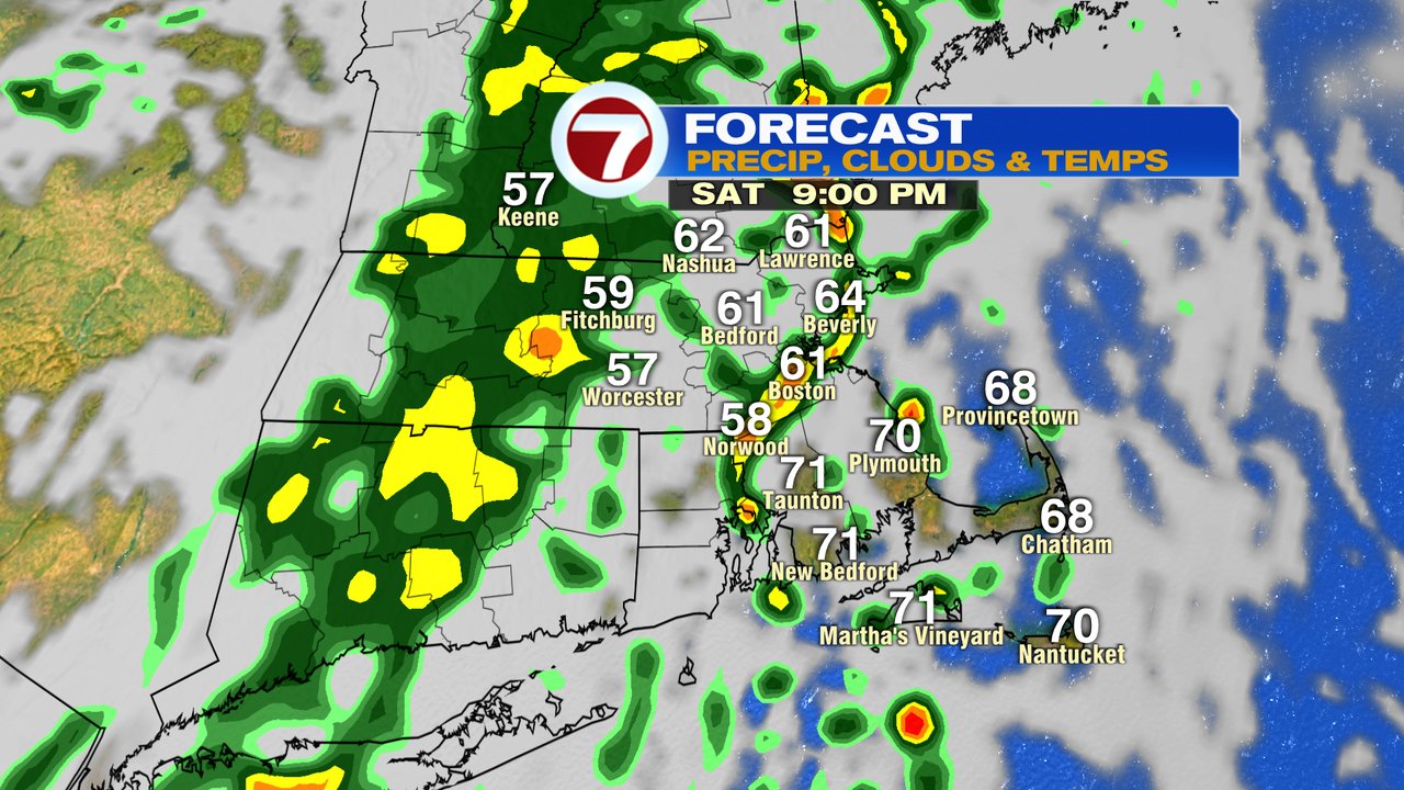
The muggy and mild air sticks around tomorrow with just a few isolated showers during the day. Breaks of sunshine through the clouds will send temps into the low to mid 70s with a gusty breeze developing out of the south. Showers and storms are more widespread tomorrow evening as a cold front sweeps on through.


On the other side of that cold front, of course, cooler air. More seasonable October weather settles in Sunday, with the core of the chill overhead Monday and Monday night. Certainly a cool crisp air mass for when the Sox get back to Fenway.