Yesterday felt like summer with highs into the low 80s, coupled with low humidity and a nice southwest breeze. Today, we flipped back to more of a spring-like pattern with clouds and a few showers, and now fading temperatures.
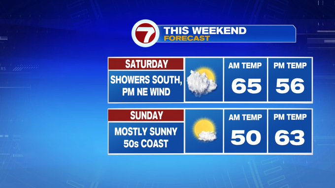
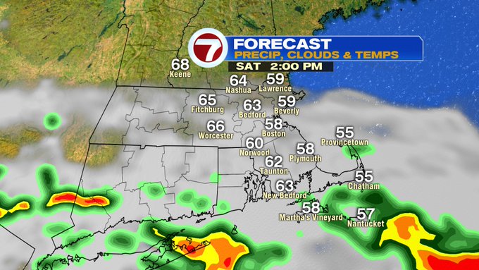
Yes, today we’re tracking high temperatures felt in the morning before fading into the 50s later this afternoon as a back door cold front spreads in from NE to SW. Boston reached 70 at 8AM, while by 9AM temperatures fell into the low 60s as the front started to dip farther southward. With this front, we’re also noticing lower dewpoints, with a much more comfortable airmass compared to earlier this morning and some gusty NE winds, which will make for some cooler conditions especially felt at the coast.
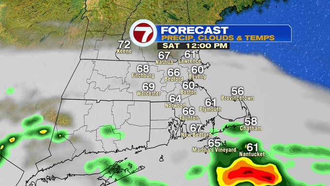
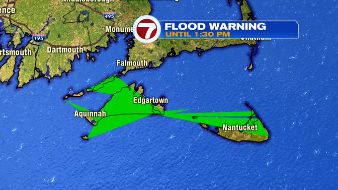
Although most locations will see dry conditions today, Martha’s Vineyard and Nantucket have been dealing with soaking rainfall, prompting a Flood Warning to be issued until 1:30pm with an additional 1-2″ of rainfall expected.
We’ll continue to notice a gradual clearing of the skies from north to south through the day today. By 7PM, we should see more sun than clouds besides the South Coast and the Cape/Islands, where clouds will linger through sunset.
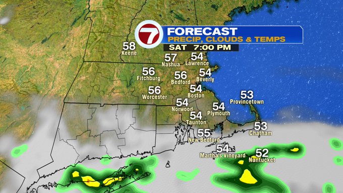
Tonight, mainly clear skies and easterly winds will give way to temperatures into the low to mid 40s.
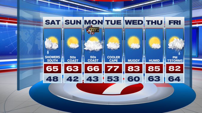
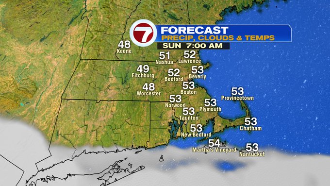
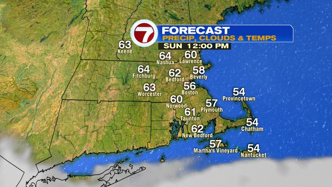
Sunday is brighter, making it the pick of the holiday weekend. The onshore breeze will still be with us on Sunday with highs at the coast only into the 50s, while inland will be stretching into the low to mid 60s.
Memorial Day Monday features mostly cloudy skies and highs into the mid to upper 60s inland, upper 50s at the coast.

Looking ahead to the rest of the work week, 80s return by the second half of the week along with the humidity! Low to mid 80s Wednesday through Friday, with Friday afternoon seeing the best chance from some thunderstorms.