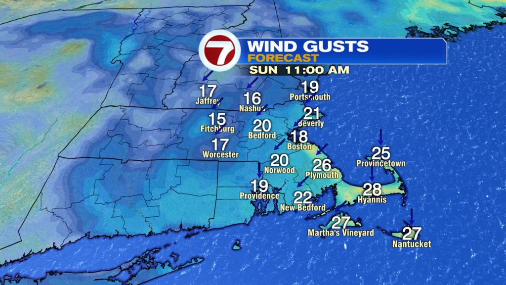
After about 0.25-0.50″ yesterday, we dried out overnight aside from a few spotty sprinkles. Today, we’ll be mainly dry as any patchy fog and early morning sprinkles tend to dissipate.
Clouds will have breaks in them for partial sunshine at times today and that’ll help lift temps into the low to mid 70s this afternoon. With an onshore breeze, it’ll be coolest at the coast.
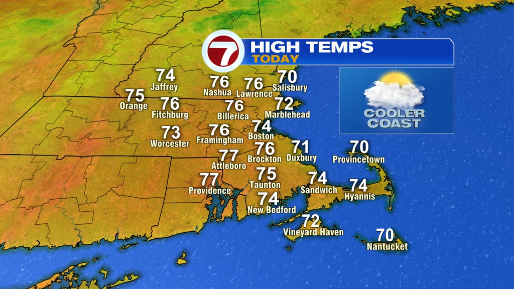
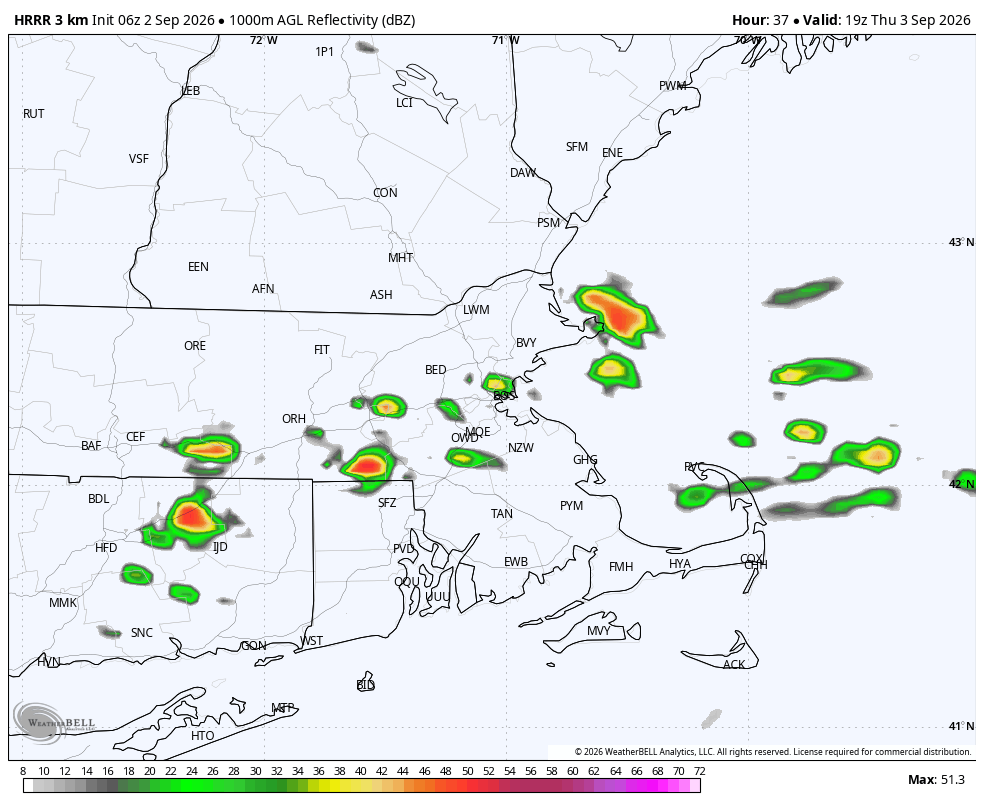
A warm front approaches from the west tonight, delivering a shot. of showers and storms late tonight and early tomorrow morning. That initial round of showers and storms moves offshore by 9am, and in it’s wake, we’ll dry out for several hours. With breaks of sun, temps jump to near 80 and with dew points jumping up into the low 70s, it’ll feel quite sticky. The warmth and humidity will also fuel a few scattered mid to late afternoon storms, out ahead of an incoming cold front.
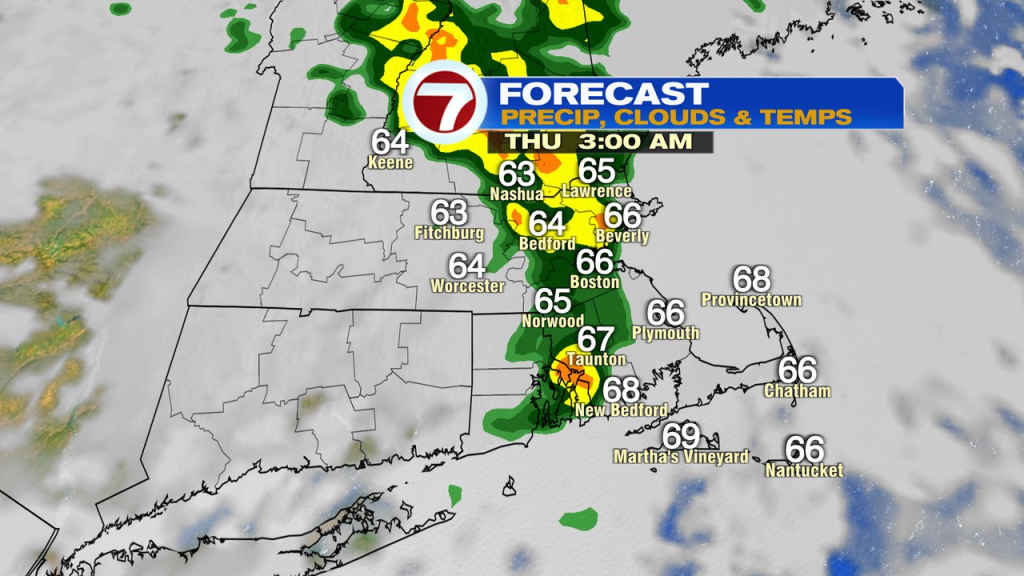
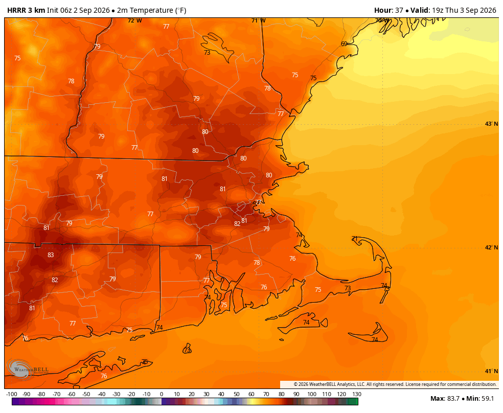
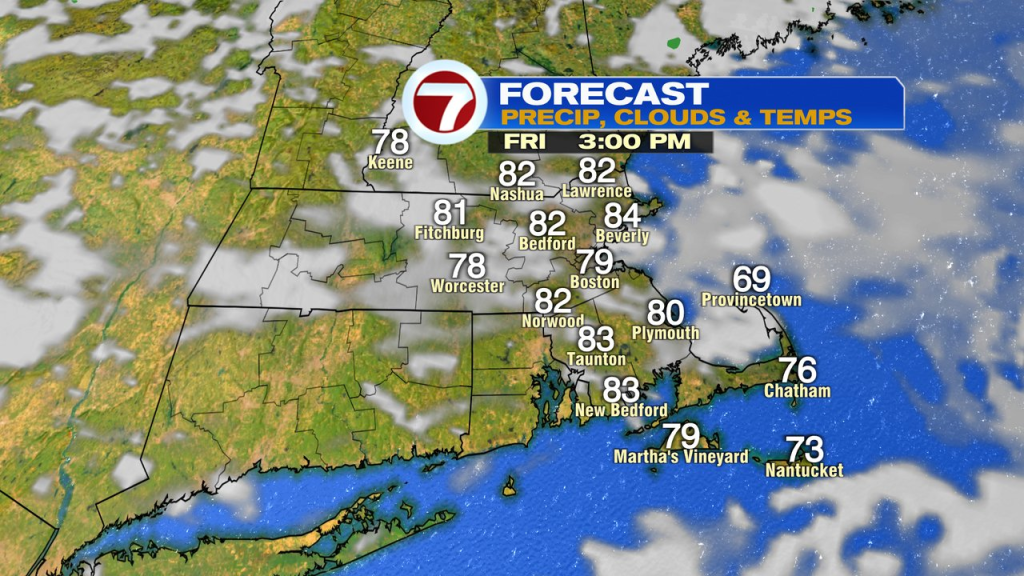
On the other side of the front, it’ll still be warm Friday, near 80, but with lowering humidity.
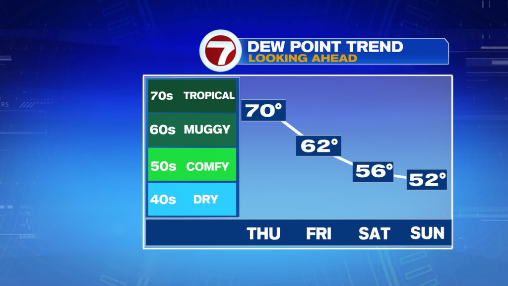
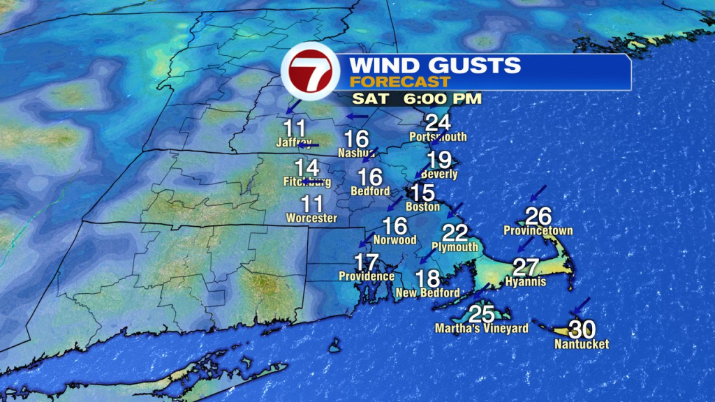
Humidity and temps lower more on Saturday, but with some chilly air and a disturbance aloft swinging on through, we’ll watch for a few scattered afternoon showers to pop-up as well. They do tend to favor interior locations. A cool breeze will develop along the coast with the strongest gusts, 25-30mph, across the Cape and Islands.
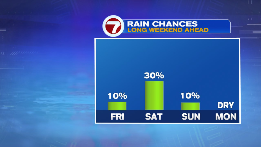
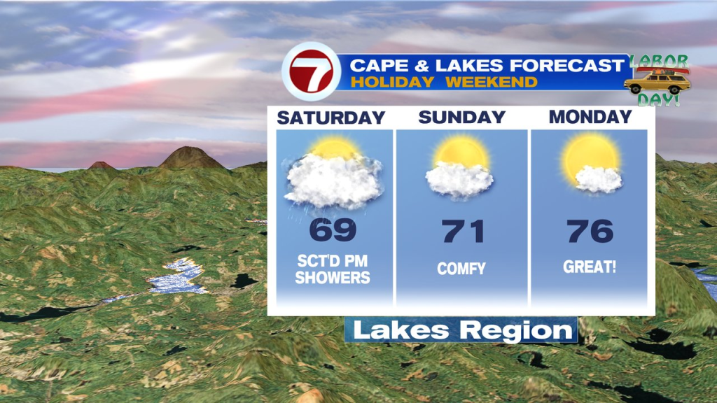
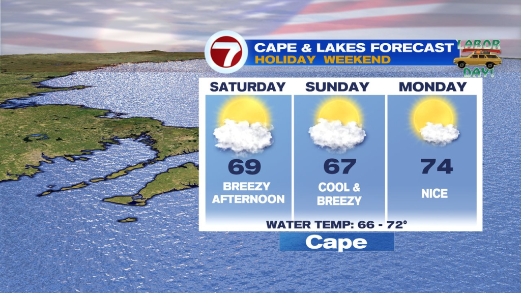
Sunday is cool, but mainly dry with a northeast breeze prevailing. Labor Day will feature dry air again and a bit milder.