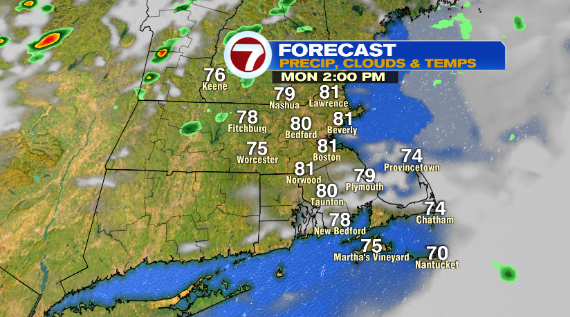
Well third time’s the charm apparently. After the first two holiday weekends were cold and complete washouts, we finally got a decent one! We had a fair amount of clouds and even some showers yesterday, but that’ll change already today. Temperatures today will climb to near 80 degrees with decreasing clouds through the morning. The afternoon will feature sunshine but also the smallest chance of a spot shower.
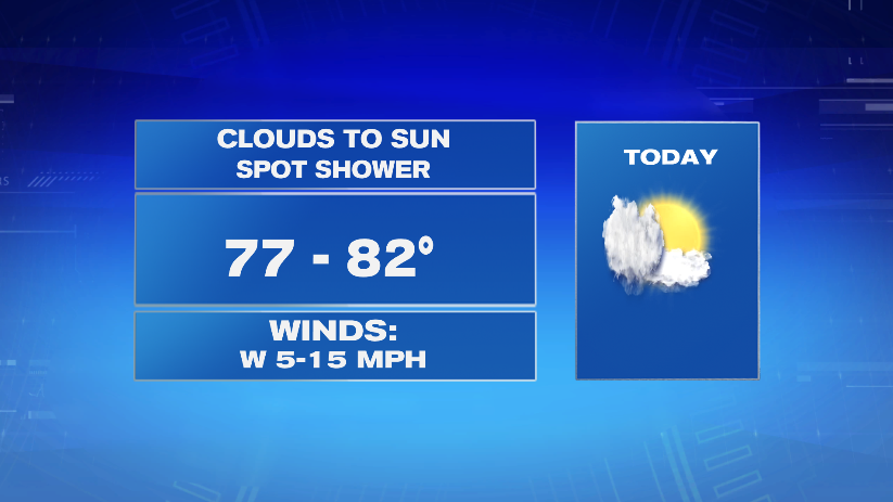
The system that’s moving through the area is a series of cold fronts. The first one, the one moving through this morning and bringing showers to the Cape will move out and take the rain and clouds with it. As the second one slides through, it could spark the most isolated shower. The chance is like 10% or less, so I’d plan as if today was a dry day.
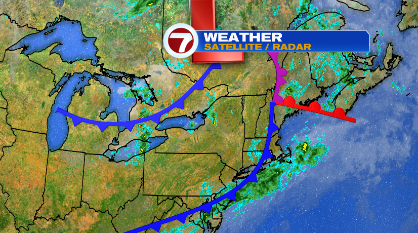
The rain we have this morning will linger for a few hours on the Cape. If you’re on the Cape or the Islands, you’ll have light rain showers to deal with through mid morning. You’ll also have the clouds linger longer in the day. For everyone else, we’re back to a partly cloudy sky by mid to late morning.
As the second cold front passes, it may spark a sprinkle. You can see that chance below. It’s light. It’s extremely isolated. But that chance will swing through the area this afternoon. As I said, plan on today being dry and go forward with those backyard BBQs.
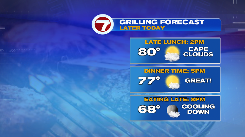
Speaking of backyard BBQs, I don’t think the afternoon or evening could be better for that!
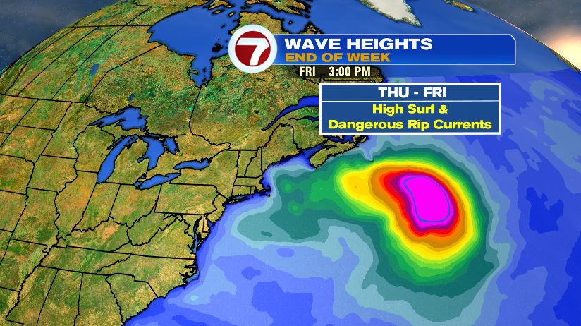
We’re also monitoring the tropics and the Atlantic Ocean for Hurricane Larry. Larry is a major hurricane as a Category 3 storm moving toward Bermuda. The track from the National Hurricane Center takes it just to the east of Bermuda.

There’s no landfall impact for us here in New England outside of rough surf and rip currents by the end of the week. Our forecast by the end of the week looks really nice, so if you’re planning on a beach day, keep this in mind. Strong waves will push all the way into the Gulf of Maine.