

Editor’s Note: Tonight’s blog was written by 7Weather intern Owen Vetree ~JR
I hope everyone has enjoyed their Wednesday, which was a bit on the warm side, nonetheless it was a pretty nice day out there.
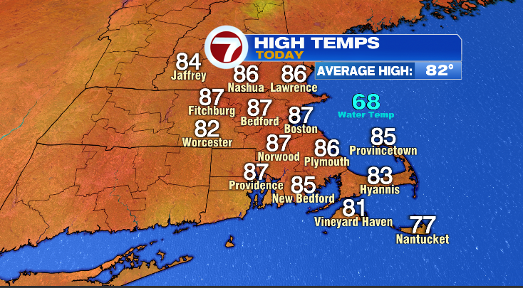
Eighty-six and eighty-seven were the most common numbers today, putting us 5 degrees our normal high for today. We are expecting this warmth to continue across the next several days, getting a little bit warmer in fact.
Our dew points today were in the lower 60s, which is average for this time of year.
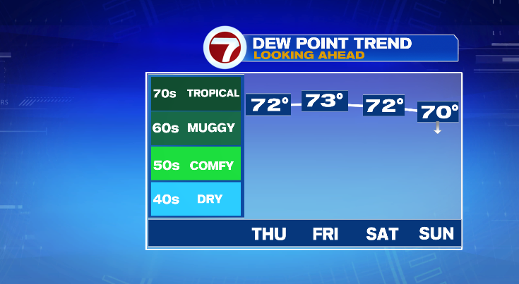
Over the next four days we will see our dew point readings be well above average, in the lower 70s. Relief from the humidity looks to come Sunday night when it drops back towards average. The arrow on Sunday is indicating falling dew points throughout the day as a front moves through. Waking up to readings at 70-71 before falling to around 65 at sunset.
To accompany this humidity, temperatures will also be quite high.
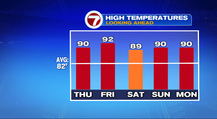
Ninety-ish for the next 5 days. Monday will see lower humidity but temperatures hold steady. Believe it or not Boston hasn’t hit 90 since July 14th, it is about time we get to 90 again in the city.
High humidity and temperatures will combine to create even higher feels like temperatures. This warrants a heat advisory.
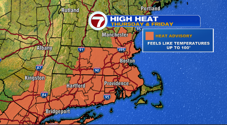
The national weather service has gone ahead and issued a heat advisory for the majority of our area, with only the Cape and the Islands excluded. We can expect to see heat index numbers get up to about 100; this will make any strenuous outdoor activities dangerous. Breaks should be taken and extra water should be consumed to help compensate for this.
The high humidity does bring the chance for some showers and thunderstorms to pop off throughout the next few days.
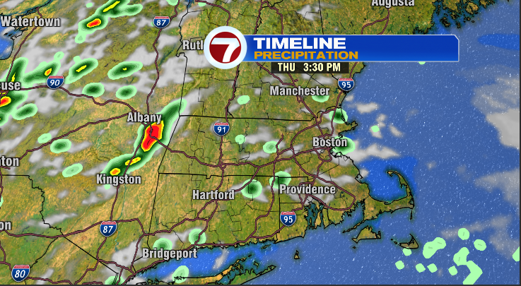
Here is Thursday afternoon, just a few scattered showers. Don’t take the exact location and timing of these showers too seriously. Figure about a 20% chance you see a little bit of rain.
The storms on Friday look like they will have an easier time getting going.
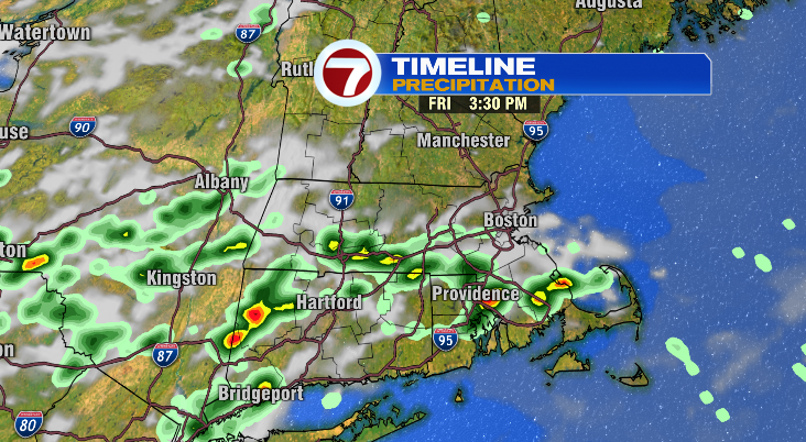
Here is Friday afternoon, the map has got a bit more coverage, but still, it isn’t super wide spread. Call it a 40% chance, but it could come down rather hard for a few minutes.
Saturday is looking similar to Friday, but it’s still too far out to show you any futurecast images for it. I can also say Sunday’s rain chances are going to be lower than the two previous days, all the way down to 10%.
Have a nice second wave of the week, stay cool, stay dry.
~Owen