
Quite cool out there today. When in the sun I noticed it (the sun) is losing firepower compared to just a month ago. When not in the sun, quite chilly indeed. Much of the eastern United States is under the influence of a cold low as seen on the satellite picture from earlier today…
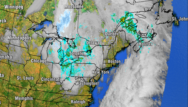
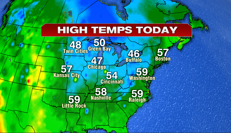
That Low Pressure is centered near Ottawa this evening and won’t move all that much until Friday. You can see the cool temps being caused by the storm…
Thankfully, that storm won’t be able to pester us with clouds and showers, rather, just a chilly breeze.
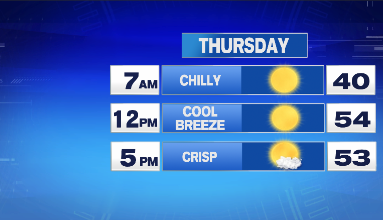
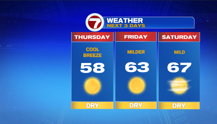
Be sure to layer up, quite chilly during the morning hours. As we look to Friday and Saturday, we’ll keep the sunshine but lose the chill!
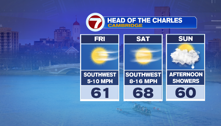
Saturday is looking very nice! We’ve had a great fall with a lot of our weekend being rain-free. Unfortunately, I don’t think we’ll be able to avoid the rain for the entire weekend as it does look like some showers will arrive by Sunday afternoon. Outdoor plans should be focused on Saturday as that is the pick of the weekend. Sunday morning, while featuring quite a few clouds should be dry. Speaking of the weekend, Head of the Charles is this weekend and Friday-Saturday look great. Depending on how quick/slow the rain arrives, perhaps most, if not all, of the event avoids the rain. More on that timeline tomorrow and Friday.
Ciao for now
~JR